File:Map of the shelling of Yeonpyeong.svg
Jump to navigation
Jump to search

Size of this PNG preview of this SVG file: 800 × 573 pixels. Other resolutions: 320 × 229 pixels | 640 × 458 pixels | 1,024 × 733 pixels | 1,280 × 916 pixels | 2,560 × 1,833 pixels | 912 × 653 pixels.
Original file (SVG file, nominally 912 × 653 pixels, file size: 338 KB)
Captions
Captions
Add a one-line explanation of what this file represents
Summary[edit]
| Description |
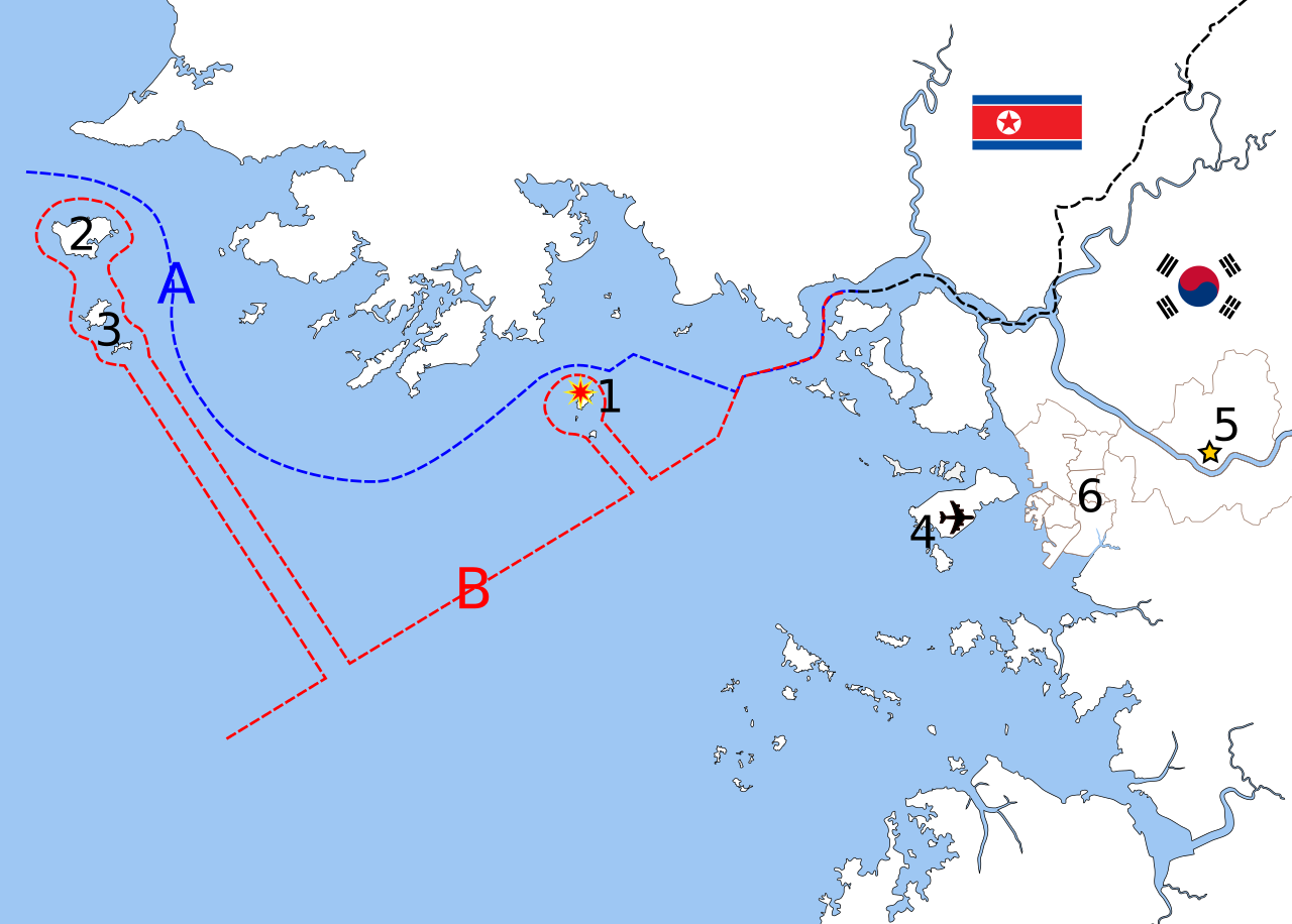
English: Map of the shelling of Yeonpyeong, language neutral version.
Polski: Mapa ostrzału wyspy Yeonpyeong.
中文(简体):延坪岛炮击事件地图,语言中性版本。
中文(繁體):延坪島炮擊事件地圖,語言中性版本。
Deutsch: Karte der Bombardierung von Yeonpyeong, sprachneutrale Version.
Français : Carte du bombardement de Yeonpyeong, version langue-neutral
Nederlands: Kaart van de granaataanval op Yeonpyeong, taalneutrale versie
|
| Date | |
| Source | Based on File:Inchon islands 2.svg (by Amble) and File:朝韩争议区(延坪岛附近).svg (by 玖巧仔). Modified and converted to language neutral version by Tomchen1989. Flags are from File:Flag of South Korea.svg and File:Flag of North Korea.svg which are in the public domain. The Northern Limit Line and the Military Demarcation Line are according to Xinhua and NYTimes. |
| Author | See above |
| Other versions |
|

Licensing[edit]
This file is licensed under the Creative Commons Attribution-Share Alike 3.0 Unported license.
Attribution: Amble, 玖巧仔 and Tomchen1989
- You are free:
- to share – to copy, distribute and transmit the work
- to remix – to adapt the work
- Under the following conditions:
- attribution – You must give appropriate credit, provide a link to the license, and indicate if changes were made. You may do so in any reasonable manner, but not in any way that suggests the licensor endorses you or your use.
- share alike – If you remix, transform, or build upon the material, you must distribute your contributions under the same or compatible license as the original.
File history
Click on a date/time to view the file as it appeared at that time.
| Date/Time | Thumbnail | Dimensions | User | Comment | |
|---|---|---|---|---|---|
| current | 10:26, 24 November 2010 | | 912 × 653 (338 KB) | Tomchen1989 (talk | contribs) | updated |
| 03:54, 24 November 2010 |  | 912 × 653 (337 KB) | Tomchen1989 (talk | contribs) | {{Information |Description={{en|1=Map of the shelling of Yeonpyeong, language neutral version}} |Source=Based on File:Inchon islands 2.svg (by User:Amble) and File:朝韩争议区(延坪岛附近).svg (by [ |
You cannot overwrite this file.
File usage on Commons
The following 2 pages use this file:
File usage on other wikis
The following other wikis use this file:
- Usage on en.wikipedia.org
- Usage on es.wikipedia.org
- Usage on fi.wikipedia.org
- Usage on hu.wikipedia.org
- Usage on ja.wikipedia.org
- Usage on ko.wikipedia.org
- Usage on pl.wikipedia.org
- Usage on pt.wikipedia.org