File:Map of the Western Cape with towns and roads.svg
Jump to navigation
Jump to search

Size of this PNG preview of this SVG file: 800 × 571 pixels. Other resolutions: 320 × 228 pixels | 640 × 457 pixels | 1,024 × 731 pixels | 1,280 × 914 pixels | 2,560 × 1,828 pixels | 1,000 × 714 pixels.
Original file (SVG file, nominally 1,000 × 714 pixels, file size: 1.68 MB)
Captions
Captions
Add a one-line explanation of what this file represents

|
This file has been superseded by Road map of the Western Cape with towns.svg. It is recommended to use the other file. Please note that deleting superseded images requires consent.
|

|
Summary[edit]
| Description |
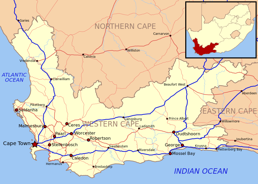
English: Map of the Western Cape province of South Africa, showing towns, main roads and major rivers. |
| Date | |
| Source | Own work |
| Author | Htonl |
Licensing[edit]
I, the copyright holder of this work, hereby publish it under the following licenses:
This file is licensed under the Creative Commons Attribution-Share Alike 3.0 Unported license.
- You are free:
- to share – to copy, distribute and transmit the work
- to remix – to adapt the work
- Under the following conditions:
- attribution – You must give appropriate credit, provide a link to the license, and indicate if changes were made. You may do so in any reasonable manner, but not in any way that suggests the licensor endorses you or your use.
- share alike – If you remix, transform, or build upon the material, you must distribute your contributions under the same or compatible license as the original.

|
Permission is granted to copy, distribute and/or modify this document under the terms of the GNU Free Documentation License, Version 1.2 or any later version published by the Free Software Foundation; with no Invariant Sections, no Front-Cover Texts, and no Back-Cover Texts. A copy of the license is included in the section entitled GNU Free Documentation License. |
You may select the license of your choice.
File history
Click on a date/time to view the file as it appeared at that time.
| Date/Time | Thumbnail | Dimensions | User | Comment | |
|---|---|---|---|---|---|
| current | 05:20, 29 January 2010 | | 1,000 × 714 (1.68 MB) | Htonl (talk | contribs) | update inset map |
| 17:10, 7 November 2008 |  | 1,000 × 714 (1.72 MB) | Htonl (talk | contribs) | {{Information |Description={{en|1=Map of the Western Cape province of South Africa, showing towns, main roads and major rivers.}} |Source=Own work by uploader |Author=Htonl |Date=2008-11-07 |Permission= |other_versions= }} <!--{{ImageUploa |
You cannot overwrite this file.
File usage on Commons
There are no pages that use this file.
File usage on other wikis
The following other wikis use this file:
- Usage on bg.wikipedia.org