File:Map of the Goulburn River.svg
Jump to navigation
Jump to search

Size of this PNG preview of this SVG file: 459 × 600 pixels. Other resolutions: 184 × 240 pixels | 367 × 480 pixels | 588 × 768 pixels | 784 × 1,024 pixels | 1,568 × 2,048 pixels | 715 × 934 pixels.
Original file (SVG file, nominally 715 × 934 pixels, file size: 3.31 MB)
Captions
Captions
Add a one-line explanation of what this file represents
| Description |
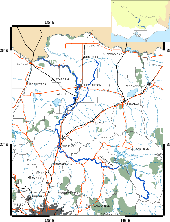
English: Map of the Goulburn River in Victoria
Goulburn River and Irrigation Channel
Creeks and other rivers
Local government and state boundaries
Railways
Highways
Murray–Darling Basin (in inset)
Parks
Lakes and sea
Urban areas
|
||
| Date | |||
| Source | Own work | ||
| Author | Cassowary |

File history
Click on a date/time to view the file as it appeared at that time.
| Date/Time | Thumbnail | Dimensions | User | Comment | |
|---|---|---|---|---|---|
| current | 18:48, 12 February 2011 | | 715 × 934 (3.31 MB) | Cassowary (talk | contribs) | {{Information |Description ={{en|1=Map of the Goulburn River in Victoria {{gfdl|migration=not-eligible}}}} |Source ={{own}} |Author =Cassowary |Date =2011-02-12 |Permission |
You cannot overwrite this file.
File usage on Commons
The following page uses this file:
File usage on other wikis
The following other wikis use this file:
- Usage on de.wikipedia.org
- Usage on en.wikipedia.org
- Usage on es.wikipedia.org
- Usage on fr.wikipedia.org
- Usage on nl.wikipedia.org
- Usage on no.wikipedia.org
- Usage on www.wikidata.org