File:Map of railway lines in the Cagliari region.png
Jump to navigation
Jump to search

Size of this preview: 450 × 600 pixels. Other resolutions: 180 × 240 pixels | 360 × 480 pixels | 576 × 768 pixels | 768 × 1,024 pixels | 2,526 × 3,367 pixels.
Original file (2,526 × 3,367 pixels, file size: 3.6 MB, MIME type: image/png)
Captions
Captions
Add a one-line explanation of what this file represents
| Description |
|
| Date | see file history |
| Source |
Own work, using
|
| Author | Maximilian Dörrbecker (Chumwa) |
| Permission (Reusing this file) |
All OpenStreetMap data and maps are Creative Commons "CC-BY-SA 2.0" licensed This file is licensed under the Creative Commons Attribution-Share Alike 2.0 Generic license.
|
File history
Click on a date/time to view the file as it appeared at that time.
| Date/Time | Thumbnail | Dimensions | User | Comment | |
|---|---|---|---|---|---|
| current | 16:35, 25 July 2015 | | 2,526 × 3,367 (3.6 MB) | Chumwa (talk | contribs) | |
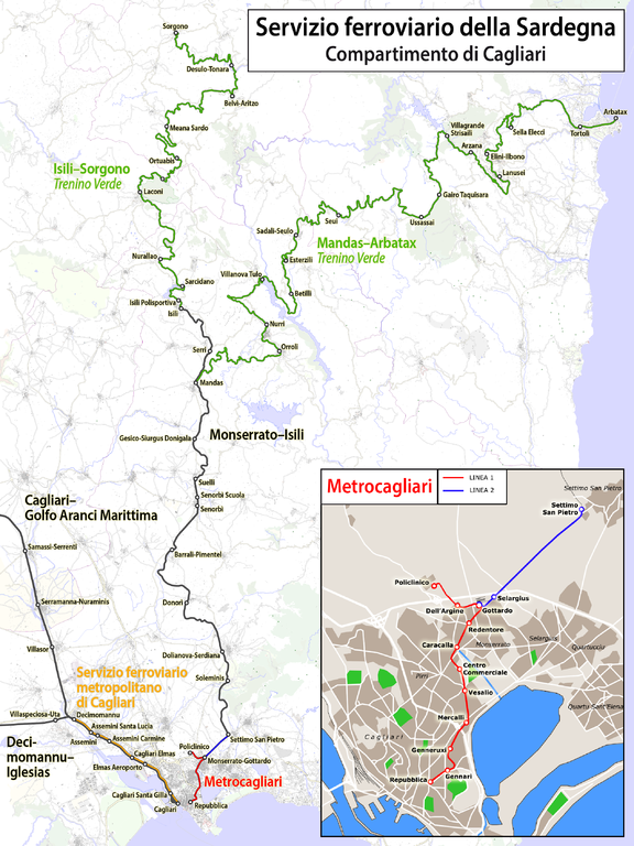
| 16:33, 25 July 2015 |  | 2,639 × 3,952 (3.37 MB) | Chumwa (talk | contribs) | {{Information |Description= *{{de|Karte der Sardischen Eisenbahnen in der Region Cagliari}} *{{it|Mapa delle Ferroviario della Sardegna - Compartimento di Cagliari}} |Author=Maximilian Dörrbecker ([[... |
You cannot overwrite this file.
File usage on Commons
The following 4 pages use this file:
File usage on other wikis
The following other wikis use this file:
- Usage on de.wikipedia.org