File:Map of major renewable energy resource in the contiguous United States.jpg
Jump to navigation
Jump to search
Size of this preview: 800 × 450 pixels. Other resolutions: 320 × 180 pixels | 640 × 360 pixels | 1,024 × 576 pixels | 1,280 × 720 pixels | 2,560 × 1,440 pixels | 4,800 × 2,700 pixels.
Original file (4,800 × 2,700 pixels, file size: 1.64 MB, MIME type: image/jpeg)
Captions
Captions
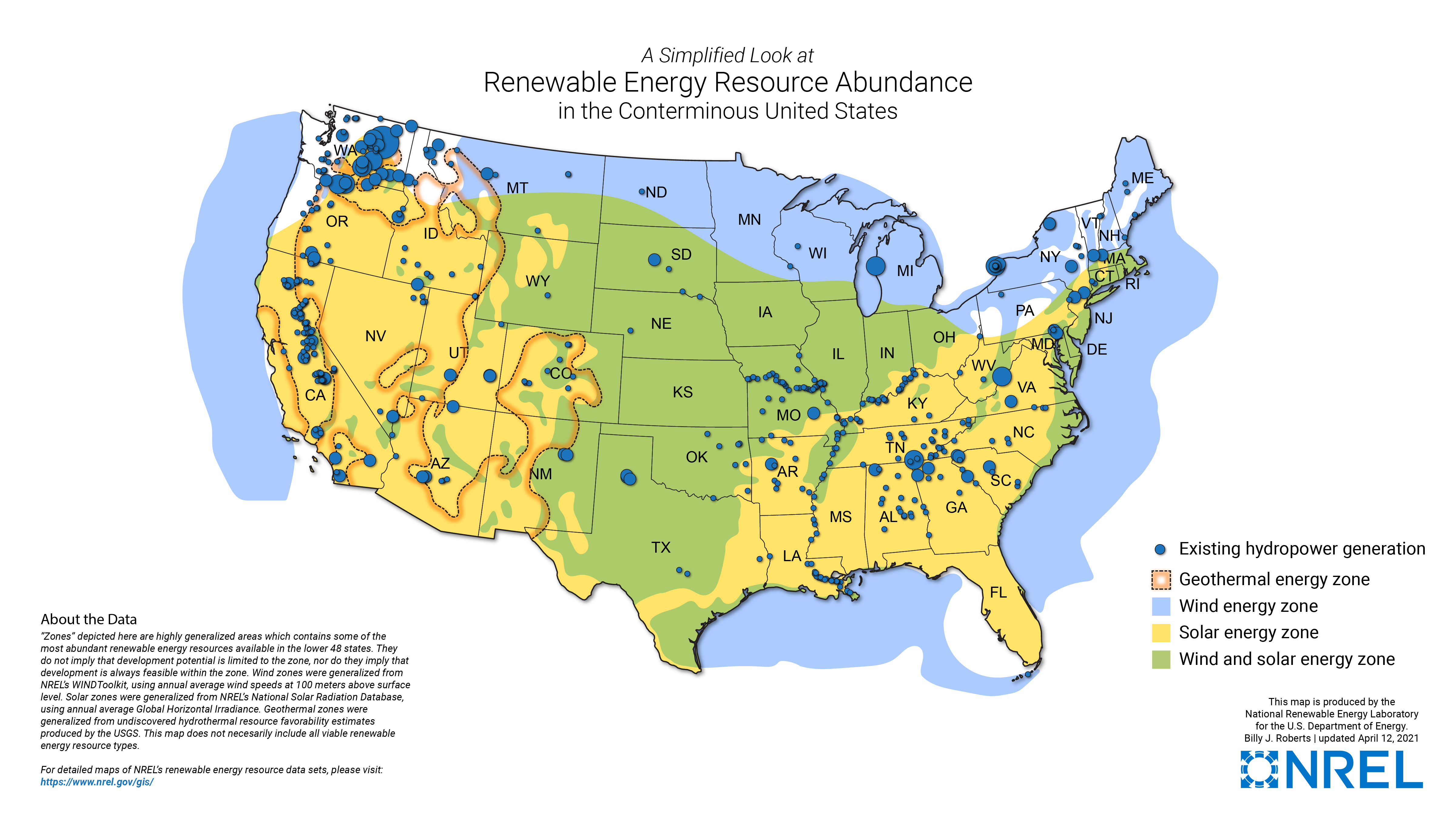
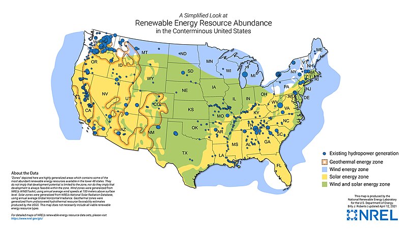
This map shows generalized renewable energy resource potential in the contiguous United States, including solar, wind, geothermal and hydropower.
Summary[edit]
| Description |
English: This map shows generalized renewable energy resource potential in the contiguous United States, including solar, wind, geothermal and hydropower. |
| Date | |
| Source | The National Renewable Energy Laboratory |
| Author | Billy J. Roberts, NREL |
Licensing[edit]
This work is in the public domain in the United States because it is a work prepared by an officer or employee of the United States Government as part of that person’s official duties under the terms of Title 17, Chapter 1, Section 105 of the US Code.
Note: This only applies to original works of the Federal Government and not to the work of any individual U.S. state, territory, commonwealth, county, municipality, or any other subdivision. This template also does not apply to postage stamp designs published by the United States Postal Service since 1978. (See § 313.6(C)(1) of Compendium of U.S. Copyright Office Practices). It also does not apply to certain US coins; see The US Mint Terms of Use.
|
 | |
| This file has been identified as being free of known restrictions under copyright law, including all related and neighboring rights. | ||
File history
Click on a date/time to view the file as it appeared at that time.
| Date/Time | Thumbnail | Dimensions | User | Comment | |
|---|---|---|---|---|---|
| current | 04:34, 19 October 2023 | | 4,800 × 2,700 (1.64 MB) | Cartographusmaximus (talk | contribs) | Uploaded a work by Billy J. Roberts, NREL from The National Renewable Energy Laboratory with UploadWizard |
You cannot overwrite this file.
File usage on Commons
There are no pages that use this file.
File usage on other wikis
The following other wikis use this file:
- Usage on en.wikipedia.org