File:Map of York County Pennsylvania School Districts.png
Jump to navigation
Jump to search
No higher resolution available.
Map_of_York_County_Pennsylvania_School_Districts.png (441 × 360 pixels, file size: 21 KB, MIME type: image/png)
Captions
Captions
Add a one-line explanation of what this file represents

|
This map image could be re-created using vector graphics as an SVG file. This has several advantages; see Commons:Media for cleanup for more information. If an SVG form of this image is available, please upload it and afterwards replace this template with
{{vector version available|new image name}}.
It is recommended to name the SVG file “Map of York County Pennsylvania School Districts.svg”—then the template Vector version available (or Vva) does not need the new image name parameter. |
Summary[edit]
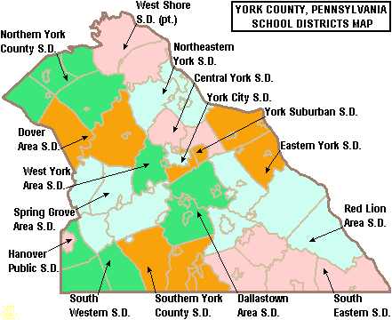
| Description | Map of York County, Pennsylvania, United States Public School Districts |
| Date | |
| Source | taken from US Census website [1] and modified by User:Ruhrfisch |
| Author | US Census, User:Ruhrfisch |
| Permission (Reusing this file) |
US Census / US Government work is public domain, my modifications licensed under the GNU Free Documentation License |
| Other versions |
 |
Licensing[edit]
I, Ruhrfisch, the copyright holder of this work, hereby publishes it under the following licenses:

|
Permission is granted to copy, distribute and/or modify this document under the terms of the GNU Free Documentation License, Version 1.2 or any later version published by the Free Software Foundation; with no Invariant Sections, no Front-Cover Texts, and no Back-Cover Texts. A copy of the license is included in the section entitled GNU Free Documentation License. |
| This file is licensed under the Creative Commons Attribution-Share Alike 3.0 Unported license. | ||
| Attribution: I, Ruhrfisch | ||
| ||
| This licensing tag was added to this file as part of the GFDL licensing update. |
This file is licensed under the Creative Commons Attribution-Share Alike 2.5 Generic license.
Attribution: I, Ruhrfisch
- You are free:
- to share – to copy, distribute and transmit the work
- to remix – to adapt the work
- Under the following conditions:
- attribution – You must give appropriate credit, provide a link to the license, and indicate if changes were made. You may do so in any reasonable manner, but not in any way that suggests the licensor endorses you or your use.
- share alike – If you remix, transform, or build upon the material, you must distribute your contributions under the same or compatible license as the original.
You may select the license of your choice.
and
This image or file is a work of a United States Census Bureau employee, taken or made as part of that person's official duties. As a work of the U.S. federal government, the image is in the public domain.
|
 |
File history
Click on a date/time to view the file as it appeared at that time.
| Date/Time | Thumbnail | Dimensions | User | Comment | |
|---|---|---|---|---|---|
| current | 21:26, 21 June 2006 | | 441 × 360 (21 KB) | Ruhrfisch (talk | contribs) | {{Information| |Description= Map of York County, Pennsylvania, United States Public School Districts |Source= taken from US Census website [http://factfinder.census.gov/] and modified by User:Ruhrfisch |Date= June 2006 |Author= US Census, Ruhrfisch |
You cannot overwrite this file.
File usage on Commons
The following page uses this file:
File usage on other wikis
The following other wikis use this file:
- Usage on en.wikipedia.org
- Dover Area School District
- Hanover Public School District
- Central York School District
- West York Area High School
- West York Area School District
- York Suburban School District
- York Suburban Senior High School
- Hanover High School (Pennsylvania)
- York Catholic High School
- West Shore School District
- York County School of Technology
- York Country Day School
- Dallastown Area School District
- Dallastown Area High School
- York City School District
- Red Lion Area School District
- Eastern York School District
- Dover Area High School
- Spring Grove Area High School
- Spring Grove Area School District
- Northeastern York School District
- Northern York County School District
- South Western School District
- South Eastern School District
- Southern York County School District
- Kennard-Dale High School
- Central York High School
- Northern High School (Dillsburg, Pennsylvania)
- Red Land High School
- Template:York County, Pennsylvania School Districts
- User:Epoloch/Projects
- Susquehannock High School
- William Penn Senior High School