File:Map of Wisconsin highlighting Dane County.svg
Jump to navigation
Jump to search

Size of this PNG preview of this SVG file: 559 × 599 pixels. Other resolutions: 224 × 240 pixels | 448 × 480 pixels | 717 × 768 pixels | 956 × 1,024 pixels | 1,911 × 2,048 pixels | 4,747 × 5,087 pixels.
Original file (SVG file, nominally 4,747 × 5,087 pixels, file size: 103 KB)
Captions
Captions
Add a one-line explanation of what this file represents
Summary[edit]
| Description |
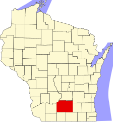
English: This is a locator map showing Dane County in Wisconsin. For more information, see Commons:United States county locator maps. |
| Date | |
| Source |
Own work: English: The maps use data from nationalatlas.gov, specifically countyp020.tar.gz on the Raw Data Download page. The maps also use state outline data from statesp020.tar.gz. The Florida maps use hydrogm020.tar.gz to display Lake Okeechobee. |
| Author | David Benbennick |
Licensing[edit]
| I, the copyright holder of this work, release this work into the public domain. This applies worldwide. In some countries this may not be legally possible; if so: I grant anyone the right to use this work for any purpose, without any conditions, unless such conditions are required by law. |
File history
Click on a date/time to view the file as it appeared at that time.
| Date/Time | Thumbnail | Dimensions | User | Comment | |
|---|---|---|---|---|---|
| current | 00:22, 13 February 2006 | | 4,747 × 5,087 (103 KB) | David Benbennick (talk | contribs) | {{subst:User:Dbenbenn/clm|county=Dane County|state=Wisconsin|type=county}} |
| 18:14, 12 February 2006 |  | 4,747 × 5,087 (103 KB) | David Benbennick (talk | contribs) | {{subst:User:Dbenbenn/clm|county=Dane County|state=Wisconsin|type=county}} |
You cannot overwrite this file.
File usage on Commons
The following 11 pages use this file:
- Category:Births in Dane County, Wisconsin
- Category:Dane County, Wisconsin
- Category:Deaths in Dane County, Wisconsin
- Category:Education in Dane County, Wisconsin
- Category:Geography of Dane County, Wisconsin
- Category:Maps of Dane County, Wisconsin
- Category:People of Dane County, Wisconsin
- Category:Populated places in Dane County, Wisconsin
- Category:Towns in Dane County, Wisconsin
- Category:Transport in Dane County, Wisconsin
- Category:Villages in Dane County, Wisconsin
File usage on other wikis
The following other wikis use this file:
- Usage on ar.wikipedia.org
- ماديسون (مقاطعة دان)
- حي سكني
- ألبيون مقاطعة دان (ويسكونسن)
- بيري (ويسكونسن)
- بلومينغ غروف (ويسكونسن)
- بريستول (مقاطعة دان)
- بيرك (ويسكونسن)
- كريستيانا (مقاطعة دان)
- بلدة كوتاغ غروف (ويسكونسن)
- دونكيرك (ويسكونسن)
- دون (مقاطعة دان)
- ماديسون (ويسكونسن)
- ميدينا (ويسكونسن)
- بلدة ميدلتون (ويسكونسن)
- مونتروز (ويسكونسن)
- بيرري (ويسكونسن)
- بليزانت سبرينغز (ويسكونسن)
- بريمروز (ويسكونسن)
- روكسبوري (ويسكونسن)
- روتلاند (ويسكونسن)
- سبرينغديل (ويسكونسن)
- سبرينغفيلد (مقاطعة دان)
- صن بريري (ويسكونسن)
- فيرمونت (ويسكونسن)
- بلدة فيرونا (ويسكونسن)
- فيينا (ويسكونسن)
- ويستبورت (ويسكونسن)
- ويندسور (ويسكونسن)
- نيويورك (مقاطعة دان)
- مقاطعة دان (ويسكونسن)
- صن برايري
- مونونا (ويسكونسن)
- ستوتون
- فيتشبورغ (ويسكونسن)
- إيدجيرتون
- ميدلتون (ويسكونسن)
- فيرونا (ويسكونسن)
- أوريغن (ويسكونسن)
- بلو ماوندس (ويسكونسن)
- كوتاج غروف (ويسكونسن)
- كروس بلاينس (ويسكونسن)
- دين (ويسكونسن)
- مازومين (ويسكونسن)
- ماونت هورب (ويسكونسن)
- بلك إرث (ويسكونسن)
- دي فورست (ويسكونسن)
- مابل بلوف (ويسكونسن)
- مك فارلاند (ويسكونسن)
- شوروود هيلز (ويسكونسن)
- واناكي (ويسكونسن)
View more global usage of this file.