File:Map of Virginia Counties and Independent Cities.svg
Jump to navigation
Jump to search

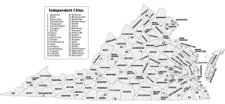
Size of this PNG preview of this SVG file: 800 × 371 pixels. Other resolutions: 320 × 149 pixels | 640 × 297 pixels | 1,024 × 475 pixels | 1,280 × 594 pixels | 2,560 × 1,189 pixels | 1,260 × 585 pixels.
Original file (SVG file, nominally 1,260 × 585 pixels, file size: 220 KB)
Captions
Captions
Add a one-line explanation of what this file represents
| Description |
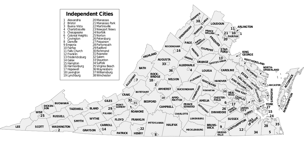
Map of Virginia counties and independent cities, SVG format. David Benbennick made the outline map modified here. For more information, see Commons:United States county locator maps. |
||
| Date | (UTC) | ||
| Source | |||
| Author | |||
| SVG development |
|
This file is licensed under the Creative Commons Attribution-Share Alike 3.0 Unported license.
- You are free:
- to share – to copy, distribute and transmit the work
- to remix – to adapt the work
- Under the following conditions:
- attribution – You must give appropriate credit, provide a link to the license, and indicate if changes were made. You may do so in any reasonable manner, but not in any way that suggests the licensor endorses you or your use.
- share alike – If you remix, transform, or build upon the material, you must distribute your contributions under the same or compatible license as the original.
Original upload log[edit]
This image is a derivative work of the following images:
- Virginia counties and independent cities map.gif licensed with Cc-by-sa-3.0-migrated-with-disclaimers, GFDL-en
- 2006-10-16T20:34:33Z JosN 1009x491 (71702 Bytes) Map of Virginia counties and independant cities.
- Map of Virginia highlighting Floyd County.svg licensed with PD-self
- 2006-02-12T17:43:56Z David Benbennick 7486x3247 (228776 Bytes) {{subst:User:Dbenbenn/clm|county=Floyd County|state=Virginia|type=county}}
Uploaded with derivativeFX
File history
Click on a date/time to view the file as it appeared at that time.
| Date/Time | Thumbnail | Dimensions | User | Comment | |
|---|---|---|---|---|---|
| current | 21:08, 8 November 2016 | | 1,260 × 585 (220 KB) | Offnfopt (talk | contribs) | removed left over boundary from defunct city removed in previous edit and centered Bedford text |
| 05:22, 8 November 2016 |  | 1,260 × 585 (219 KB) | Offnfopt (talk | contribs) | Update per request @ W:WP:GL/MAP Bedford is no longer a city so removing from list | |
| 18:43, 15 September 2009 |  | 1,260 × 585 (742 KB) | Soundoftoday (talk | contribs) | Fit to legal-size paper | |
| 18:36, 15 September 2009 |  | 7,488 × 3,249 (741 KB) | Soundoftoday (talk | contribs) | {{Information |Description=Map of Virginia counties and independent cities. David Benbennick made the outline map modified here. For more information, see Commons:United States county locator maps. |Source=*[[:File:Virginia_countie |
You cannot overwrite this file.
File usage on Commons
The following page uses this file:
File usage on other wikis
The following other wikis use this file:
- Usage on bjn.wikipedia.org
- Usage on cy.wikipedia.org
- Usage on en.wikipedia.org
- Usage on fa.wikipedia.org
- Usage on fi.wikipedia.org
- Usage on frr.wikipedia.org
- Usage on hu.wikipedia.org
- Usage on id.wikipedia.org
- Usage on pt.wikipedia.org
- Usage on ro.wikipedia.org
- Usage on ru.wikipedia.org
- Usage on sq.wikipedia.org
- Usage on tr.wikipedia.org