File:Map of USA NC.svg
Jump to navigation
Jump to search

Size of this PNG preview of this SVG file: 286 × 186 pixels. Other resolutions: 320 × 208 pixels | 640 × 416 pixels | 1,024 × 666 pixels | 1,280 × 832 pixels | 2,560 × 1,665 pixels.
Original file (SVG file, nominally 286 × 186 pixels, file size: 167 KB)
Captions
Captions
Add a one-line explanation of what this file represents
Clickable version
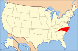
| Description | Map of USA with North Carolina highlighted | ||||||||
| Date | see file history below. | ||||||||
| Source | own work by uploader, based on Image:Map of USA without state names.svg | ||||||||
| Author |
This version: uploader Base versions this one is derived from: originally created by en:User:Wapcaplet |
||||||||
| Permission (Reusing this file) |
This file is licensed under the Creative Commons Attribution 2.0 Generic license.
|
||||||||
| Other versions | image:Map of USA with state names.svg |

File history
Click on a date/time to view the file as it appeared at that time.
| Date/Time | Thumbnail | Dimensions | User | Comment | |
|---|---|---|---|---|---|
| current | 09:39, 9 June 2006 | | 286 × 186 (167 KB) | Huebi~commonswiki (talk | contribs) | {{Information| |Description=Map of USA with North Carolina highlighted |other_versions=image:Map of USA with state names.svg }} Category:Maps of the United States Category:Maps of North Carolina Category:SVG maps {{GFDL-en}}{{cc-by-2.0} |
You cannot overwrite this file.
File usage on Commons
The following 9 pages use this file:
- Locator maps for U.S. states
- File:Map of USA NC.svg
- File:Map of USA highlighting North Carolina.png
- Category:Cities in North Carolina
- Category:Locator maps of cities in North Carolina
- Category:Locator maps of counties of North Carolina
- Category:Maps of Catholic dioceses of North Carolina
- Category:Maps of North Carolina
- Category:Videos from North Carolina
File usage on other wikis
The following other wikis use this file:
- Usage on af.wikipedia.org
- Usage on ang.wikipedia.org
- Usage on an.wikipedia.org
- Usage on ay.wikipedia.org
- Usage on az.wikipedia.org
- Usage on az.wiktionary.org
- Usage on ba.wikipedia.org
- Usage on bi.wikipedia.org
- Usage on bpy.wikipedia.org
- Usage on br.wikipedia.org
- Usage on bxr.wikipedia.org
- Usage on ca.wikipedia.org
- Usage on ceb.wikipedia.org
- Usage on ce.wikipedia.org
- Usage on cs.wikipedia.org
- Administrativní dělení Spojených států amerických
- Charlotte (Severní Karolína)
- Princeville (Severní Karolína)
- Portál:Geografie/Článek měsíce/Příprava
- Greensboro
- Portál:Geografie/Článek měsíce/2010/08
- Portál:Geografie/Článek měsíce/Archiv
- Portál:Geografie/Článek měsíce/2011/12
- Durham (Severní Karolína)
- Waynesville (Severní Karolína)
- Thomasville (Severní Karolína)
- Winston-Salem
- Usage on cv.wikipedia.org
- Usage on da.wikipedia.org
- Usage on de.wikipedia.org
- Benutzer:Wolfgang1018/Wikipedia-Quiz
- Kategorie:North Carolina
- Clemmons (North Carolina)
- Vorwahlergebnisse der Präsidentschaftswahl in den Vereinigten Staaten 2008
- Flaggen und Siegel der US-Bundesstaaten
- Geographie North Carolinas
- Vorwahlergebnisse der Präsidentschaftswahl in den Vereinigten Staaten 2016
- Vorwahlergebnisse der Präsidentschaftswahl in den Vereinigten Staaten 2020
- Vorwahlergebnisse der Präsidentschaftswahl in den Vereinigten Staaten 2024
- Benutzer:Sarkana/Vorwahlergebnisse 2024
- Usage on de.wiktionary.org
- Usage on el.wikipedia.org
- Usage on en.wikipedia.org
View more global usage of this file.