File:Map of USA MI.svg
Jump to navigation
Jump to search

Size of this PNG preview of this SVG file: 286 × 186 pixels. Other resolutions: 320 × 208 pixels | 640 × 416 pixels | 1,024 × 666 pixels | 1,280 × 832 pixels | 2,560 × 1,665 pixels.
Original file (SVG file, nominally 286 × 186 pixels, file size: 167 KB)
Captions
Captions
Add a one-line explanation of what this file represents
Clickable version
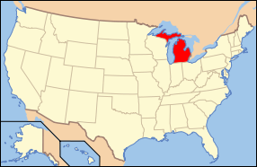
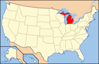
| Description | Map of USA with Michigan highlighted | ||||||||
| Date | see file history below. | ||||||||
| Source |
Own work This vector image includes elements that have been taken or adapted from this file: |
||||||||
| Author |
|
||||||||
| Permission (Reusing this file) |
This file is licensed under the Creative Commons Attribution 2.0 Generic license.
|
||||||||
| Other versions |
|
||||||||
| SVG development |


File history
Click on a date/time to view the file as it appeared at that time.
| Date/Time | Thumbnail | Dimensions | User | Comment | |
|---|---|---|---|---|---|
| current | 07:08, 9 June 2006 | | 286 × 186 (167 KB) | Huebi~commonswiki (talk | contribs) | {{Information| |Description=Map of USA with Michigan highlighted |other_versions=image:Map of USA with state names.svg }} Category:Maps of the United States Category:Maps of Michigan Category:SVG maps {{GFDL-en}}{{cc-by-2.0}}{{cc-by-sa- |
You cannot overwrite this file.
File usage on Commons
The following 74 pages use this file:
- Locator maps for U.S. states
- File:M-6 in 1936.jpg
- File:M-86 December 1927.png
- File:Map of USA MI.svg
- File:Map of USA highlighting Michigan.png
- File:US 2 near Manistique in 1936.jpg
- Category:Allegan County, Michigan
- Category:Berrien County, Michigan
- Category:Births in Allegan County, Michigan
- Category:Births in Berrien County, Michigan
- Category:Births in Calhoun County, Michigan
- Category:Births in Eaton County, Michigan
- Category:Births in Kalamazoo County, Michigan
- Category:Births in Oakland County, Michigan
- Category:Births in Washtenaw County, Michigan
- Category:Branch County, Michigan
- Category:Calhoun County, Michigan
- Category:Cass County, Michigan
- Category:Cities in Michigan
- Category:Deaths in Berrien County, Michigan
- Category:Deaths in Calhoun County, Michigan
- Category:Deaths in Kalamazoo County, Michigan
- Category:Deaths in Oakland County, Michigan
- Category:Deaths in Washtenaw County, Michigan
- Category:Eaton County, Michigan
- Category:Geography of Allegan County, Michigan
- Category:Geography of Van Buren County, Michigan
- Category:Hillsdale County, Michigan
- Category:Isabella County, Michigan
- Category:Kalamazoo County, Michigan
- Category:Lenawee County, Michigan
- Category:Locator maps of cities in Michigan
- Category:Locator maps of counties of Michigan
- Category:Maps of Allegan County, Michigan
- Category:Maps of Berrien County, Michigan
- Category:Maps of Branch County, Michigan
- Category:Maps of Calhoun County, Michigan
- Category:Maps of Cass County, Michigan
- Category:Maps of Catholic dioceses of Michigan
- Category:Maps of Eaton County, Michigan
- Category:Maps of Hillsdale County, Michigan
- Category:Maps of Isabella County, Michigan
- Category:Maps of Kalamazoo County, Michigan
- Category:Maps of Lenawee County, Michigan
- Category:Maps of Michigan
- Category:Maps of Oakland County, Michigan
- Category:Maps of St. Joseph County, Michigan
- Category:Maps of Van Buren County, Michigan
- Category:Maps of Washtenaw County, Michigan
- Category:National Register of Historic Places in Oakland County, Michigan
- Category:Oakland County, Michigan
- Category:People of Allegan County, Michigan
- Category:People of Berrien County, Michigan
- Category:People of Branch County, Michigan
- Category:People of Calhoun County, Michigan
- Category:People of Cass County, Michigan
- Category:People of Eaton County, Michigan
- Category:People of Isabella County, Michigan
- Category:People of Kalamazoo County, Michigan
- Category:People of Lenawee County, Michigan
- Category:People of Oakland County, Michigan
- Category:People of St. Joseph County, Michigan
- Category:People of Washtenaw County, Michigan
- Category:Populated places in Allegan County, Michigan
- Category:Populated places in Oakland County, Michigan
- Category:Populated places in Van Buren County, Michigan
- Category:Populated places in Washtenaw County, Michigan
- Category:St. Joseph County, Michigan
- Category:Transport in Allegan County, Michigan
- Category:Transport in Branch County, Michigan
- Category:Transport in Lenawee County, Michigan
- Category:Van Buren County, Michigan
- Category:Videos from Michigan
- Category:Washtenaw County, Michigan
File usage on other wikis
The following other wikis use this file:
- Usage on af.wikipedia.org
- Usage on ang.wikipedia.org
- Usage on arc.wikipedia.org
- Usage on ay.wikipedia.org
- Usage on az.wiktionary.org
- Usage on ban.wikipedia.org
- Usage on bat-smg.wikipedia.org
- Usage on bcl.wikipedia.org
- Usage on be-tarask.wikipedia.org
- Usage on bi.wikipedia.org
- Usage on bo.wikipedia.org
- Usage on bpy.wikipedia.org
- Usage on bxr.wikipedia.org
- Usage on ca.wikipedia.org
- Usage on ce.wikipedia.org
- Usage on co.wikipedia.org
- Usage on cs.wikipedia.org
- Usage on cv.wikipedia.org
- Usage on da.wikipedia.org
- Usage on de.wikipedia.org
- Benutzer:Wolfgang1018/Wikipedia-Quiz
- Kategorie:Michigan
- Vorwahlergebnisse der Präsidentschaftswahl in den Vereinigten Staaten 2008
- Flaggen und Siegel der US-Bundesstaaten
- Vorwahlergebnisse der Präsidentschaftswahl in den Vereinigten Staaten 2016
- Vorwahlergebnisse der Präsidentschaftswahl in den Vereinigten Staaten 2020
- Vorwahlergebnisse der Präsidentschaftswahl in den Vereinigten Staaten 2024
- Benutzer:Sarkana/Vorwahlergebnisse 2024
- Usage on de.wiktionary.org
- Usage on el.wikipedia.org
- Usage on en.wikipedia.org
View more global usage of this file.