File:Map of Thuringia (1680)-DE.svg
Jump to navigation
Jump to search

Size of this PNG preview of this SVG file: 685 × 600 pixels. Other resolutions: 274 × 240 pixels | 548 × 480 pixels | 877 × 768 pixels | 1,169 × 1,024 pixels | 2,338 × 2,048 pixels | 1,329 × 1,164 pixels.
Original file (SVG file, nominally 1,329 × 1,164 pixels, file size: 1.18 MB)
Captions
Captions
Add a one-line explanation of what this file represents
Summary[edit]
-DE.svg&action=edit§ion=1)
| Description |
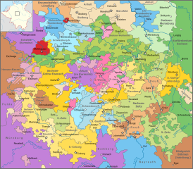
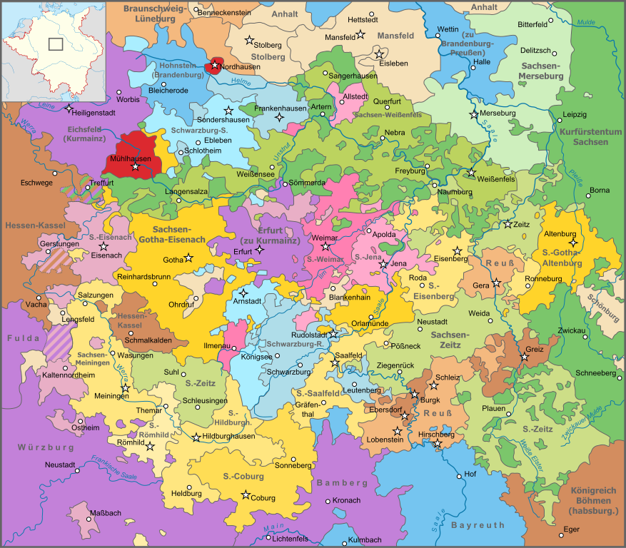
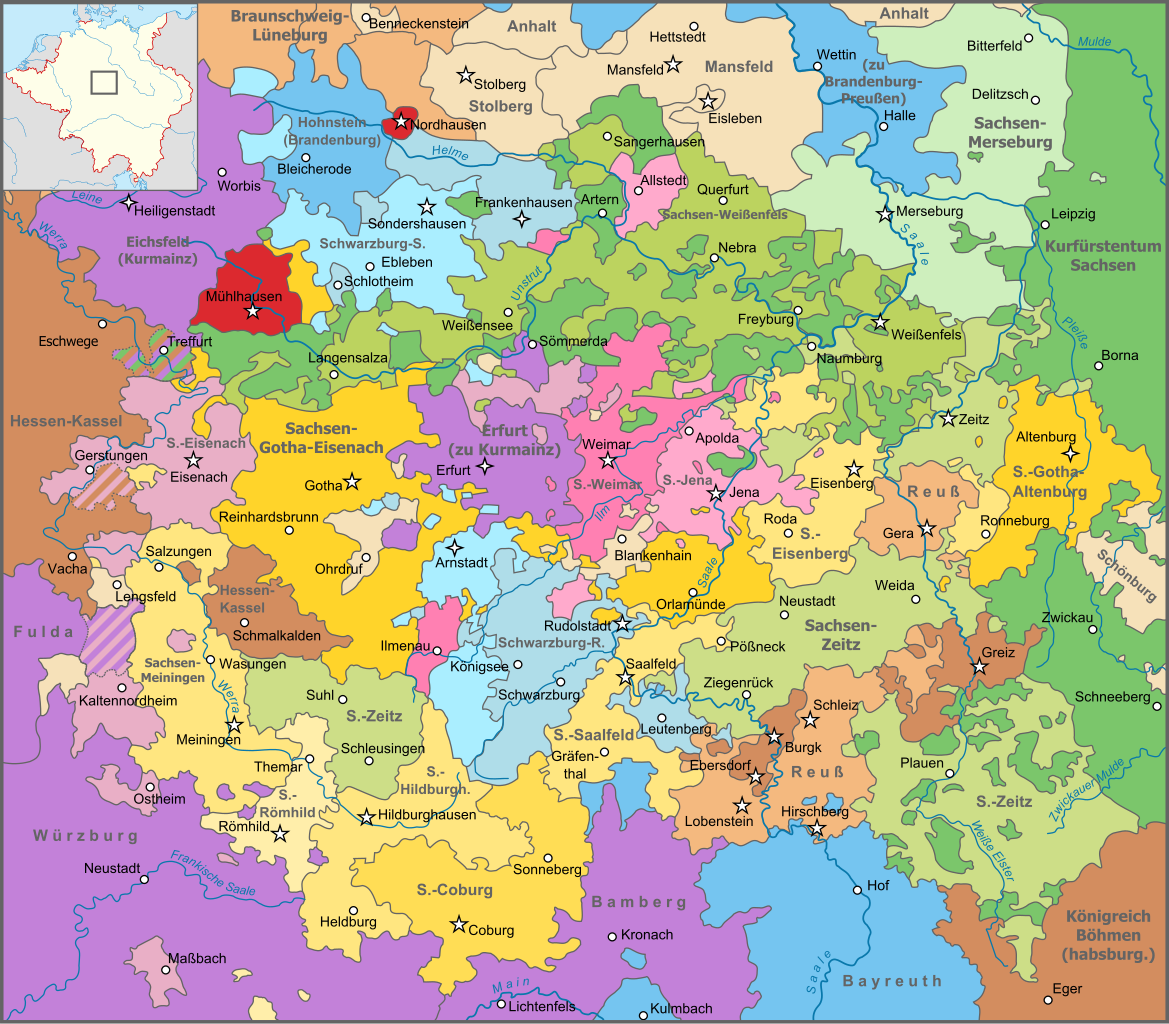
Deutsch: Karte Thüringens und angrenzender Gebiete im Heiligen Römischen Reich im Jahr 1680.
Nederlands: Kaart van Thüringen in 1680, na de delingen van Saksen-Weimar (1672) en Saksen-Gotha (1680). |
| Date | |
| Source |
This file was derived from: Map of Thuringia (1680)-NL.svg: |
| Author |
|
-NL.svg)
| This is a retouched picture, which means that it has been digitally altered from its original version. Modifications: German translation. The original can be viewed here: Map of Thuringia (1680)-NL.svg:
|
Licensing[edit]
-DE.svg&action=edit§ion=2)
I, the copyright holder of this work, hereby publish it under the following license:
This file is licensed under the Creative Commons Attribution-Share Alike 3.0 Unported license.
- You are free:
- to share – to copy, distribute and transmit the work
- to remix – to adapt the work
- Under the following conditions:
- attribution – You must give appropriate credit, provide a link to the license, and indicate if changes were made. You may do so in any reasonable manner, but not in any way that suggests the licensor endorses you or your use.
- share alike – If you remix, transform, or build upon the material, you must distribute your contributions under the same or compatible license as the original.
Original upload log[edit]
-DE.svg&action=edit§ion=3)
This image is a derivative work of the following images:
- File:Map_of_Thuringia_(1680)-NL.svg licensed with Cc-by-sa-3.0
- 2013-10-13T13:31:49Z Sir Iain 1329x1164 (1496331 Bytes) User created page with UploadWizard
Uploaded with derivativeFX
File history
Click on a date/time to view the file as it appeared at that time.
| Date/Time | Thumbnail | Dimensions | User | Comment | |
|---|---|---|---|---|---|
| current | 12:32, 30 May 2015 | | 1,329 × 1,164 (1.18 MB) | Furfur (talk | contribs) | Details |
| 16:24, 15 December 2013 |  | 1,329 × 1,164 (1.15 MB) | Furfur (talk | contribs) | mit kleiner Innenkarte | |
| 16:13, 15 December 2013 |  | 1,329 × 1,164 (958 KB) | Furfur (talk | contribs) | == {{int:filedesc}} == {{Information |Description={{de|1=Karte Thüringens und angrenzender Gebiete im Heiligen Römischen Reich im Jahr 1680.}} {{nl|1=Kaart van Thüringen in 1680, na de delingen van Saksen-Weimar (1672) en Saksen-Gotha (1680).}} |dat... |
You cannot overwrite this file.
File usage on Commons
The following 2 pages use this file:
File usage on other wikis
The following other wikis use this file:
- Usage on de.wikipedia.org
- Usage on en.wikipedia.org
- Usage on fr.wikipedia.org
- Usage on ja.wikipedia.org
- Usage on lt.wikipedia.org
- Usage on nl.wikipedia.org
- Usage on pl.wikipedia.org
- Usage on pl.wiktionary.org
- Usage on sv.wikipedia.org
- Usage on zh.wikipedia.org
-DE.svg&oldid=606470262)