File:Map of Strandzha Sakar en.svg
Jump to navigation
Jump to search

Size of this PNG preview of this SVG file: 800 × 513 pixels. Other resolutions: 320 × 205 pixels | 640 × 411 pixels | 1,024 × 657 pixels | 1,280 × 821 pixels | 2,560 × 1,643 pixels | 1,596 × 1,024 pixels.
Original file (SVG file, nominally 1,596 × 1,024 pixels, file size: 6.28 MB)
Captions
Captions
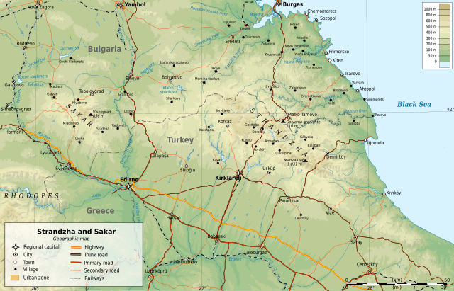
Geographic map of Strandzha and Sakar mountains in Bulgaria and Turkey (in English)
Summary[edit]
| Description | |
| Date | |
| Source |
 |
| Author | Ikonact |
Licensing[edit]
I, the copyright holder of this work, hereby publish it under the following license:
This file is licensed under the Creative Commons Attribution-Share Alike 3.0 Unported license.
- You are free:
- to share – to copy, distribute and transmit the work
- to remix – to adapt the work
- Under the following conditions:
- attribution – You must give appropriate credit, provide a link to the license, and indicate if changes were made. You may do so in any reasonable manner, but not in any way that suggests the licensor endorses you or your use.
- share alike – If you remix, transform, or build upon the material, you must distribute your contributions under the same or compatible license as the original.
File history
Click on a date/time to view the file as it appeared at that time.
| Date/Time | Thumbnail | Dimensions | User | Comment | |
|---|---|---|---|---|---|
| current | 00:10, 12 March 2013 | | 1,596 × 1,024 (6.28 MB) | Ikonact (talk | contribs) | correction of cyrillic text |
| 00:01, 12 March 2013 |  | 1,596 × 1,024 (6.28 MB) | Ikonact (talk | contribs) | User created page with UploadWizard |
You cannot overwrite this file.
File usage on Commons
The following 2 pages use this file:
File usage on other wikis
The following other wikis use this file:
- Usage on cs.wikipedia.org
- Usage on en.wikipedia.org
- Usage on fr.wikipedia.org
- Usage on it.wikipedia.org
- Usage on pt.wikipedia.org
- Usage on ro.wikipedia.org