File:Map of Reno Co, Ks, USA.png
Jump to navigation
Jump to search

Size of this preview: 800 × 568 pixels. Other resolutions: 320 × 227 pixels | 640 × 454 pixels | 1,024 × 726 pixels | 1,184 × 840 pixels.
Original file (1,184 × 840 pixels, file size: 355 KB, MIME type: image/png)
Captions
Captions
Add a one-line explanation of what this file represents
Summary[edit]
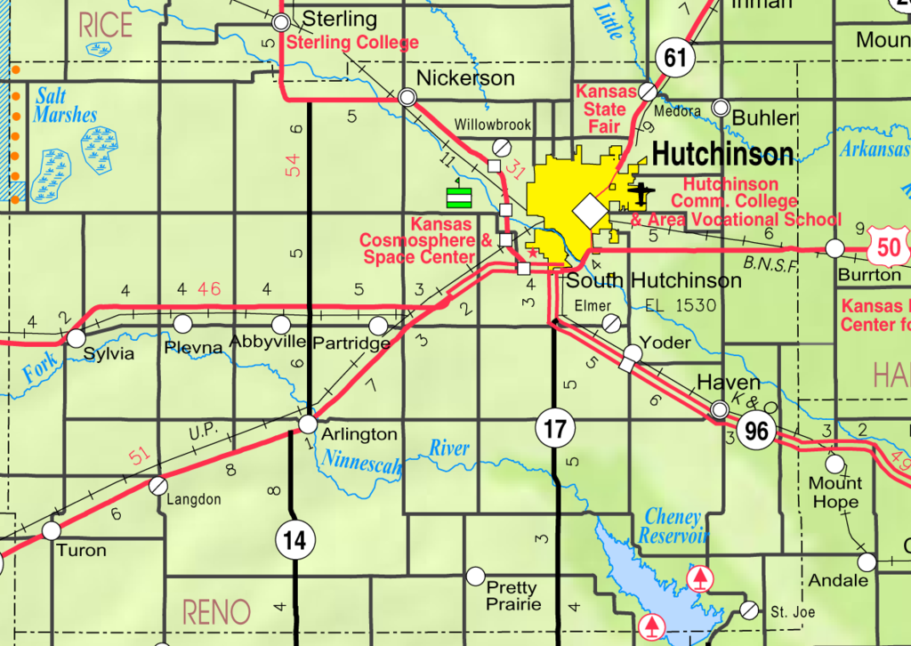
| Description | This map of Reno County, Kansas, USA, is copied at a resolution of 300 pixels/inch from the original PDF file. |
| Date | |
| Source | Kansas 2005–2006 Official Transportation Map [1] (map legend) |
| Author | Designed and published by the Kansas Department of Transportation. |
| Permission (Reusing this file) |
Licensing[edit]
| This work has been released into the public domain by its author, Kansas Department of Transportation. This applies worldwide. In some countries this may not be legally possible; if so: Kansas Department of Transportation grants anyone the right to use this work for any purpose, without any conditions, unless such conditions are required by law.
|
This map is published by the Kansas Department of Transportation and is distributed to the public free of charge. KDOT makes no warranties, guarantees, or representations for accuracy of this information and assumes no liability for errors or omissions. Maps produced using tax payer dollars are free for public use.
File history
Click on a date/time to view the file as it appeared at that time.
| Date/Time | Thumbnail | Dimensions | User | Comment | |
|---|---|---|---|---|---|
| current | 15:34, 10 June 2006 | | 1,184 × 840 (355 KB) | Moverton (talk | contribs) | Source: Kansas 2005-2006 Official Transportation Map {{PD-US}} |
You cannot overwrite this file.
File usage on Commons
There are no pages that use this file.
File usage on other wikis
The following other wikis use this file:
- Usage on azb.wikipedia.org
- Usage on en.wikipedia.org
- Reno County, Kansas
- Abbyville, Kansas
- Arlington, Kansas
- Buhler, Kansas
- Haven, Kansas
- Hutchinson, Kansas
- Langdon, Kansas
- Nickerson, Kansas
- Partridge, Kansas
- Plevna, Kansas
- Pretty Prairie, Kansas
- South Hutchinson, Kansas
- Sylvia, Kansas
- Turon, Kansas
- Willowbrook, Kansas
- Castleton, Kansas
- Yoder, Kansas
- Cheney Reservoir
- Yaggy, Kansas
- Kent, Kansas
- The Highlands, Kansas
- Usage on es.wikipedia.org
- Usage on it.wikipedia.org
- Usage on nl.wikipedia.org
- Usage on ro.wikipedia.org
- Usage on ru.wikipedia.org
- Usage on sh.wikipedia.org
View more global usage of this file.