File:Map of Maluku Islands-en.svg
Jump to navigation
Jump to search

Size of this PNG preview of this SVG file: 593 × 600 pixels. Other resolutions: 237 × 240 pixels | 474 × 480 pixels | 759 × 768 pixels | 1,012 × 1,024 pixels | 2,024 × 2,048 pixels | 1,363 × 1,379 pixels.
Original file (SVG file, nominally 1,363 × 1,379 pixels, file size: 329 KB)
Captions
Captions
Add a one-line explanation of what this file represents
Summary[edit]
| Description |
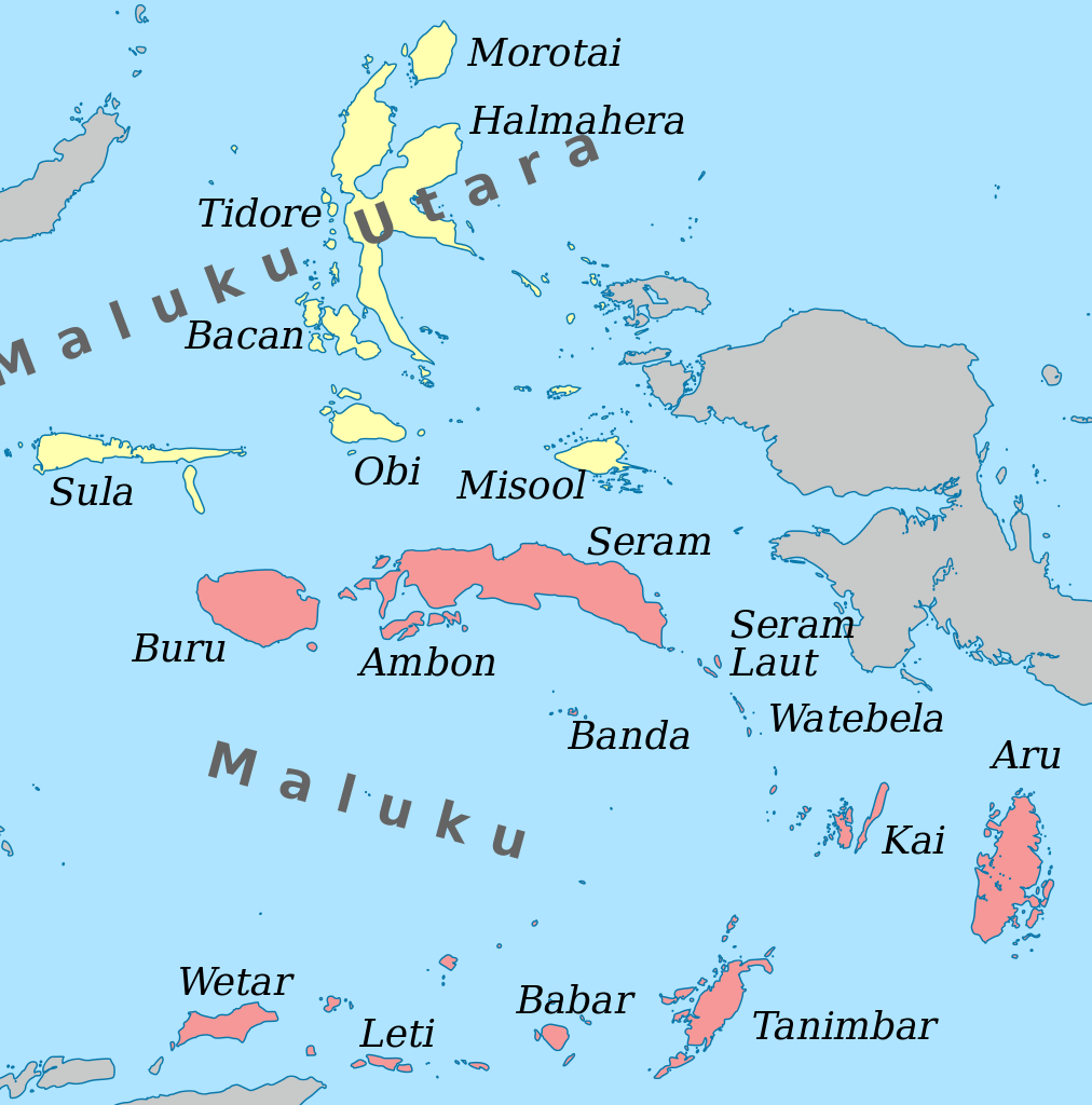
English: Map of the Maluku Islands. |
| Date | |
| Source | Own work – self-made in Inkscape based on a 0-meter trace of SRTM30_PLUS data. |
| Author | Oona Räisänen (Mysid) |
Licensing[edit]
I, the copyright holder of this work, hereby publish it under the following license:
| This file is made available under the Creative Commons CC0 1.0 Universal Public Domain Dedication. | |
| The person who associated a work with this deed has dedicated the work to the public domain by waiving all of their rights to the work worldwide under copyright law, including all related and neighboring rights, to the extent allowed by law. You can copy, modify, distribute and perform the work, even for commercial purposes, all without asking permission.
|
File history
Click on a date/time to view the file as it appeared at that time.
| Date/Time | Thumbnail | Dimensions | User | Comment | |
|---|---|---|---|---|---|
| current | 08:00, 22 October 2012 | | 1,363 × 1,379 (329 KB) | Mysid (talk | contribs) | Atauro belongs to East Timor |
| 16:15, 17 April 2011 |  | 1,363 × 1,379 (372 KB) | Mysid (talk | contribs) | remove curved text (not working) | |
| 16:13, 17 April 2011 |  | 1,363 × 1,379 (372 KB) | Mysid (talk | contribs) | {{Information |Description ={{en|1=Map of the Maluku Islands.}} |Source ={{own}} - self-made in Inkscape. |Author =Mysid |Date =2010-04-17 |Permission = |other_versions = }} [[Cate |
You cannot overwrite this file.
File usage on Commons
The following page uses this file:
File usage on other wikis
The following other wikis use this file:
- Usage on af.wikipedia.org
- Usage on ar.wikipedia.org
- Usage on el.wikipedia.org
- Usage on en.wikipedia.org
- Usage on eo.wikipedia.org
- Usage on fa.wikipedia.org
- Usage on ga.wikipedia.org
- Usage on id.wikipedia.org
- Usage on ilo.wikipedia.org
- Usage on incubator.wikimedia.org
- Usage on ja.wikipedia.org
- Usage on min.wikipedia.org
- Usage on ml.wikipedia.org
- Usage on mrj.wikipedia.org
- Usage on nl.wikipedia.org
- Usage on pnb.wikipedia.org
- Usage on sw.wikipedia.org
- Usage on tr.wikipedia.org
- Usage on ur.wikipedia.org
- Usage on war.wikipedia.org