File:Map of Kentucky highlighting Jefferson County.svg
Jump to navigation
Jump to search

Size of this PNG preview of this SVG file: 800 × 345 pixels. Other resolutions: 320 × 138 pixels | 640 × 276 pixels | 1,024 × 441 pixels | 1,280 × 551 pixels | 2,560 × 1,103 pixels | 6,770 × 2,916 pixels.
Original file (SVG file, nominally 6,770 × 2,916 pixels, file size: 127 KB)
Captions
Captions
Add a one-line explanation of what this file represents
Summary[edit]
| Description |
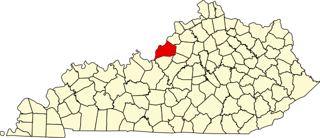
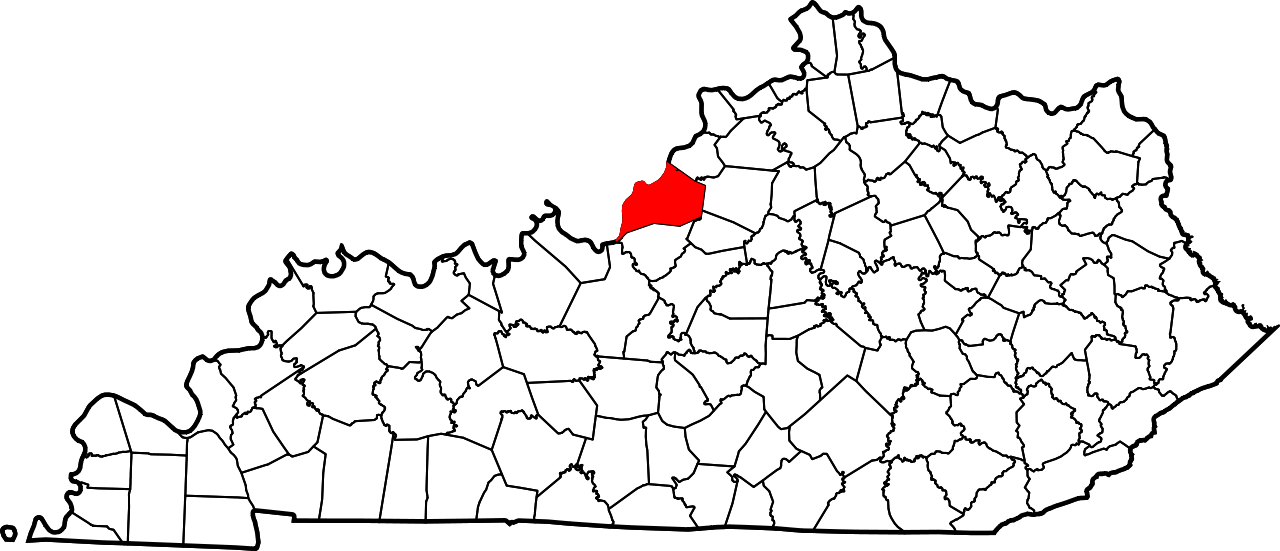
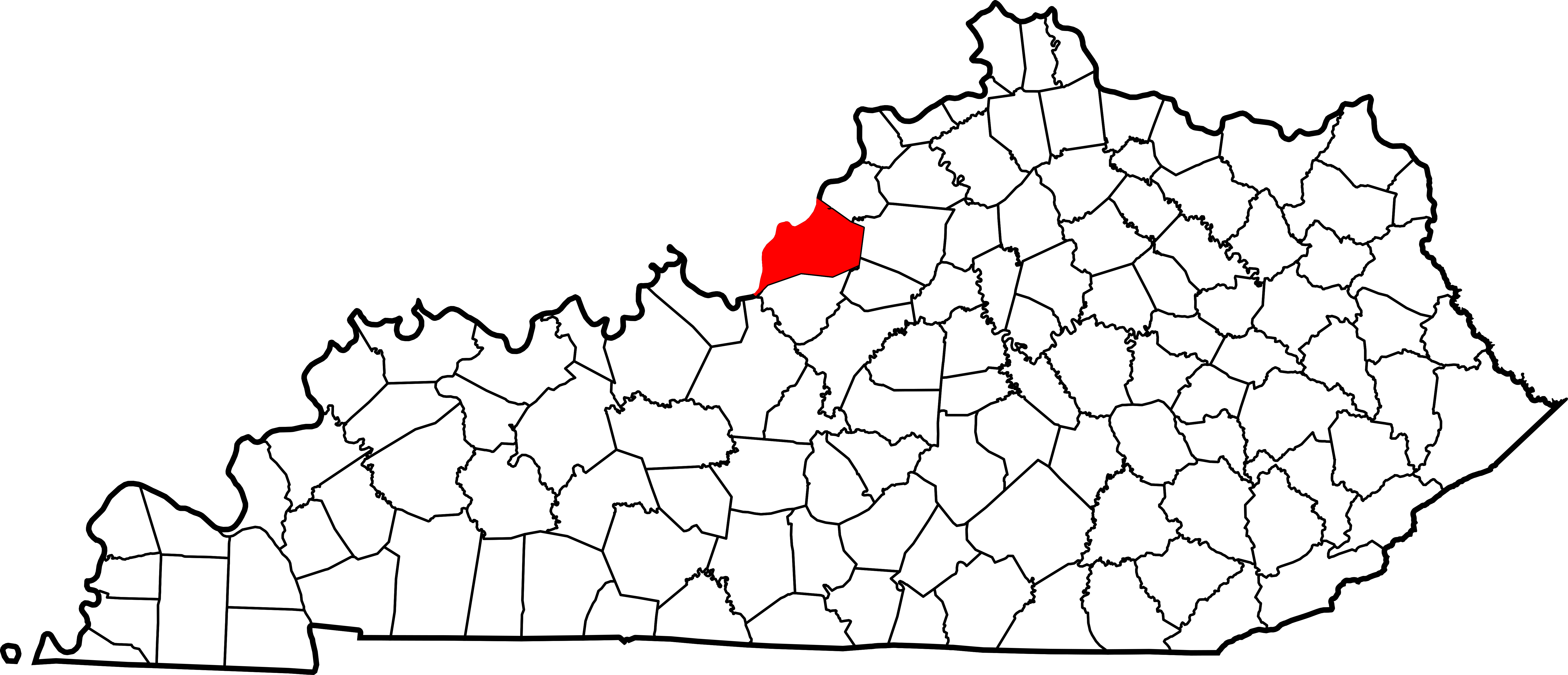
English: This is a locator map showing Jefferson County in Kentucky. For more information, see Commons:United States county locator maps. |
| Date | |
| Source |
Own work: English: The maps use data from nationalatlas.gov, specifically countyp020.tar.gz on the Raw Data Download page. The maps also use state outline data from statesp020.tar.gz. The Florida maps use hydrogm020.tar.gz to display Lake Okeechobee. |
| Author | David Benbennick |
Licensing[edit]
| I, the copyright holder of this work, release this work into the public domain. This applies worldwide. In some countries this may not be legally possible; if so: I grant anyone the right to use this work for any purpose, without any conditions, unless such conditions are required by law. |
File history
Click on a date/time to view the file as it appeared at that time.
| Date/Time | Thumbnail | Dimensions | User | Comment | |
|---|---|---|---|---|---|
| current | 12:22, 12 February 2006 | | 6,770 × 2,916 (127 KB) | David Benbennick (talk | contribs) | {{subst:User:Dbenbenn/clm|county=Jefferson County|state=Kentucky}} |
You cannot overwrite this file.
File usage on Commons
The following 6 pages use this file:
File usage on other wikis
The following other wikis use this file:
- Usage on ar.wikipedia.org
- لويفيل (كنتاكي)
- مقاطعة جيفيرسون (كنتاكي)
- أنشوراغ
- أودوبون بارك
- بانكروفت (كنتاكي)
- باربورميد
- بيتشوود (كنتاكي)
- بيليميد
- بيليوود
- بلو ريدج مانور
- بريروود (كنتاكي)
- برويك بوينت
- براونزبورو فارم
- براونزبورو فيليج
- كامبريدج (كنتاكي)
- كولدستريم
- كريكسايد
- كروسغيت
- دوغلاس هيلز
- درويد هيلز
- فينكاسل
- فوريست هيلز (كنتاكي)
- غلينفيو هيلز
- غلينفيو مانور
- غلينفيو
- غوز كريك
- غريمور ديفونديل
- غرين سبرينغ
- هيريتاغ كريك
- هيكوري هيل
- هيلز أند دالاس
- هولو كريك
- هوليفيل
- هيوستن أكريس
- هورستبورن أكريس
- هورستبورن
- إنديان هيلز
- كينغسلي (كنتاكي)
- لانغدون بلاس
- لينكولنشاير (كنتاكي)
- ليندون (كنتاكي)
- لينفيو
- مانور كريك
- ماريهيل إيستيت
- ميدو فال
- ميدوبروك فارم
- ميدوفيو إيستيت
- ميدلتاون (كنتاكي)
- موكينغبيرد فالي
- مورلاند (كنتاكي)
View more global usage of this file.