File:Map of Kansas highlighting Greenwood County.svg
Jump to navigation
Jump to search

Size of this PNG preview of this SVG file: 800 × 410 pixels. Other resolutions: 320 × 164 pixels | 640 × 328 pixels | 1,024 × 525 pixels | 1,280 × 656 pixels | 2,560 × 1,313 pixels | 6,607 × 3,388 pixels.
Original file (SVG file, nominally 6,607 × 3,388 pixels, file size: 24 KB)
Captions
Captions
Add a one-line explanation of what this file represents
Summary[edit]
| Description |
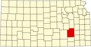
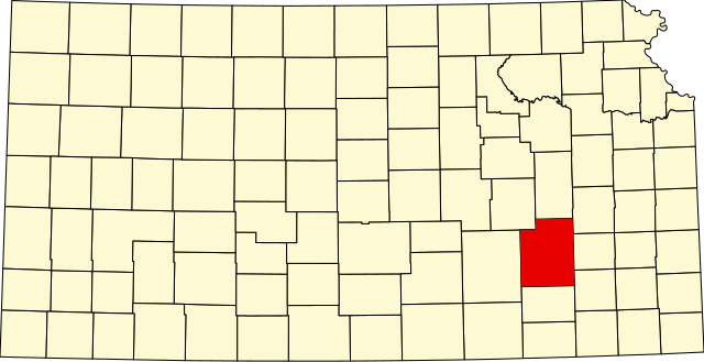
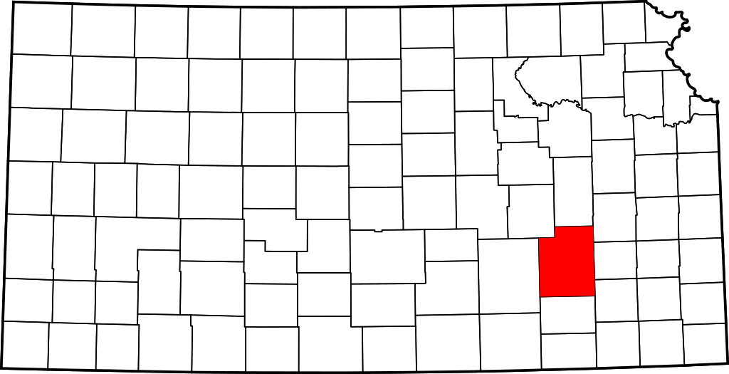
English: This is a locator map showing Greenwood County in Kansas. For more information, see Commons:United States county locator maps. |
| Date | |
| Source |
Own work: English: The maps use data from nationalatlas.gov, specifically countyp020.tar.gz on the Raw Data Download page. The maps also use state outline data from statesp020.tar.gz. The Florida maps use hydrogm020.tar.gz to display Lake Okeechobee. |
| Author | David Benbennick |
Licensing[edit]
| I, the copyright holder of this work, release this work into the public domain. This applies worldwide. In some countries this may not be legally possible; if so: I grant anyone the right to use this work for any purpose, without any conditions, unless such conditions are required by law. |
File history
Click on a date/time to view the file as it appeared at that time.
| Date/Time | Thumbnail | Dimensions | User | Comment | |
|---|---|---|---|---|---|
| current | 12:17, 12 February 2006 | | 6,607 × 3,388 (24 KB) | David Benbennick (talk | contribs) | {{subst:User:Dbenbenn/clm|county=Greenwood County|state=Kansas}} |
You cannot overwrite this file.
File usage on Commons
The following 4 pages use this file:
File usage on other wikis
The following other wikis use this file:
- Usage on ar.wikipedia.org
- Usage on bg.wikipedia.org
- Usage on bpy.wikipedia.org
- Usage on cdo.wikipedia.org
- Usage on ceb.wikipedia.org
- Usage on ce.wikipedia.org
- Usage on cs.wikipedia.org
- Usage on cy.wikipedia.org
- Usage on de.wikipedia.org
- Usage on en.wikipedia.org
- List of counties in Kansas
- Greenwood County, Kansas
- Climax, Kansas
- Eureka, Kansas
- Fall River, Kansas
- Hamilton, Kansas
- Madison, Kansas
- Severy, Kansas
- Virgil, Kansas
- Template:Greenwood County, Kansas
- Bachelor Township, Greenwood County, Kansas
- Eureka Township, Greenwood County, Kansas
- Fall River Township, Greenwood County, Kansas
- Janesville Township, Greenwood County, Kansas
- Lane Township, Greenwood County, Kansas
- Madison Township, Greenwood County, Kansas
- Otter Creek Township, Greenwood County, Kansas
- Pleasant Grove Township, Greenwood County, Kansas
- Quincy Township, Greenwood County, Kansas
- Salem Township, Greenwood County, Kansas
- Salt Springs Township, Greenwood County, Kansas
- Shell Rock Township, Greenwood County, Kansas
- South Salem Township, Greenwood County, Kansas
- Spring Creek Township, Greenwood County, Kansas
- Twin Grove Township, Greenwood County, Kansas
- Lamont, Kansas
- Neal, Kansas
- User:Nyttend/County templates/KS/1
- National Register of Historic Places listings in Greenwood County, Kansas
- Piedmont, Kansas
- Category:Populated places in Greenwood County, Kansas
- Quincy, Kansas
- Reece, Kansas
- Thrall, Kansas
- Ivanpah, Kansas
- Teterville, Kansas
- Utopia, Kansas
- Lapland, Kansas
View more global usage of this file.