File:Map of Colorado highlighting Boulder County.svg
Jump to navigation
Jump to search

Size of this PNG preview of this SVG file: 800 × 579 pixels. Other resolutions: 320 × 232 pixels | 640 × 463 pixels | 1,024 × 741 pixels | 1,280 × 926 pixels | 2,560 × 1,852 pixels | 6,234 × 4,511 pixels.
Original file (SVG file, nominally 6,234 × 4,511 pixels, file size: 67 KB)
Captions
Captions
Add a one-line explanation of what this file represents
Summary[edit]
| Description |
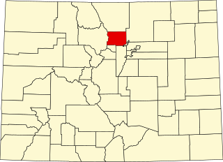
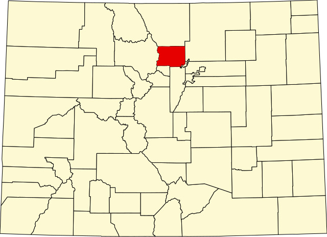
English: A map of Colorado highlighting Boulder County. For more information, see Commons:United States county locator maps. |
| Date | |
| Source |
Own work: English: The maps use data from nationalatlas.gov, specifically countyp020.tar.gz on the Raw Data Download page. The maps also use state outline data from statesp020.tar.gz. The Florida maps use hydrogm020.tar.gz to display Lake Okeechobee. |
| Author | David Benbennick |
Licensing[edit]
| I, the copyright holder of this work, release this work into the public domain. This applies worldwide. In some countries this may not be legally possible; if so: I grant anyone the right to use this work for any purpose, without any conditions, unless such conditions are required by law. |
File history
Click on a date/time to view the file as it appeared at that time.
| Date/Time | Thumbnail | Dimensions | User | Comment | |
|---|---|---|---|---|---|
| current | 05:42, 13 February 2006 | | 6,234 × 4,511 (67 KB) | David Benbennick (talk | contribs) | New version, smaller file size |
You cannot overwrite this file.
File usage on Commons
The following 11 pages use this file:
- File:Boulder County, Colorado until November 15, 2001.svg
- Category:Births in Boulder County, Colorado
- Category:Boulder County, Colorado
- Category:Deaths in Boulder County, Colorado
- Category:Education in Boulder County, Colorado
- Category:Geography of Boulder County, Colorado
- Category:Maps of Boulder County, Colorado
- Category:National Register of Historic Places in Boulder County, Colorado
- Category:People of Boulder County, Colorado
- Category:Populated places in Boulder County, Colorado
- Category:Transport in Boulder County, Colorado
File usage on other wikis
The following other wikis use this file:
- Usage on ar.wikipedia.org
- Usage on be.wikipedia.org
- Usage on bg.wikipedia.org
- Usage on bpy.wikipedia.org
- Usage on cdo.wikipedia.org
- Usage on ceb.wikipedia.org
- Usage on ce.wikipedia.org
- Usage on cs.wikipedia.org
- Usage on cy.wikipedia.org
- Usage on de.wikipedia.org
- Usage on en.wikipedia.org
- List of counties in Colorado
- Boulder, Colorado
- Boulder County, Colorado
- Allenspark, Colorado
- Coal Creek, Jefferson County, Colorado
- Eldora, Colorado
- Eldorado Springs, Colorado
- Erie, Colorado
- Gold Hill, Colorado
- Gunbarrel, Colorado
- Jamestown, Colorado
- Lafayette, Colorado
- Longmont, Colorado
- Louisville, Colorado
- Lyons, Colorado
- Nederland, Colorado
- Niwot, Colorado
- Superior, Colorado
- Ward, Colorado
- Hygiene, Colorado
- Pinecliffe, Colorado
- Caribou, Colorado
- Space Science Institute
- Altona, Colorado
- Template:Boulder County, Colorado
- List of Colorado municipalities by county
- User:Nyttend/County templates/CO
View more global usage of this file.