File:Map of Battle of the Changjin reservoir.jpg
Jump to navigation
Jump to search
Size of this preview: 469 × 599 pixels. Other resolutions: 188 × 240 pixels | 376 × 480 pixels | 601 × 768 pixels | 801 × 1,024 pixels | 1,603 × 2,048 pixels | 3,623 × 4,629 pixels.
Original file (3,623 × 4,629 pixels, file size: 1.96 MB, MIME type: image/jpeg)
Captions
Captions
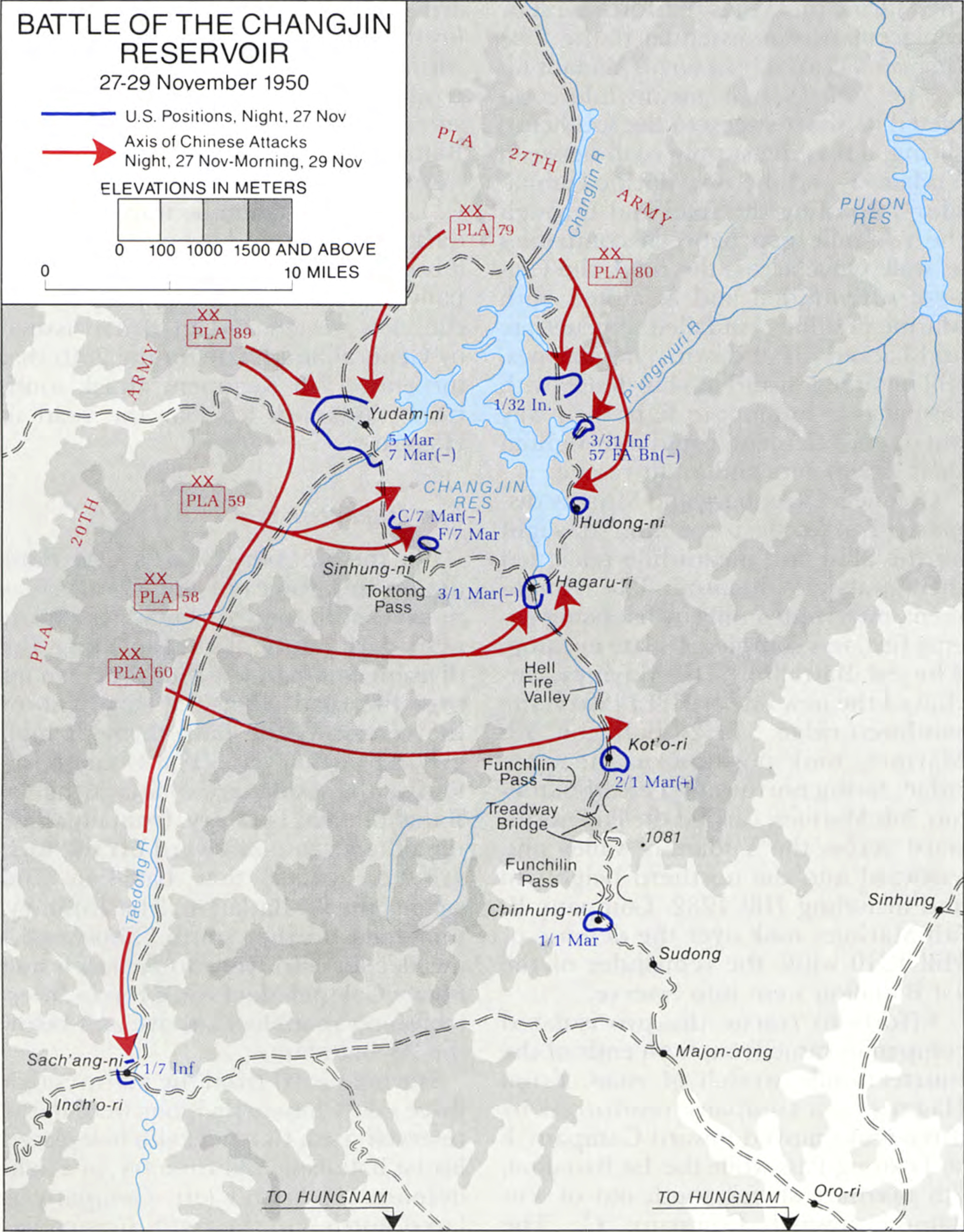
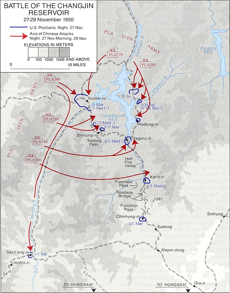
Battle of the Chosin Reservoir
Summary[edit]
| Description |
中文(繁體):長津湖戰役地圖。紅色箭號是中國人民志願軍進攻路線,藍線是聯合國軍防線。
地名中英對照(從北到南,從西到東):
|
| Date | |
| Source | Ebb and Flow: November 1950–July 1951, p. 95 |
| Author | Billy C. Mossman, United States Army Center of Military History |
| Other versions |
 |
Licensing[edit]
| This image is in the public domain because it contains materials that originally came from the United States Army Center of Military History, subject to the following qualification.
Note: The images of all badges, insignia, decorations and medals on the "CMH Online" web site are produced by the United States Army Institute of Heraldry and protected by Title 18, United States Code, Section 704 and the Code of Federal Regulations (32 CFR, Part 507). Permission to use these images for commercial purposes must be obtained from The Institute of Heraldry prior to their use. |

|
File history
Click on a date/time to view the file as it appeared at that time.
| Date/Time | Thumbnail | Dimensions | User | Comment | |
|---|---|---|---|---|---|
| current | 00:59, 10 July 2022 | | 3,623 × 4,629 (1.96 MB) | Happyseeu (talk | contribs) | Uploaded a work by Billy C. Mossman from [https://www.history.army.mil/html/books/020/20-4/CMH_Pub_20-4.pdf ''Ebb and Flow: November 1950–July 1951'', p. 95] with UploadWizard |
You cannot overwrite this file.
File usage on Commons
The following 2 pages use this file: