File:Map of Arizona highlighting Pima County.svg
Jump to navigation
Jump to search

Size of this PNG preview of this SVG file: 487 × 599 pixels. Other resolutions: 195 × 240 pixels | 390 × 480 pixels | 624 × 768 pixels | 832 × 1,024 pixels | 1,664 × 2,048 pixels | 893 × 1,099 pixels.
Original file (SVG file, nominally 893 × 1,099 pixels, file size: 260 KB)
Captions
Captions
Add a one-line explanation of what this file represents
Summary[edit]
| Description |
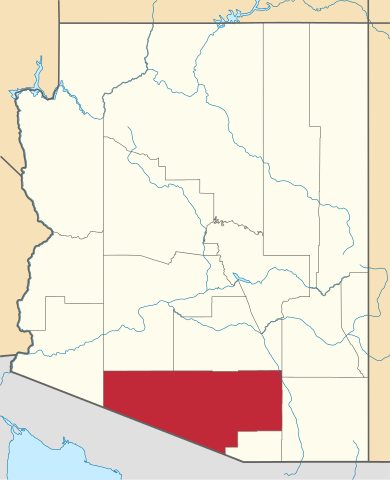
English: Locator map of Pima County in Arizona. |
||
| Date | |||
| Source | v.1: David Benbennick; v.2: File:USA Arizona location map.svg | ||
| Author | Own work. | ||
| Permission (Reusing this file) |
|
||
| Other versions | |||
| Commons images used |
- For more information, see Commons:United States county locator maps.
File history
Click on a date/time to view the file as it appeared at that time.
| Date/Time | Thumbnail | Dimensions | User | Comment | |
|---|---|---|---|---|---|
| current | 22:21, 28 February 2015 | | 893 × 1,099 (260 KB) | Sumiaz (talk | contribs) | Newer version based on File:USA Arizona location map.svg |
| 10:08, 12 February 2006 |  | 5,453 × 6,322 (56 KB) | David Benbennick (talk | contribs) | {{subst:User:Dbenbenn/clm|county=Pima County|state=Arizona}} |
You cannot overwrite this file.
File usage on Commons
The following 10 pages use this file:
- Category:Births in Pima County, Arizona
- Category:Deaths in Pima County, Arizona
- Category:Geography of Pima County, Arizona
- Category:History of Pima County, Arizona
- Category:Maps of Pima County, Arizona
- Category:National Register of Historic Places in Pima County, Arizona
- Category:People of Pima County, Arizona
- Category:Pima County, Arizona
- Category:Populated places in Pima County, Arizona
- Category:Santa Cruz County, Arizona
File usage on other wikis
The following other wikis use this file:
- Usage on ar.wikipedia.org
- توسان (أريزونا)
- قائمة مقاطعات أريزونا
- مقاطعة بيما (أريزونا)
- مارانا (أريزونا)
- أورو فالي (أريزونا)
- ساهوريتا (أريزونا)
- ساوث توكسون
- كاساس أدوبز
- محمية توهونو اودهام
- كاتالينا (أريزونا)
- غرين فالي (أريزونا)
- آجو (أريزونا)
- أفرا فالي (أريزونا)
- سانتا روزا (أريزونا)
- كورونا دي توكسون (أريزونا)
- دريكسل هايهتس (أريزونا)
- توكسون إستيتس (أريزونا)
- قالب:مقاطعة بيما (أريزونا)
- ثري بوينتس (أريزونا)
- تانكي فيردي (أريزونا)
- فايل (أريزونا)
- Usage on bg.wikipedia.org
- Usage on bpy.wikipedia.org
- Usage on ca.wikipedia.org
- Tucson
- Avra Valley
- Casas Adobes
- Catalina Foothills
- Corona de Tucson
- Drexel Heights
- Drexel-Alvernon
- East Sahuarita
- Flowing Wells
- Green Valley (Arizona)
- Santa Rosa (Arizona)
- Littletown
- Marana
- Oro Valley
- Picture Rocks (Arizona)
- Pisinemo
- Sahuarita
- Sells
- South Tucson
- Summit (Arizona)
- Tanque Verde
- Three Points
- Tortolita
- Tucson Estates
- Vail (Arizona)
View more global usage of this file.