File:Map of Île de la Cité with monuments - OpenStreetMap 2015.svg
Jump to navigation
Jump to search

Size of this PNG preview of this SVG file: 800 × 545 pixels. Other resolutions: 320 × 218 pixels | 640 × 436 pixels | 1,024 × 698 pixels | 1,280 × 873 pixels | 2,560 × 1,745 pixels | 2,401 × 1,637 pixels.
Original file (SVG file, nominally 2,401 × 1,637 pixels, file size: 564 KB)
Captions
Captions
Add a one-line explanation of what this file represents
Summary[edit]
| Description |
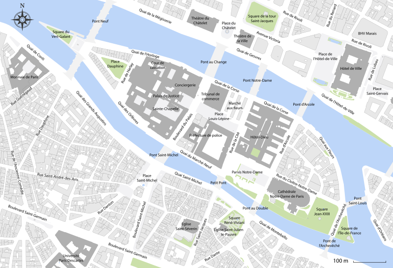
English: Map of Île de la Cité with monuments, Paris, France. |
| Date | |
| Source | Own work |
| Author | Paris 16 and OpenStreetMap contributors |
Licensing[edit]
I, the copyright holder of this work, hereby publish it under the following license:
This file is licensed under the Creative Commons Attribution-Share Alike 4.0 International license.
- You are free:
- to share – to copy, distribute and transmit the work
- to remix – to adapt the work
- Under the following conditions:
- attribution – You must give appropriate credit, provide a link to the license, and indicate if changes were made. You may do so in any reasonable manner, but not in any way that suggests the licensor endorses you or your use.
- share alike – If you remix, transform, or build upon the material, you must distribute your contributions under the same or compatible license as the original.
This image has been assessed using the Quality image guidelines and is considered a Quality image.
|
File history
Click on a date/time to view the file as it appeared at that time.
| Date/Time | Thumbnail | Dimensions | User | Comment | |
|---|---|---|---|---|---|
| current | 04:10, 28 November 2021 | | 2,401 × 1,637 (564 KB) | Paris 16 (talk | contribs) | |
| 19:20, 4 December 2020 |  | 512 × 349 (565 KB) | Paris 16 (talk | contribs) | ||
| 20:46, 27 November 2015 |  | 2,401 × 1,637 (861 KB) | Paris 16 (talk | contribs) | Expand | |
| 20:35, 27 November 2015 |  | 2,401 × 1,637 (461 KB) | Paris 16 (talk | contribs) | ||
| 20:34, 27 November 2015 |  | 2,401 × 1,637 (454 KB) | Paris 16 (talk | contribs) | User created page with UploadWizard |
You cannot overwrite this file.
File usage on Commons
The following 10 pages use this file:
- User:Chumwa/OgreBot/Transport Maps/2015 November 21-30
- User:Chumwa/OgreBot/Transport Maps/2020 December 1-10
- User:Chumwa/OgreBot/Transport Maps/2021 November 21-30
- User:Chumwa/OgreBot/Travel and communication maps/2020 December 1-10
- User:Chumwa/OgreBot/Travel and communication maps/2021 November 21-30
- User:Paris 16/Recent uploads/2015 November 25-27
- User:Paris 16/Recent uploads/2020 December 3-4
- User:Paris 16/Recent uploads/2021 November 28-30
- Commons:Quality images/Subject/Non photographic media
- Commons:Quality images candidates/Archives July 18 2020
File usage on other wikis
The following other wikis use this file:
- Usage on fi.wikipedia.org
- Usage on fr.wikipedia.org
- Usage on it.wikipedia.org
- Usage on nl.wikipedia.org
- Usage on ro.wikipedia.org
- Usage on vi.wikipedia.org