File:Map barney circle.jpg
Jump to navigation
Jump to search

Size of this preview: 490 × 599 pixels. Other resolutions: 196 × 240 pixels | 393 × 480 pixels | 628 × 768 pixels | 838 × 1,024 pixels | 1,961 × 2,397 pixels.
Original file (1,961 × 2,397 pixels, file size: 232 KB, MIME type: image/jpeg)
Captions
Captions
Add a one-line explanation of what this file represents
Summary[edit]
| Description |
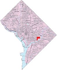
English: This image is a modified version of a self-generated reference map from the U.S. Census Bureau's American Factfinder at http://factfinder.census.gov/ by Wikipedia user Msclguru. |
| Date | 18 May 2006 (according to Exif data) |
| Source | Own work |
| Author | User:Msclguru |


This image or file is a work of a United States Census Bureau employee, taken or made as part of that person's official duties. As a work of the U.S. federal government, the image is in the public domain.
|
 |
Licensing[edit]
| This work has been released into the public domain by its author, Msclguru. This applies worldwide. In some countries this may not be legally possible; if so: |
Original upload log[edit]
Transferred from en.wikipedia to Commons using For the Common Good.
The original description page was here. All following user names refer to en.wikipedia.
| Date/Time | Dimensions | User | Comment |
|---|---|---|---|
| 16:40, 9 June 2006 | 1,961 × 2,397 (238,037 bytes) | w:en:Msclguru (talk | contribs) | (This image is a modified version of a self-generated reference map from the [[U.S. Census Bureau]]'s American Factfinder at http://factfinder.census.gov/ by Wikipedia user [[User:Msclguru|Msclguru]]. {{PD-USGov}} ) |
| 16:33, 31 May 2006 | 671 × 842 (371,282 bytes) | w:en:Msclguru (talk | contribs) | (Self-made by applying personal edits to public domain (government) document {{GFDL-self}}) |
| 17:17, 18 May 2006 | 671 × 842 (370,399 bytes) | w:en:Msclguru (talk | contribs) | (Personal edits to public domain document) |
File history
Click on a date/time to view the file as it appeared at that time.
| Date/Time | Thumbnail | Dimensions | User | Comment | |
|---|---|---|---|---|---|
| current | 21:05, 8 September 2012 | | 1,961 × 2,397 (232 KB) | OgreBot (talk | contribs) | (BOT): Reverting to most recent version before archival |
| 21:05, 8 September 2012 |  | 671 × 842 (363 KB) | OgreBot (talk | contribs) | (BOT): Uploading old version of file from en.wikipedia; originally uploaded on 2006-05-31 16:33:02 by Msclguru | |
| 21:05, 8 September 2012 |  | 671 × 842 (362 KB) | OgreBot (talk | contribs) | (BOT): Uploading old version of file from en.wikipedia; originally uploaded on 2006-05-18 17:17:58 by Msclguru | |
| 20:57, 8 September 2012 |  | 1,961 × 2,397 (232 KB) | Bulwersator (talk | contribs) | Transferred from en.wikipedia: see original upload log above |
You cannot overwrite this file.
File usage on Commons
The following page uses this file:
File usage on other wikis
The following other wikis use this file:
- Usage on en.wikipedia.org
- Usage on ur.wikipedia.org
- Usage on www.wikidata.org
- Usage on zh.wikipedia.org