File:Map after Ptolemy's Geographia (Burney MS 111, f.38v).png
Jump to navigation
Jump to search
Size of this preview: 430 × 599 pixels. Other resolutions: 172 × 240 pixels | 344 × 480 pixels | 551 × 768 pixels | 735 × 1,024 pixels | 1,720 × 2,396 pixels.
Original file (1,720 × 2,396 pixels, file size: 5.75 MB, MIME type: image/png)
Captions
Captions
Add a one-line explanation of what this file represents
Summary[edit]
.png&action=edit§ion=1)
| Description |
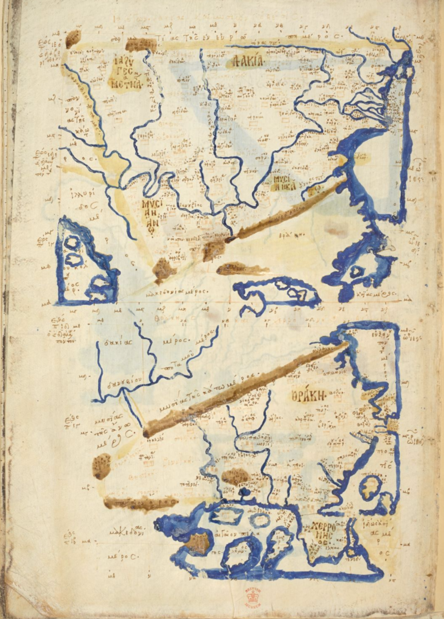
Latina: Dacia et Thrace English: The Ninth European Map (in two parts) from a Greek manuscript edition of Ptolemy's Geography, depicting the Wandering Iazyges, Dacia, Upper and Lower Moesia (mislabeled as Mysia), and Thrace Ἀρχαία ἑλληνικὴ: Ἰαζύγων, Δακίας, και Μυσιων Δΰο Θέσις / Θράκης κὰι Χερρονήσου Θέσις: Ἰάζϋγεσ Μετανασται, Δακία, Μϋσΐα ἡ Ἄνων κὰι ἡ Κάτων, Θράκη, κὰι Χερρόνησος |
| Date | |
| Source | Burney MS 111 at the British Library |
| Author | Ptolemy |
Licensing[edit]
.png&action=edit§ion=2)
|
This work is in the public domain in its country of origin and other countries and areas where the copyright term is the author's life plus 70 years or fewer. This work is in the public domain in the United States because it was published (or registered with the U.S. Copyright Office) before January 1, 1929. | |
| This file has been identified as being free of known restrictions under copyright law, including all related and neighboring rights. | |
| Annotations | This image is annotated: View the annotations at Commons |
.png)
File history
Click on a date/time to view the file as it appeared at that time.
| Date/Time | Thumbnail | Dimensions | User | Comment | |
|---|---|---|---|---|---|
| current | 04:01, 28 August 2016 | | 1,720 × 2,396 (5.75 MB) | LlywelynII (talk | contribs) | User created page with UploadWizard |
You cannot overwrite this file.
File usage on Commons
The following page uses this file:
.jpeg.png&redirect=no)
File usage on other wikis
The following other wikis use this file:
.png&oldid=601450033)