File:Map Canada political 2.png
Jump to navigation
Jump to search

Size of this preview: 693 × 599 pixels. Other resolutions: 278 × 240 pixels | 555 × 480 pixels | 888 × 768 pixels | 1,184 × 1,024 pixels | 1,280 × 1,107 pixels.
Original file (1,280 × 1,107 pixels, file size: 387 KB, MIME type: image/png)
Captions
Captions
Add a one-line explanation of what this file represents
| Description |
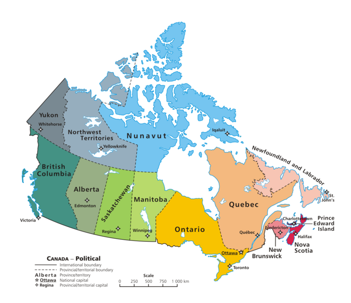
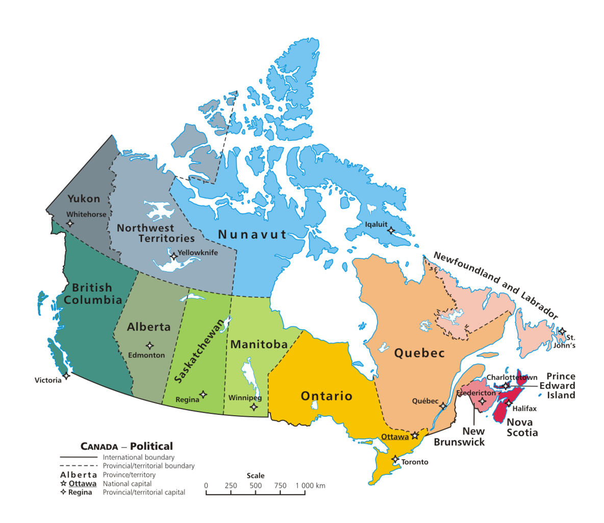
English: A map of Canada exhibiting its ten provinces and three territories, and their capitals. |
| Date | (UTC) |
| Source | |
| Author |
|
| This is a retouched picture, which means that it has been digitally altered from its original version. Modifications: + PNG transparency outline. The original can be viewed here: Map Canada political.png: File:Map Canada political.png. Modifications made by GIMP.
|
I, the copyright holder of this work, hereby publish it under the following license:
| |
This work has been released into the public domain by its author, Example, at the [[::|English Wikipedia]] project. This applies worldwide. In case this is not legally possible: |
Original upload log[edit]
This image is a derivative work of the following images:
- File:Map_Canada_political.png licensed with PD-user-w
- 2007-06-13T02:50:40Z Andrew pmk 1280x1107 (250520 Bytes) optimize png
- 2007-06-06T01:38:46Z Andrew pmk 1280x1107 (250520 Bytes) optimize png
- 2006-06-06T09:35:23Z Kaveh 1280x1107 (302665 Bytes) == Summary == [[Canada]]: political map – depicting |provinces/territories and capital cities. Drawn and adapted by [[:en:User:E Pluribus Anthony|E Pluribus Anthony]] from [http://atlas.gc.ca/site/english/maps/reference/n
Uploaded with derivativeFX
File history
Click on a date/time to view the file as it appeared at that time.
| Date/Time | Thumbnail | Dimensions | User | Comment | |
|---|---|---|---|---|---|
| current | 03:08, 7 February 2010 | | 1,280 × 1,107 (387 KB) | Merosonox~commonswiki (talk | contribs) | {{Information |Description={{en|1=A map of Canada exhibiting its ten provinces and three territories, and their capitals.}} |Source=*File:Map_Canada_political.png |Date=2010-02-07 03:06 (UTC) |Author=*File:Map_Canada_political.png: [[:en:User: |
You cannot overwrite this file.
File usage on Commons
There are no pages that use this file.
File usage on other wikis
The following other wikis use this file:
- Usage on diq.wikipedia.org
- Usage on ta.wikipedia.org
- Usage on tr.wikipedia.org
- Kanada
- Şablon:Kanada'nın eyaletleri ve bölgeleri
- Manitoba
- Saskatchewan
- Ontario
- Kategori:Kanada'nın eyaletleri
- Prens Edward Adası
- New Brunswick
- Québec
- Alberta
- Yeni İskoçya
- Newfoundland ve Labrador
- Yukon
- Kuzeybatı Toprakları
- Nunavut
- Kanada'nın eyaletleri ve bölgeleri
- Kategori:Kanada'nın eyaletleri ve bölgeleri
- Kategori:Kanada'nın bölgeleri
- Banks Adası
- Britanya Kolumbiyası
- Saint-Maurice—Laflèche