File:Map Caddo oil field(Louisiana).png
Jump to navigation
Jump to search

Size of this preview: 644 × 599 pixels. Other resolutions: 258 × 240 pixels | 516 × 480 pixels | 894 × 832 pixels.
Original file (894 × 832 pixels, file size: 244 KB, MIME type: image/png)
Captions
Captions
Add a one-line explanation of what this file represents
Summary[edit]
.png&action=edit§ion=1)
| Description |
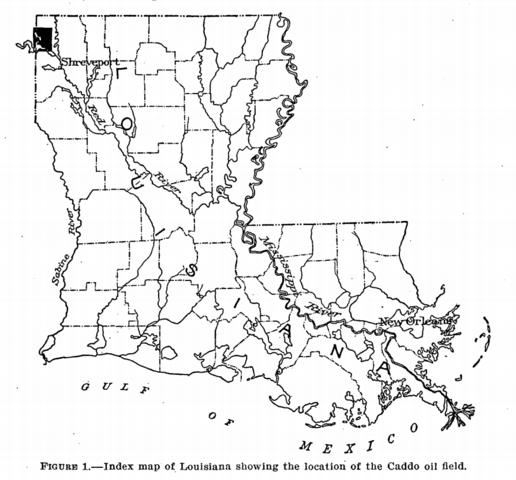
English: Index map of Louisiana showing the location of the Caddo oil field. |
| Date | |
| Source | http://pubs.usgs.gov/bul/0619/report.pdf |
| Author | George Charlton Matson |
- Other information
English: DEPARTMENT OF THE INTERIOR
FRANKLIN K. LANE, Secretary UNITED STATES GEOLOGICAL SURVEY GEORGE OTIS SMITH, Director
Bulletin 619
This image is in the public domain in the United States because it only contains materials that originally came from the United States Geological Survey, an agency of the United States Department of the Interior. For more information, see the official USGS copyright policy.
|
Licensing[edit]
.png&action=edit§ion=2)
This media file is in the public domain in the United States. This applies to U.S. works where the copyright has expired, often because its first publication occurred prior to January 1, 1929, and if not then due to lack of notice or renewal. See this page for further explanation.
|
 | |
 |
This image might not be in the public domain outside of the United States; this especially applies in the countries and areas that do not apply the rule of the shorter term for US works, such as Canada, Mainland China (not Hong Kong or Macao), Germany, Mexico, and Switzerland. The creator and year of publication are essential information and must be provided. See Wikipedia:Public domain and Wikipedia:Copyrights for more details.
|
File history
Click on a date/time to view the file as it appeared at that time.
| Date/Time | Thumbnail | Dimensions | User | Comment | |
|---|---|---|---|---|---|
| current | 16:30, 25 May 2015 | | 894 × 832 (244 KB) | Moist towelett (talk | contribs) | {{subst:Upload marker added by en.wp UW}} {{Information |Description = {{en|ndex map of Louisiana showing the location of the Caddo oil field.}} |Source = http://pubs.usgs.gov/bul/0619/report.pdf |Date = 1916 |Author = George Charlton Matson }} ;Other... |
You cannot overwrite this file.
File usage on Commons
There are no pages that use this file.
File usage on other wikis
The following other wikis use this file:
- Usage on en.wikipedia.org
- Usage on ru.wikipedia.org
- Usage on www.wikidata.org
.png&oldid=493414806)