File:Map 11 Amundsen Sea Ed 4.jpg
Jump to navigation
Jump to search

Size of this preview: 418 × 599 pixels. Other resolutions: 167 × 240 pixels | 335 × 480 pixels | 536 × 768 pixels | 714 × 1,024 pixels | 1,429 × 2,048 pixels | 2,880 × 4,128 pixels.
Original file (2,880 × 4,128 pixels, file size: 1.11 MB, MIME type: image/jpeg)
Captions
Captions
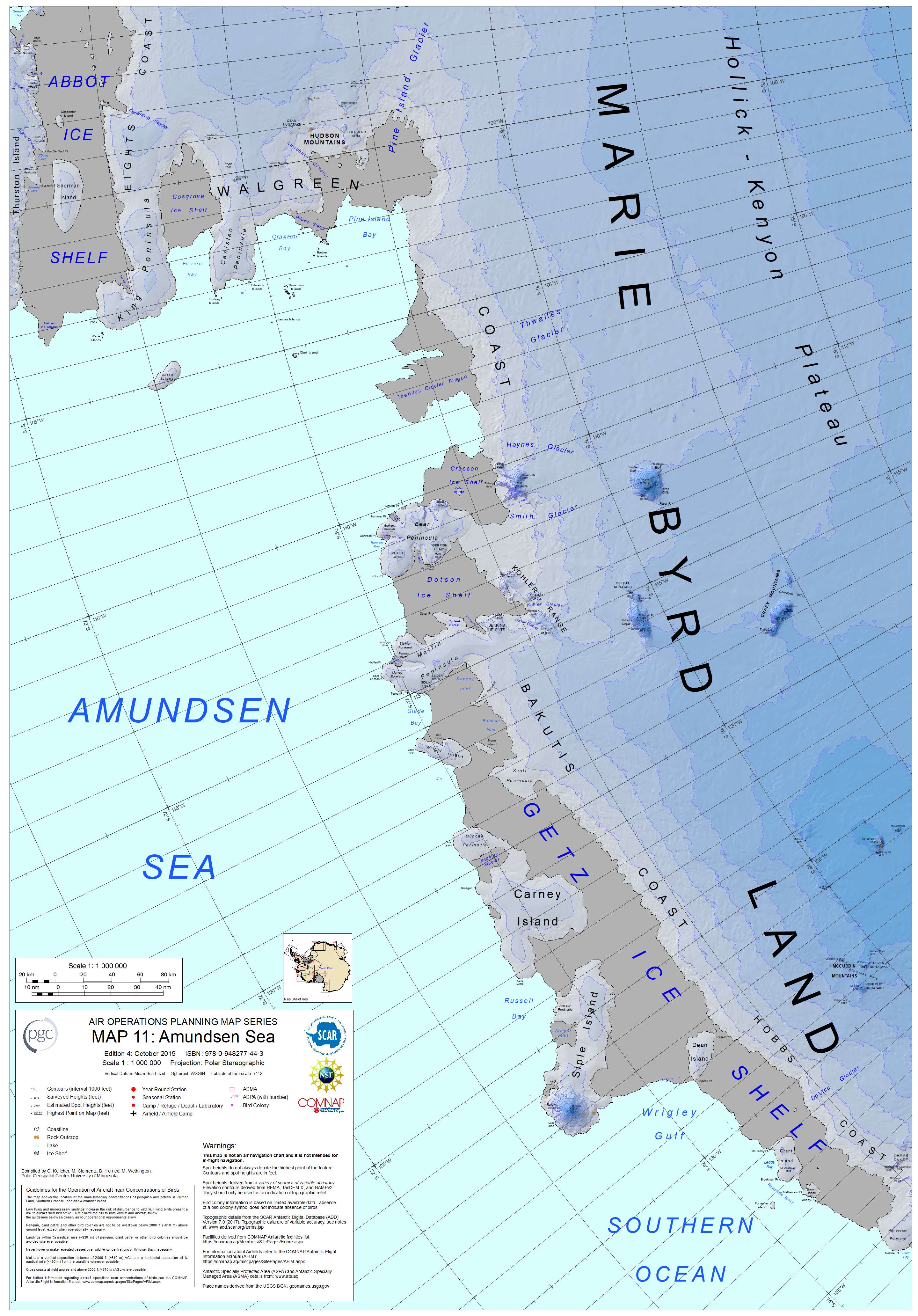
Amundsen Sea and Marie Byrd Land map, Antarctica
Summary[edit]
| Description |
Français : Carte de la mer d'Amundsen et de la Terre Marie Byrd, Antarctique
English: Amundsen Sea and Marie Byrd Land map, Antarctica |
| Date | |
| Source | https://data.pgc.umn.edu/maps/antarctica/pgc/17/preview/Map%2011%20Amundsen%20Sea%20Ed%204.jpg |
| Author | C. Kelleher, M. Clementz, B. Herried, M. Wethington as a work-for-hire of the Polar Geospacial Center, University of Michigan |
Licensing[edit]

|
The copyright holder of this file, the Polar Geospatial Center, allows anyone to use it for any purpose, provided that the copyright holder is properly attributed. Redistribution, derivative work, commercial use, and all other use is permitted. |
Attribution:
Polar Geospatial Center, 2018, PGC Map Catalog, https://doi.org/10.7910/DVN/6R8F7U, Harvard Dataverse, V1, Map 13, 29 July 2019]
|
File history
Click on a date/time to view the file as it appeared at that time.
| Date/Time | Thumbnail | Dimensions | User | Comment | |
|---|---|---|---|---|---|
| current | 14:06, 3 January 2022 | | 2,880 × 4,128 (1.11 MB) | Rémih (talk | contribs) | Uploaded a work by C. Kelleher, M. Clementz, B. Herried, M. Wethington as a work-for-hire of the Polar Geospacial Center, University of Michigan from https://data.pgc.umn.edu/maps/antarctica/pgc/17/preview/Map%2011%20Amundsen%20Sea%20Ed%204.jpg with UploadWizard |
You cannot overwrite this file.
File usage on Commons
The following page uses this file:
File usage on other wikis
The following other wikis use this file:
- Usage on hr.wikipedia.org