File:MapEmirateSharjah.PNG
Jump to navigation
Jump to search
No higher resolution available.
MapEmirateSharjah.PNG (597 × 486 pixels, file size: 9 KB, MIME type: image/png)
Captions
Captions
Add a one-line explanation of what this file represents
Summary[edit]
| Description |
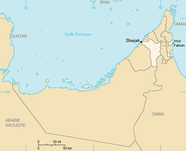
Description:Carte de l'émirat de Sharjah,Emirats arabes unis
|
| Date | 4 September 2006 (original upload date) |
| Source | Own work |
| Author | Rémih |
Licensing[edit]
| I, the copyright holder of this work, release this work into the public domain. This applies worldwide. In some countries this may not be legally possible; if so: I grant anyone the right to use this work for any purpose, without any conditions, unless such conditions are required by law. |
File history
Click on a date/time to view the file as it appeared at that time.
| Date/Time | Thumbnail | Dimensions | User | Comment | |
|---|---|---|---|---|---|
| current | 23:43, 14 October 2013 | | 597 × 486 (9 KB) | Ras67 (talk | contribs) | cropped |
| 10:26, 4 September 2006 |  | 603 × 492 (17 KB) | Rémih (talk | contribs) | *Description:Carte de l'émirat de Sharjah,Emirats arabes unis *Auteur:Rémih Category:Maps of the United Arab Emirates |
You cannot overwrite this file.
File usage on Commons
The following page uses this file:
File usage on other wikis
The following other wikis use this file:
- Usage on br.wikipedia.org
- Usage on frp.wikipedia.org
- Usage on ja.wikipedia.org
- Usage on kn.wikipedia.org
- Usage on ko.wikipedia.org
- Usage on nn.wikipedia.org
- Usage on pnb.wikipedia.org
- Usage on ro.wikipedia.org
- Usage on sh.wikipedia.org
- Usage on ta.wikipedia.org