File:Mangaiamap.png
Jump to navigation
Jump to search

Size of this preview: 800 × 596 pixels. Other resolutions: 320 × 238 pixels | 640 × 477 pixels | 1,024 × 763 pixels | 1,280 × 954 pixels | 2,000 × 1,490 pixels.
Original file (2,000 × 1,490 pixels, file size: 801 KB, MIME type: image/png)
Captions
Captions
Add a one-line explanation of what this file represents
Summary[edit]
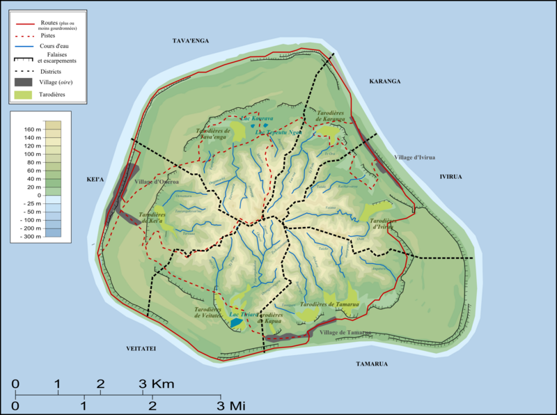
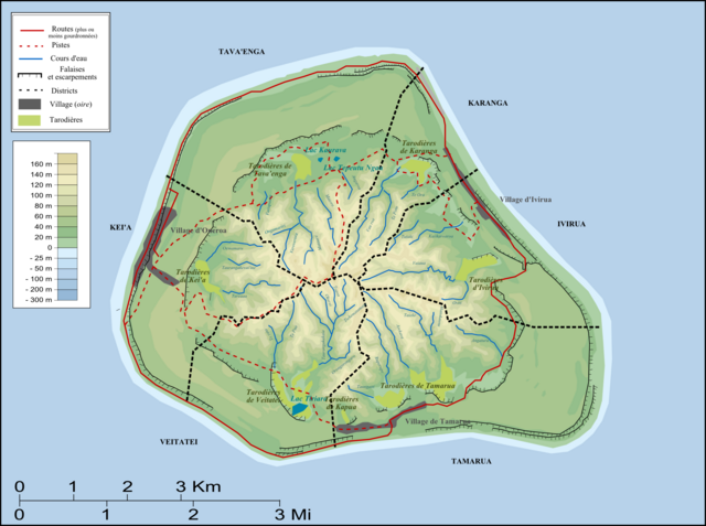
| Description | Carte de Mangaia/map of Mangaia |
| Date | |
| Source | Own work |
| Author | Nevers |
Licensing[edit]
| I, the copyright holder of this work, release this work into the public domain. This applies worldwide. In some countries this may not be legally possible; if so: I grant anyone the right to use this work for any purpose, without any conditions, unless such conditions are required by law. |
File history
Click on a date/time to view the file as it appeared at that time.
| Date/Time | Thumbnail | Dimensions | User | Comment | |
|---|---|---|---|---|---|
| current | 18:05, 1 January 2008 | | 2,000 × 1,490 (801 KB) | Nevers (talk | contribs) | {{Information |Description=Carte de Mangaia/map of Mangaia |Source=travail personnel |Date=Janvier 2008 |Author= Nevers |Permission= |other_versions= }} Category:Cook Islands |
You cannot overwrite this file.
File usage on Commons
There are no pages that use this file.
File usage on other wikis
The following other wikis use this file:
- Usage on fr.wikipedia.org