File:Malaysia location map.svg
Jump to navigation
Jump to search

Size of this PNG preview of this SVG file: 800 × 305 pixels. Other resolutions: 320 × 122 pixels | 640 × 244 pixels | 1,024 × 390 pixels | 1,280 × 487 pixels | 2,560 × 975 pixels | 1,200 × 457 pixels.
Original file (SVG file, nominally 1,200 × 457 pixels, file size: 499 KB)
Captions
Captions
Add a one-line explanation of what this file represents
Summary[edit]
| Description |
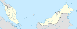
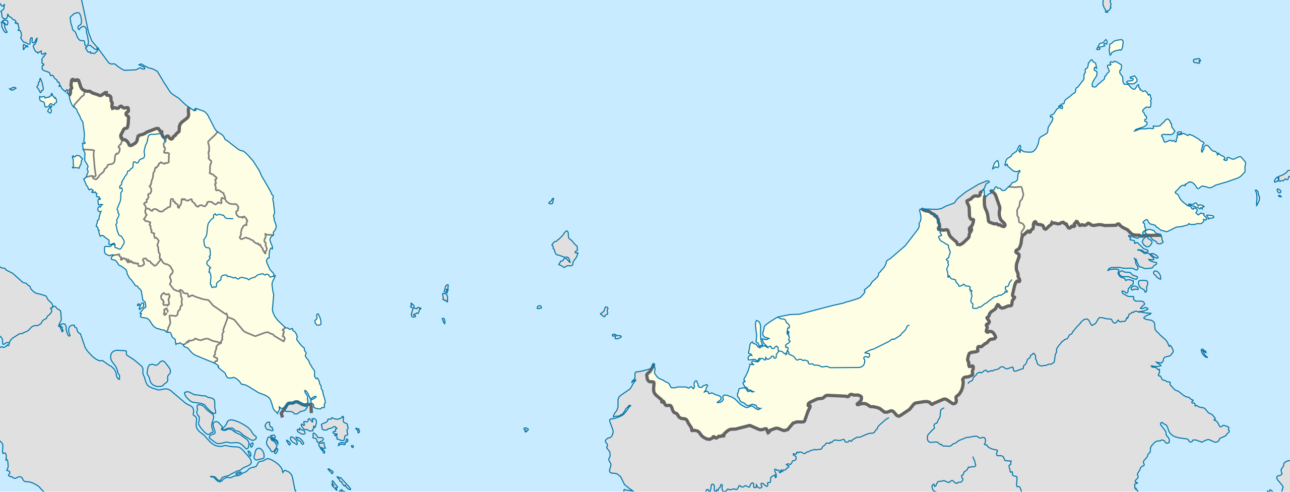
English: Location map of Malaysia.
Equirectangular projection. Strechted by 100.0%. Geographic limits of the map: * N: 8.0° N * S: 0.0° N * W: 99.0° E * E: 120.0° EMade with Natural Earth. Free vector and raster map data @ naturalearthdata.com. |
| Date | |
| Source | Own work |
| Author | Uwe Dedering |
| Other versions |
|
Licensing[edit]
I, the copyright holder of this work, hereby publish it under the following licenses:
This file is licensed under the Creative Commons Attribution-Share Alike 3.0 Unported license.
- You are free:
- to share – to copy, distribute and transmit the work
- to remix – to adapt the work
- Under the following conditions:
- attribution – You must give appropriate credit, provide a link to the license, and indicate if changes were made. You may do so in any reasonable manner, but not in any way that suggests the licensor endorses you or your use.
- share alike – If you remix, transform, or build upon the material, you must distribute your contributions under the same or compatible license as the original.

|
Permission is granted to copy, distribute and/or modify this document under the terms of the GNU Free Documentation License, Version 1.2 or any later version published by the Free Software Foundation; with no Invariant Sections, no Front-Cover Texts, and no Back-Cover Texts. A copy of the license is included in the section entitled GNU Free Documentation License. |
You may select the license of your choice.
File history
Click on a date/time to view the file as it appeared at that time.
| Date/Time | Thumbnail | Dimensions | User | Comment | |
|---|---|---|---|---|---|
| current | 13:45, 22 February 2010 | 1,200 × 457 (499 KB) | Uwe Dedering (talk | contribs) | complete new version with right projection and colors | |
| 23:31, 18 July 2009 | 1,170 × 400 (540 KB) | Mdzafri (talk | contribs) | more detailed map. | ||
| 16:38, 9 February 2009 | 1,171 × 400 (558 KB) | Doctor Dodge (talk | contribs) | resized to 400 x 1170 | ||
| 14:43, 9 February 2009 | 3,000 × 1,025 (558 KB) | Doctor Dodge (talk | contribs) | {{Information |Description={{en|1=Location map for Malaysia}} |Source=Own work by uploader |Author=Doctor Dodge |Date=9 febbraio 2009 |Permission= |other_versions= }} <!--{{ImageUpload|full}}--> Category:Location maps of Asia |
You cannot overwrite this file.
File usage on Commons
The following 30 pages use this file:
- User:SpinnerLaserz/Flags/Flags of Malaysia/Malaysia
- User talk:NordNordWest/Archive5
- Commons:Graphic Lab/Map workshop/Archive/2013
- Commons:Graphic Lab/Map workshop/Archive/2016
- Commons:Graphic Lab/Map workshop/Archive/2022
- File:Johor in Malaysia.svg
- File:Kedah in Malaysia.svg
- File:Kelantan in Malaysia.svg
- File:Kuala Lumpur in Malaysia.svg
- File:Kuala Lumpur in Malaysia (special marker).svg
- File:Kuala Lumpur in Malaysia (zoom).svg
- File:Labuan in Malaysia.svg
- File:Labuan in Malaysia (special marker).svg
- File:Malacca in Malaysia.svg
- File:Malaysia relief location map.jpg
- File:Malaysia tree diagram.svg
- File:Negeri Sembilan in Malaysia.svg
- File:Pahang in Malaysia.svg
- File:Penang in Malaysia.svg
- File:Penang in Malaysia (special marker).svg
- File:Perak in Malaysia.svg
- File:Perlis in Malaysia.svg
- File:Perlis in Malaysia (special marker).svg
- File:Putrajaya in Malaysia.svg
- File:Putrajaya in Malaysia (special marker).svg
- File:Putrajaya in Malaysia (zoom).svg
- File:Sabah in Malaysia.svg
- File:Sarawak in Malaysia.svg
- File:Selangor in Malaysia.svg
- File:Terengganu in Malaysia.svg
.svg)
.svg)
.svg)
.svg)
.svg)
.svg)
.svg)
File usage on other wikis
The following other wikis use this file:
- Usage on ace.wikipedia.org
- Usage on af.wikipedia.org
- Usage on an.wikipedia.org
- Usage on ar.wikipedia.org
- Usage on ast.wikipedia.org
- Gran Premiu de Malasia de 2007
- Gran Premiu de Malasia de 2006
- Gran Premiu de Malasia de 2008
- Torres Petronas
- Menara Telekom
- Kuala Lumpur
- Aeropuertu Internacional de Penang - Malasia
- Putrajaya
- George Town
- Petaling Jaya
- Estadiu Nacional Bukit Jalil
- Península de Malaca
- Estrechu de Singapur
- Estrechu de Johor
- Torre de Kuala Lumpur
- Kuching
- Ipoh
- Malasia Peninsular
- Alor Setar
- Kota Kinabalu
- Johor Bahru
- Módulu:Mapa de llocalización/datos/Malasia
- Módulu:Mapa de llocalización/datos/Malasia/usu
- Aeropuertu Internacional de Kuala Lumpur
- Sepang
- Circuitu Internacional de Sepang
- Aeropuertu de Tawau
- Puertu de Johor
- Puertu de Kemaman
- Semporna
- Islla Tengah
- Usage on azb.wikipedia.org
- Usage on az.wikipedia.org
View more global usage of this file.