File:Madeira location (PT and EU).jpg
Jump to navigation
Jump to search
Size of this preview: 714 × 600 pixels. Other resolutions: 286 × 240 pixels | 572 × 480 pixels | 915 × 768 pixels | 1,219 × 1,024 pixels | 2,048 × 1,720 pixels.
Original file (2,048 × 1,720 pixels, file size: 226 KB, MIME type: image/jpeg)
Captions
Captions
Add a one-line explanation of what this file represents

|
File:EU-Portugal with Madeira circled.svg is a vector version of this file. It should be used in place of this JPG file when not inferior.
File:Madeira location (PT and EU).jpg → File:EU-Portugal with Madeira circled.svg
For more information, see Help:SVG. |
 |
Summary[edit]
.jpg&action=edit§ion=1)
| Description |
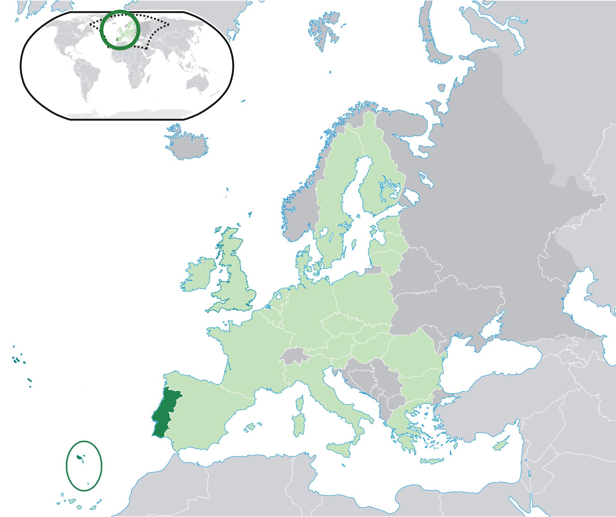
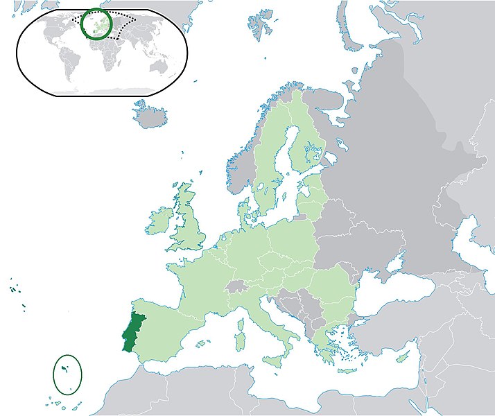
English: Location of Madeira Islands - Madeira Autonomous Region - (red), in Portugal (green) and in the European Union (blue).
Português: Localização da Madeira - Região Autónoma da Madeira - (vermelho), em Portugal (verde) e na União Europeia (azul)
Español: Localización de Madeira - Región Autónoma de Madeira - (rojo), en Portugal (verde) y en la Unión Europea |
| Date | |
| Source | Derivate from Location Portugal EU Europe.png |
| Author | It's a new modified file derivate from Location Portugal EU Europe.png |
Licensing[edit]
.jpg&action=edit§ion=2)

|
Permission is granted to copy, distribute and/or modify this document under the terms of the GNU Free Documentation License, Version 1.2 or any later version published by the Free Software Foundation; with no Invariant Sections, no Front-Cover Texts, and no Back-Cover Texts. A copy of the license is included in the section entitled GNU Free Documentation License. |
| This file is licensed under the Creative Commons Attribution-Share Alike 3.0 Unported license. | ||
| ||
| This licensing tag was added to this file as part of the GFDL licensing update. |
File history
Click on a date/time to view the file as it appeared at that time.
| Date/Time | Thumbnail | Dimensions | User | Comment | |
|---|---|---|---|---|---|
| current | 16:35, 3 April 2011 | | 2,048 × 1,720 (226 KB) | The Ogre (talk | contribs) | Correc t location of Madeira, since it must include the Savage islands |
| 16:26, 28 January 2009 |  | 1,736 × 1,478 (150 KB) | Maycoll F. Vieira (talk | contribs) | {{Information |Description={{en|1=Location of Madeira Islands - Madeira Autonomous Region - (red), in Portugal (green) and in the European Union (blue).}} {{pt|1=Localização da Madeira - Região Autónoma da Madeira - (vermelho), em Portugal (verde) e n |
You cannot overwrite this file.
File usage on Commons
There are no pages that use this file.
File usage on other wikis
The following other wikis use this file:
- Usage on en.wikipedia.org
- Usage on ta.wikinews.org
- Usage on uk.wikipedia.org
- Usage on yo.wikipedia.org
.jpg&oldid=754028500)