File:MX-DF-División política.svg
Jump to navigation
Jump to search

Size of this PNG preview of this SVG file: 448 × 600 pixels. Other resolutions: 179 × 240 pixels | 358 × 480 pixels | 574 × 768 pixels | 765 × 1,024 pixels | 1,530 × 2,048 pixels.
Original file (SVG file, nominally 765 × 1,024 pixels, file size: 29 KB)
Captions
Captions
Add a one-line explanation of what this file represents
Summary[edit]
| Description |
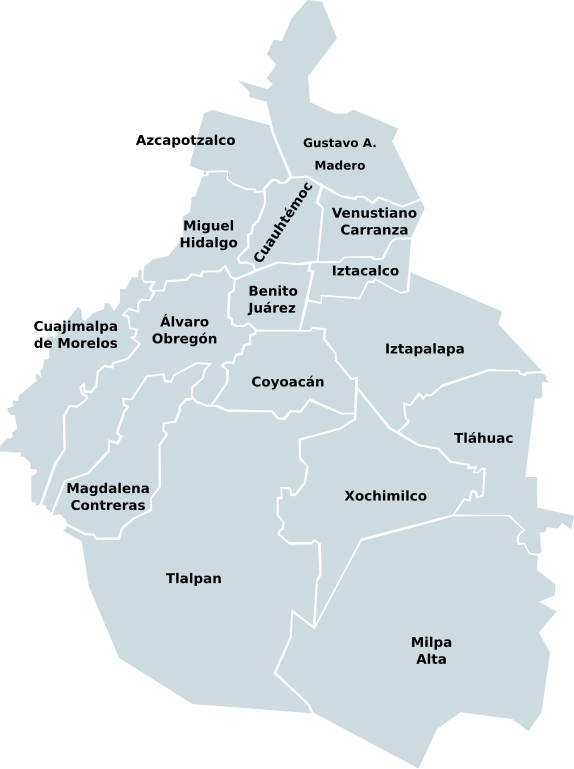
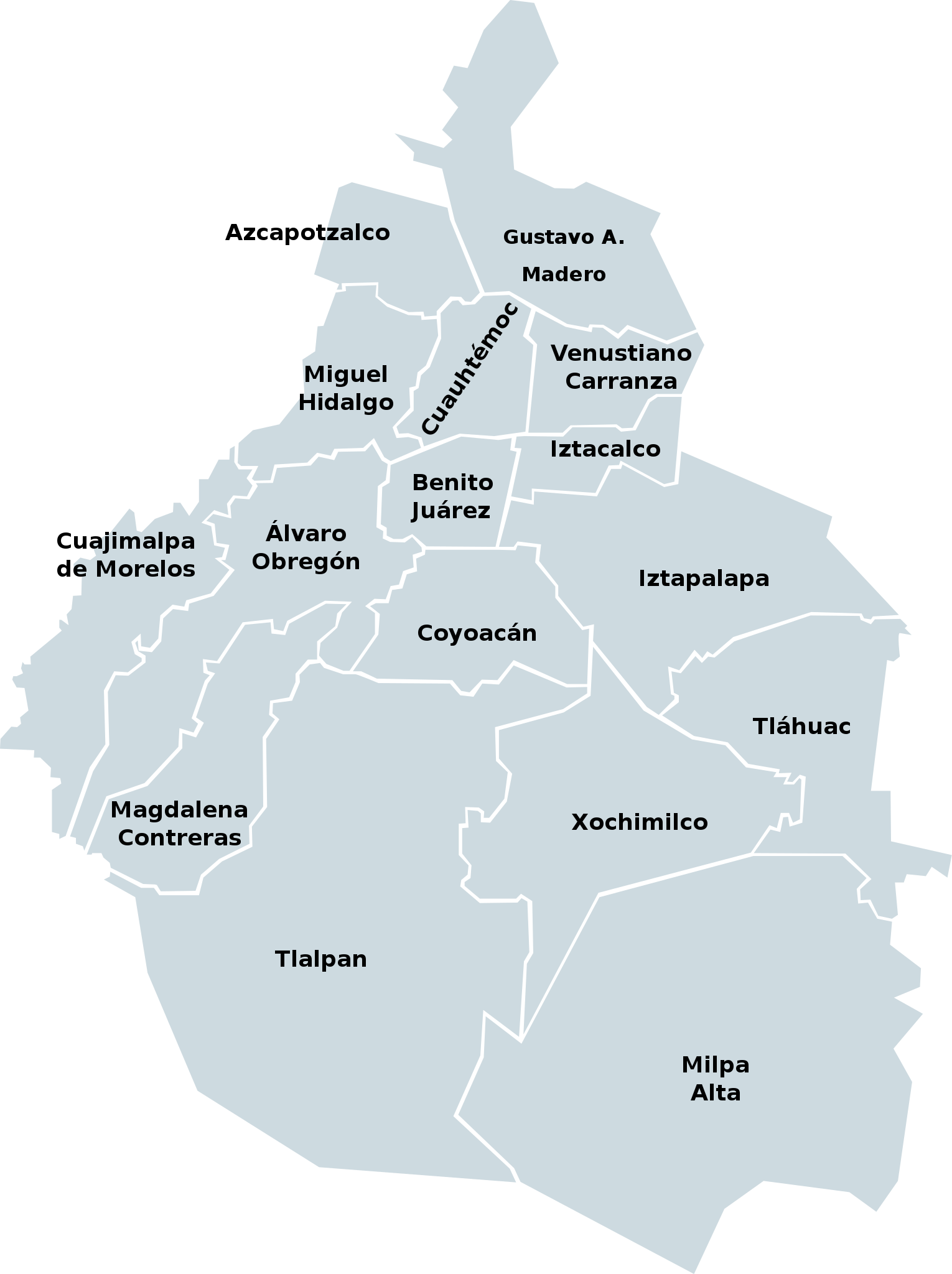
English: Administrative division of the Federal District, Mexico.
Español: División política del Distrito Federal |
| Date | |
| Source | Own work based on: Mexico map, MX-DFE.svg by El bart089 |
| Author | EOZyo |
| SVG development |
Licensing[edit]
| I, the copyright holder of this work, release this work into the public domain. This applies worldwide. In some countries this may not be legally possible; if so: I grant anyone the right to use this work for any purpose, without any conditions, unless such conditions are required by law. |
File history
Click on a date/time to view the file as it appeared at that time.
| Date/Time | Thumbnail | Dimensions | User | Comment | |
|---|---|---|---|---|---|
| current | 08:16, 19 September 2008 | | 765 × 1,024 (29 KB) | EOZyo (talk | contribs) | Reverted to version as of 08:12, 19 September 2008 |
| 08:16, 19 September 2008 |  | 765 × 1,024 (30 KB) | EOZyo (talk | contribs) | Changed font size for Gustavo A. Madero | |
| 08:12, 19 September 2008 |  | 765 × 1,024 (29 KB) | EOZyo (talk | contribs) | {{Information |Description={{en|1=Administrative division of the Federal District, Mexico.}} {{es|1=División política del Distrito Federal}} |Source=Based on Image:Mexico_map,_MX-DFE.svg |Author=EOZyo |Date=2008-09-19 |Permission= |o |
You cannot overwrite this file.
File usage on Commons
The following 2 pages use this file:
File usage on other wikis
The following other wikis use this file:
- Usage on de.wikipedia.org
- Usage on en.wikipedia.org
- Usage on es.wikipedia.org
- Usage on frr.wikipedia.org
- Usage on hu.wikipedia.org
- Usage on incubator.wikimedia.org
- Usage on lad.wikipedia.org
- Usage on mt.wikipedia.org
- Usage on pt.wikipedia.org
- Usage on sco.wikipedia.org
- Usage on sr.wikipedia.org
- Usage on tr.wikipedia.org
- Usage on zh.wikipedia.org