File:Luther region 1519.png
Jump to navigation
Jump to search
Size of this preview: 800 × 509 pixels. Other resolutions: 320 × 204 pixels | 640 × 407 pixels | 1,119 × 712 pixels.
Original file (1,119 × 712 pixels, file size: 2.3 MB, MIME type: image/png)
Captions
Captions
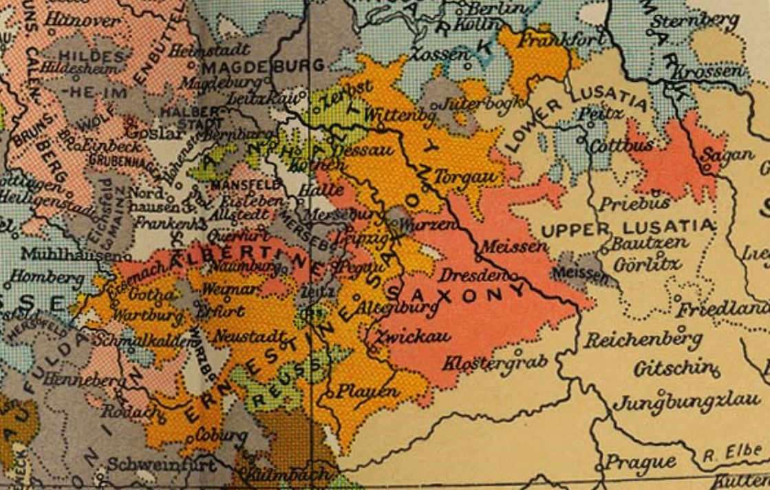
Political map of the region tied to Martin Luther in 1519.
Summary[edit]
| Description |
English: Political map of the region tied to Martin Luther in 1519. |
| Date | |
| Source | public domain map from PCL collection at the University of Texas - [1] |
| Author | edited by Sir Adolphus William Ward, G.W. Prothero, Sir Stanley Mordaunt Leathes, and E.A. Benians. Cambridge University Press; London. 1912. |
Licensing[edit]
|
This work is in the public domain in its country of origin and other countries and areas where the copyright term is the author's life plus 70 years or fewer. This work is in the public domain in the United States because it was published (or registered with the U.S. Copyright Office) before January 1, 1929. | |
| This file has been identified as being free of known restrictions under copyright law, including all related and neighboring rights. | |
File history
Click on a date/time to view the file as it appeared at that time.
| Date/Time | Thumbnail | Dimensions | User | Comment | |
|---|---|---|---|---|---|
| current | 14:42, 13 May 2019 | | 1,119 × 712 (2.3 MB) | Ernio48 (talk | contribs) | Bessere Positionierung. |
| 17:39, 11 May 2019 |  | 884 × 611 (1.56 MB) | Ernio48 (talk | contribs) | User created page with UploadWizard |
You cannot overwrite this file.
File usage on Commons
The following page uses this file:
File usage on other wikis
The following other wikis use this file:
- Usage on de.wikipedia.org
- Usage on de.wikiversity.org
- Usage on fr.wikipedia.org
- Usage on pl.wikipedia.org