File:Lowell National Historical Park Official Map.jpg
Jump to navigation
Jump to search
Size of this preview: 722 × 600 pixels. Other resolutions: 289 × 240 pixels | 578 × 480 pixels | 925 × 768 pixels | 1,233 × 1,024 pixels | 2,384 × 1,980 pixels.
Original file (2,384 × 1,980 pixels, file size: 917 KB, MIME type: image/jpeg)
Captions
Captions
Add a one-line explanation of what this file represents
Summary[edit]
| Description |
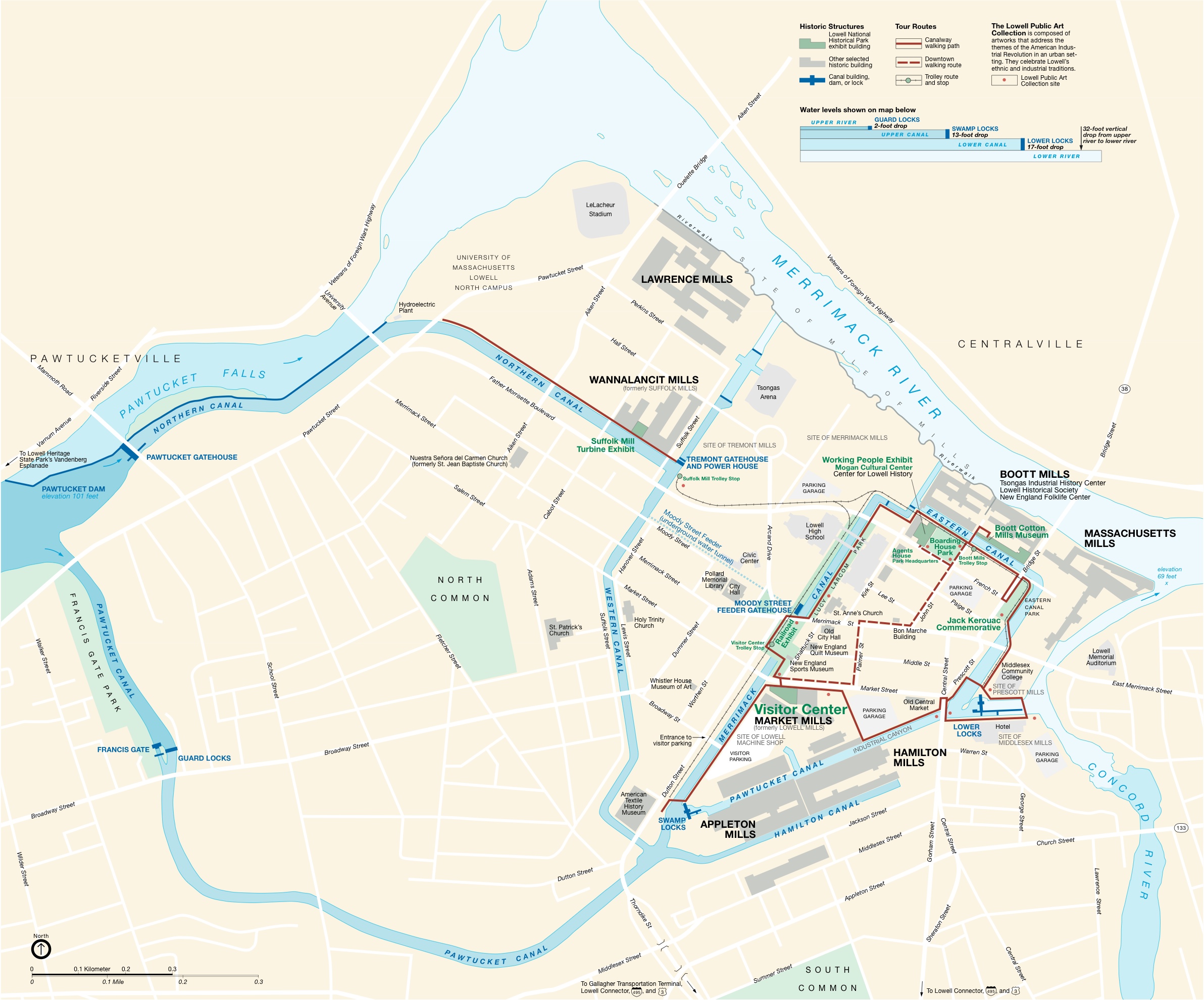
English: National Park Service map of the Lowell National Historical Park — in Lowell, Massachusetts. |
|||||||||
| Source | National Park Service | |||||||||
| Creator |
National Park Service |
|||||||||
| Geotemporal data | ||||||||||
| Map location | Lowell, MA | |||||||||
| Map type | thematic | |||||||||
| Scale | 1:6340 | |||||||||
| Heading |
 |
|||||||||
| Bounding box |
|
|||||||||
| Georeferencing | ||||||||||
Licensing[edit]
| This image or media file contains material based on a work of a National Park Service employee, created as part of that person's official duties. As a work of the U.S. federal government, such work is in the public domain in the United States. See the NPS website and NPS copyright policy for more information. |
File history
Click on a date/time to view the file as it appeared at that time.
| Date/Time | Thumbnail | Dimensions | User | Comment | |
|---|---|---|---|---|---|
| current | 14:50, 13 July 2009 | | 2,384 × 1,980 (917 KB) | Jlpapple (talk | contribs) | {{Information |Description= |Source=NPS |Date= |Author= |Permission= |other_versions= }} Category:Maps |
| 14:50, 13 July 2009 |  | 2,384 × 1,980 (917 KB) | Jlpapple (talk | contribs) | {{Information |Description= |Source=NPS |Date= |Author= |Permission= |other_versions= }} Category:Maps |
You cannot overwrite this file.
File usage on Commons
There are no pages that use this file.
File usage on other wikis
The following other wikis use this file:
- Usage on en.wikipedia.org
- Usage on fr.wikipedia.org
- Usage on nl.wikipedia.org
- Usage on zh.wikipedia.org