File:Low head dam at Newby Bridge - geograph.org.uk - 1226662.jpg
Jump to navigation
Jump to search
No higher resolution available.
Low_head_dam_at_Newby_Bridge_-_geograph.org.uk_-_1226662.jpg (640 × 480 pixels, file size: 84 KB, MIME type: image/jpeg)
Captions
Captions
Add a one-line explanation of what this file represents
Summary[edit]
| Description |
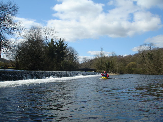
English: Low head dam at Newby Bridge This weir is the low head dam which establishes the water level in Windermere as the River Leven pours over it to start its brief journey to the sea. Owing to spawning beds being directly below, canoeists are discouraged from running the weir, but normally put on river right just below it from the minor road by Newby Bridge station. Paddling up to visit the playwave formed by the river right fish step appears acceptable and this is easiest in the aerated water below the weir, which has little in the way of a stopper at the low water level seen here. |
| Date | |
| Source | From geograph.org.uk |
| Author | Andy Waddington |
| Attribution (required by the license) | Andy Waddington / Low head dam at Newby Bridge / |
| Camera location | | View this and other nearby images on: OpenStreetMap |
|---|
_heading:247.00&language=en)
| Object location | | View this and other nearby images on: OpenStreetMap |
|---|
_heading:247.00&language=en)
Licensing[edit]

|
This image was taken from the Geograph project collection. See this photograph's page on the Geograph website for the photographer's contact details. The copyright on this image is owned by Andy Waddington and is licensed for reuse under the Creative Commons Attribution-ShareAlike 2.0 license.
|
This file is licensed under the Creative Commons Attribution-Share Alike 2.0 Generic license.
Attribution: Andy Waddington
- You are free:
- to share – to copy, distribute and transmit the work
- to remix – to adapt the work
- Under the following conditions:
- attribution – You must give appropriate credit, provide a link to the license, and indicate if changes were made. You may do so in any reasonable manner, but not in any way that suggests the licensor endorses you or your use.
- share alike – If you remix, transform, or build upon the material, you must distribute your contributions under the same or compatible license as the original.
File history
Click on a date/time to view the file as it appeared at that time.
| Date/Time | Thumbnail | Dimensions | User | Comment | |
|---|---|---|---|---|---|
| current | 10:16, 26 February 2011 | | 640 × 480 (84 KB) | GeographBot (talk | contribs) | == {{int:filedesc}} == {{Information |description={{en|1=Low head dam at Newby Bridge This weir is the low head dam which establishes the water level in Windermere as the River Leven pours over it to start its brief journey to the sea. Owing to spawning b |
You cannot overwrite this file.
File usage on Commons
There are no pages that use this file.