File:Loughborough Central Railway Station - geograph.org.uk - 2150956.jpg
Loughborough_Central_Railway_Station_-_geograph.org.uk_-_2150956.jpg (800 × 511 pixels, file size: 93 KB, MIME type: image/jpeg)
Captions
Captions
Summary[edit]
| Description |
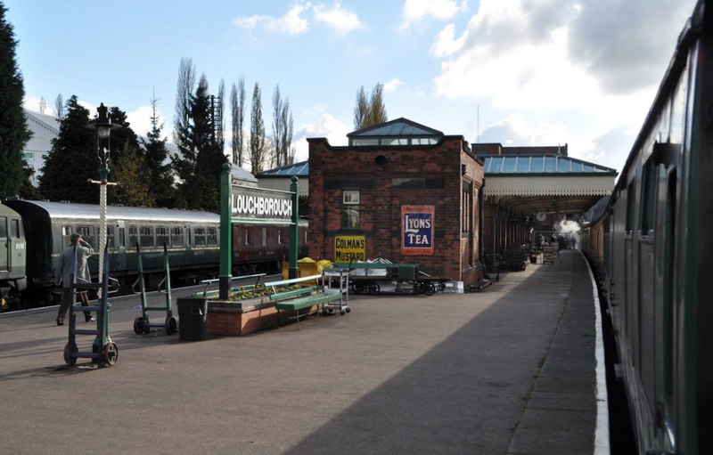
English: Loughborough Central Railway Station, near to Loughborough, Leicestershire, Great Britain.
This is a recreation of a mid 1960s photo taken before closure. <a title="http://www.gcrleicester.info/html/trip_to_nottingham___rugby.html" rel="nofollow" href="http://www.gcrleicester.info/html/trip_to_nottingham___rugby.html">Link</a><img style="padding-left:2px;" alt="External link" title="External link - shift click to open in new window" src="http://s0.geograph.org.uk/img/external.png" width="10" height="10"/> (second down). |
| Date | |
| Source | From geograph.org.uk; transferred by User:Rubberstamp using geograph_org2commons. |
| Author | Ashley Dace |
| Permission (Reusing this file) |
Creative Commons Attribution Share-alike license 2.0 |
| Attribution (required by the license) | Ashley Dace / Loughborough Central Railway Station / |
| Camera location | | View this and other nearby images on: OpenStreetMap |
|---|
| Object location | | View this and other nearby images on: OpenStreetMap |
|---|
_region:GB-GBN_heading:135.00&language=en)
Licensing[edit]

|
This image was taken from the Geograph project collection. See this photograph's page on the Geograph website for the photographer's contact details. The copyright on this image is owned by Ashley Dace and is licensed for reuse under the Creative Commons Attribution-ShareAlike 2.0 license.
|
- You are free:
- to share – to copy, distribute and transmit the work
- to remix – to adapt the work
- Under the following conditions:
- attribution – You must give appropriate credit, provide a link to the license, and indicate if changes were made. You may do so in any reasonable manner, but not in any way that suggests the licensor endorses you or your use.
- share alike – If you remix, transform, or build upon the material, you must distribute your contributions under the same or compatible license as the original.
File history
Click on a date/time to view the file as it appeared at that time.
| Date/Time | Thumbnail | Dimensions | User | Comment | |
|---|---|---|---|---|---|
| current | 19:25, 24 December 2010 | | 800 × 511 (93 KB) | File Upload Bot (Magnus Manske) (talk | contribs) |
You cannot overwrite this file.
File usage on Commons
The following page uses this file:
File usage on other wikis
The following other wikis use this file:
- Usage on en.wikipedia.org
- Usage on www.wikidata.org