File:Locator Electorate of Cologne with Duchy of Westphalia (1560).svg
Jump to navigation
Jump to search

Size of this PNG preview of this SVG file: 800 × 530 pixels. Other resolutions: 320 × 212 pixels | 640 × 424 pixels | 1,024 × 678 pixels | 1,280 × 848 pixels | 2,560 × 1,695 pixels | 5,029 × 3,330 pixels.
Original file (SVG file, nominally 5,029 × 3,330 pixels, file size: 466 KB)
Captions
Captions
Add a one-line explanation of what this file represents
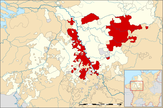
| Description | Locator map of the Electorate of Cologne + Duchy of Westphalia, modernday North Rhine-Westphalia, Germany |
| Date | |
| Source | File:Locator Principality of Stavelot-Malmedy (1560).svg |
| Author | ZH2000 |
| Permission (Reusing this file) |
This file is licensed under the Creative Commons Attribution-Share Alike 3.0 Unported license.
|
.svg)
File history
Click on a date/time to view the file as it appeared at that time.
| Date/Time | Thumbnail | Dimensions | User | Comment | |
|---|---|---|---|---|---|
| current | 19:07, 18 May 2014 | | 5,029 × 3,330 (466 KB) | Hans Erren (talk | contribs) | Rheinberg ist Kurkölnisch (Hantsche 2000) |
| 17:32, 28 April 2011 |  | 5,029 × 3,330 (466 KB) | ZH2010 (talk | contribs) | {{Information |Description= Locator map of the Electorate of Cologne + Duchy of Westphalia, modernday North Rhine-Westphalia, Germany |Source= File:Locator Principality of Stavelot-Malmedy (1560).svg |Date=2010-04-28 |Author= ZH2000 |Permission |
You cannot overwrite this file.
File usage on Commons
The following page uses this file:
File usage on other wikis
The following other wikis use this file:
- Usage on ar.wikipedia.org
- Usage on az.wikipedia.org
- Usage on bg.wikipedia.org
- Usage on cs.wikipedia.org
- Usage on da.wikipedia.org
- Usage on de.wikipedia.org
- Usage on el.wikipedia.org
- Usage on en.wikipedia.org
- Usage on es.wikipedia.org
- Usage on et.wikipedia.org
- Usage on fa.wikipedia.org
- Usage on fi.wikipedia.org
- Usage on he.wikipedia.org
- Usage on hu.wikipedia.org
- Usage on id.wikipedia.org
- Usage on it.wikipedia.org
- Usage on ja.wikipedia.org
- Usage on ko.wikipedia.org
- Usage on nn.wikipedia.org
- Usage on no.wikipedia.org
- Usage on pt.wikipedia.org
- Usage on ru.wikipedia.org
- Usage on sv.wikipedia.org
- Usage on tr.wikipedia.org
- Usage on uk.wikipedia.org
- Usage on vi.wikipedia.org
- Usage on www.wikidata.org
- Usage on zh.wikipedia.org
.svg&oldid=574860827)