File:LocationCrimea.PNG
Jump to navigation
Jump to search

Size of this preview: 720 × 600 pixels. Other resolutions: 288 × 240 pixels | 576 × 480 pixels | 922 × 768 pixels | 1,200 × 1,000 pixels.
Original file (1,200 × 1,000 pixels, file size: 98 KB, MIME type: image/png)
Captions
Captions
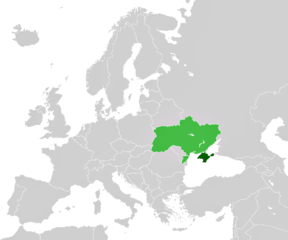
A map depicting location of Crimea (within Ukraine)
| Description |
English: A map depicting location of Crimea (within Ukraine). |
|||
| Source |
licenced as own work of the uploaders
|
|||
| Author | unstated, see "source" section for the uploaders | |||
| Permission (Reusing this file) |
|
|||
| Other versions |
|


File history
Click on a date/time to view the file as it appeared at that time.
| Date/Time | Thumbnail | Dimensions | User | Comment | |
|---|---|---|---|---|---|
| current | 15:38, 27 April 2011 | | 1,200 × 1,000 (98 KB) | ANGELUS (talk | contribs) | improved |
| 15:48, 4 March 2014 |  | 1,200 × 1,000 (98 KB) | CoArms (talk | contribs) | This map is LocationCrimea, not the Russian involvement in the Crimean crisis. |
You cannot overwrite this file.
File usage on Commons
The following 3 pages use this file:
File usage on other wikis
The following other wikis use this file:
- Usage on de.wikipedia.org
- Wikipedia:Hauptseite/Archiv/18. März 2014
- Wikipedia:Hauptseite/Archiv/19. März 2014
- Wikipedia:Hauptseite/Archiv/20. März 2014
- Wikipedia:Hauptseite/Archiv/21. März 2014
- Wikipedia:Hauptseite/Archiv/22. März 2014
- Wikipedia:Hauptseite/Archiv/23. März 2014
- Wikipedia:Hauptseite/Archiv/24. März 2014
- Wikipedia:Hauptseite/Archiv/25. März 2014
- Usage on fiu-vro.wikipedia.org
- Usage on pl.wikipedia.org
- Usage on sl.wikipedia.org
- Usage on su.wikipedia.org
- Usage on sw.wikipedia.org
- Usage on vi.wikipedia.org