File:Localización de Ceuta.png
Jump to navigation
Jump to search
No higher resolution available.
Localización_de_Ceuta.png (306 × 204 pixels, file size: 4 KB, MIME type: image/png)
Captions
Captions
Add a one-line explanation of what this file represents

|
File:Localización de Ceuta.svg is a vector version of this file. It should be used in place of this PNG file when not inferior.
File:Localización de Ceuta.png → File:Localización de Ceuta.svg
For more information, see Help:SVG. |
 |
Summary[edit]
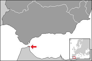
Map extent is fitted to NUTS ES3 area (Southern Spain).
Licensing[edit]
I, the copyright holder of this work, hereby publish it under the following licenses:

|
Permission is granted to copy, distribute and/or modify this document under the terms of the GNU Free Documentation License, Version 1.2 or any later version published by the Free Software Foundation; with no Invariant Sections, no Front-Cover Texts, and no Back-Cover Texts. A copy of the license is included in the section entitled GNU Free Documentation License. |
| This file is licensed under the Creative Commons Attribution-Share Alike 3.0 Unported license. | ||
| ||
| This licensing tag was added to this file as part of the GFDL licensing update. |
You may select the license of your choice.
File history
Click on a date/time to view the file as it appeared at that time.
| Date/Time | Thumbnail | Dimensions | User | Comment | |
|---|---|---|---|---|---|
| current | 06:36, 22 August 2015 | | 306 × 204 (4 KB) | Kontrollstellekundl (talk | contribs) | red dotted |
| 23:15, 25 December 2009 |  | 306 × 204 (2 KB) | Martin H. (talk | contribs) | Reverted to version as of 08:03, 2 October 2006 | |
| 20:21, 25 December 2009 |  | 250 × 189 (27 KB) | Vegggggggggggggg (talk | contribs) | {{Information |Description={{es|1=.}} |Source=. |Author=. |Date=. |Permission= |other_versions= }} | |
| 08:03, 2 October 2006 |  | 306 × 204 (2 KB) | Martorell (talk | contribs) | == Summary == Map extent is fitted to NUTS ES3 area (Southern Spain). Category:Spain Category:Maps of autonomous communities of Spain == Licensing == {{self|GFDL}} |
You cannot overwrite this file.
File usage on Commons
The following 2 pages use this file:
File usage on other wikis
The following other wikis use this file:
- Usage on an.wikipedia.org
- Usage on azb.wikipedia.org
- Usage on br.wikipedia.org
- Usage on ca.wikipedia.org
- Usage on de.wikipedia.org
- Usage on eo.wikipedia.org
- Usage on es.wikipedia.org
- Usage on eu.wikipedia.org
- Usage on ext.wikipedia.org
- Usage on hi.wikipedia.org
- Usage on io.wikipedia.org
- Usage on it.wikipedia.org
- Usage on ku.wikipedia.org
- Usage on lij.wikipedia.org
- Usage on lmo.wikipedia.org
- Usage on nso.wikipedia.org
- Usage on pl.wikipedia.org
- Usage on pl.wiktionary.org
- Usage on pms.wikipedia.org
- Usage on ta.wikipedia.org
- Usage on yo.wikipedia.org