File:Liberia map.png
Jump to navigation
Jump to search
No higher resolution available.
Liberia_map.png (330 × 355 pixels, file size: 10 KB, MIME type: image/png)
Captions
Captions
Add a one-line explanation of what this file represents
Summary[edit]
| Description |
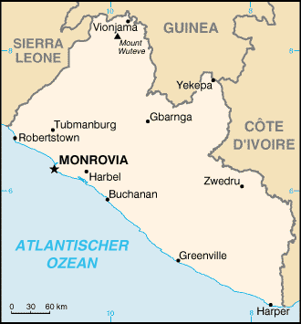
Deutsch: Karte von Liberia aus dem CIA World Factbook |
| Date | 14 February 2007 (original upload date) |
| Source | Factbook, translated version from german wikipedia |
| Author | CIA, translated by de:Benutzer:Head at de.wikipedia |
Licensing[edit]
This image is in the public domain because it contains materials that originally came from the United States Central Intelligence Agency's World Factbook.
|
 |
File history
Click on a date/time to view the file as it appeared at that time.
| Date/Time | Thumbnail | Dimensions | User | Comment | |
|---|---|---|---|---|---|
| current | 20:44, 24 January 2006 | | 330 × 355 (10 KB) | Maksim (talk | contribs) | La bildo estas kopiita de wikipedia:de. La originala priskribo estas: * Beschreibung: Karte von LiberiaVoinjama statt Vionjama * Übersetzung: Benutzer:Head {{PD-USGov}} CIA World Factbook Kategorie:Bild:Karte {| border="1" ! date/tim |
You cannot overwrite this file.
File usage on Commons
There are no pages that use this file.
File usage on other wikis
The following other wikis use this file:
- Usage on als.wikipedia.org
- Usage on de.wiktionary.org
- Usage on ht.wikipedia.org
- Usage on nl.wikipedia.org