File:Level crossing at Pont Croesor (geograph 2109382).jpg
Jump to navigation
Jump to search
No higher resolution available.
Level_crossing_at_Pont_Croesor_(geograph_2109382).jpg (640 × 480 pixels, file size: 85 KB, MIME type: image/jpeg)
Captions
Captions
Add a one-line explanation of what this file represents
Summary
[edit].jpg&action=edit§ion=1)
| Description |
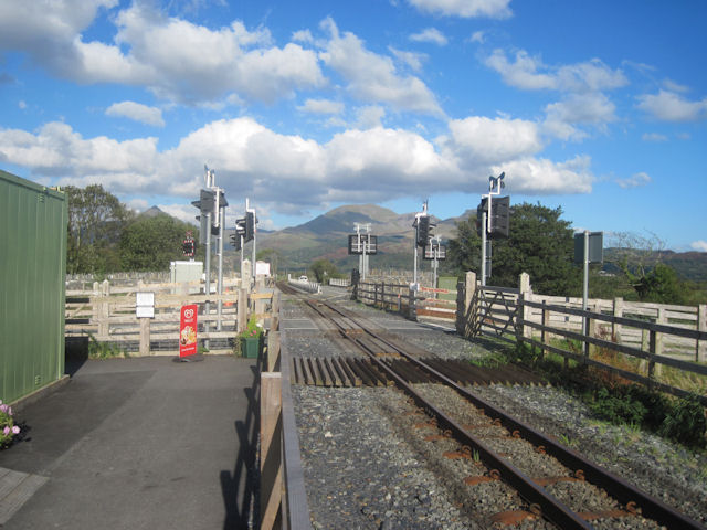
English: Level crossings at Pont Croesor, just north of the station and with the bridge in the background. The further of the two crossings carries the B4410 road across the Welsh Highland Railway, before both cross the bridge together. |
| Date | Taken on 7 October 2010 |
| Source | From geograph.org.uk |
| Author | John Firth |
| Permission (Reusing this file) |
Creative Commons Attribution Share-alike license 2.0 |
| Attribution (required by the license) | John Firth / Level crossing at Pont Croesor / |
| Camera location | | View this and other nearby images on: OpenStreetMap |
|---|
.jpg¶ms=052.950463_N_-004.097003_E_globe:Earth_type:camera_source:geograph-osgb36(SH59214129)_heading:22.00&language=en)
| Object location | | View this and other nearby images on: OpenStreetMap |
|---|
.jpg¶ms=052.950920_N_-004.096580_E_globe:Earth_class:object_type:object_source:geograph-osgb36(SH59244134)_heading:22.00&language=en)
Licensing
[edit].jpg&action=edit§ion=2)

|
This image was taken from the Geograph project collection. See this photograph's page on the Geograph website for the photographer's contact details. The copyright on this image is owned by John Firth and is licensed for reuse under the Creative Commons Attribution-ShareAlike 2.0 license.
|
This file is licensed under the Creative Commons Attribution-Share Alike 2.0 Generic license.
Attribution: John Firth
- You are free:
- to share – to copy, distribute and transmit the work
- to remix – to adapt the work
- Under the following conditions:
- attribution – You must give appropriate credit, provide a link to the license, and indicate if changes were made. You may do so in any reasonable manner, but not in any way that suggests the licensor endorses you or your use.
- share alike – If you remix, transform, or build upon the material, you must distribute your contributions under the same or compatible license as the original.
File history
Click on a date/time to view the file as it appeared at that time.
| Date/Time | Thumbnail | Dimensions | User | Comment | |
|---|---|---|---|---|---|
| current | 17:13, 13 December 2019 | | 640 × 480 (85 KB) | Chris j wood (talk | contribs) | Transferred from geograph.co.uk using [https://tools.wmflabs.org/geograph2commons/ geograph2commons] |
You cannot overwrite this file.
File usage on Commons
The following page uses this file:
.jpg&oldid=876159781)