File:Landsat 8 - OLI - 2013-09-08 - Krakow - Nowa Huta - Wieliczka - Niepołomice - Puszcza Niepołomicka - Bochnia - Brzesko.jpg
Jump to navigation
Jump to search

Size of this preview: 799 × 600 pixels. Other resolutions: 320 × 240 pixels | 640 × 480 pixels | 1,024 × 768 pixels | 1,280 × 960 pixels | 2,560 × 1,921 pixels | 5,179 × 3,886 pixels.
Original file (5,179 × 3,886 pixels, file size: 12.86 MB, MIME type: image/jpeg)
Captions
Captions
Add a one-line explanation of what this file represents
Summary[edit]
| Description |
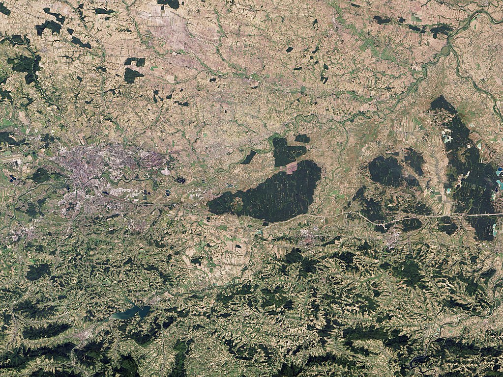
Polski: Zdjęcie wykonane przez instrument OLI satelity Landsat 8 w dniu 8 września 2013 roku.
Od lewej widoczne: aglomeracja Krakowa, Nowa Huta (północ) i Wieliczka (południe), Niepołomice i Puszcza Niepołomicka, a także Bochnia i Brzesko, i Lasy Redłowskie (przy prawej krawędzi) Duży zbiornik wodny u dołu zdjęcia - Jezioro Dobczyckie. |
| Date | |
| Source | http://landsat.visibleearth.nasa.gov/view.php?id=82464 |
| Author | NASA GSFC |
Licensing[edit]
| This file is in the public domain in the United States because it was solely created by NASA. NASA copyright policy states that "NASA material is not protected by copyright unless noted". (See Template:PD-USGov, NASA copyright policy page or JPL Image Use Policy.) | ||
 |
Warnings:
|
| Annotations | This image is annotated: View the annotations at Commons |
File history
Click on a date/time to view the file as it appeared at that time.
| Date/Time | Thumbnail | Dimensions | User | Comment | |
|---|---|---|---|---|---|
| current | 12:51, 20 May 2014 | | 5,179 × 3,886 (12.86 MB) | NH2501 (talk | contribs) | User created page with UploadWizard |
You cannot overwrite this file.
File usage on Commons
There are no pages that use this file.
File usage on other wikis
The following other wikis use this file:
- Usage on pl.wikipedia.org