File:La Palma LANDSAT-Canary Islands.png
Jump to navigation
Jump to search

Size of this preview: 800 × 549 pixels. Other resolutions: 320 × 219 pixels | 640 × 439 pixels | 1,022 × 701 pixels.
Original file (1,022 × 701 pixels, file size: 1.04 MB, MIME type: image/png)
Captions
Captions
Add a one-line explanation of what this file represents
| Description |
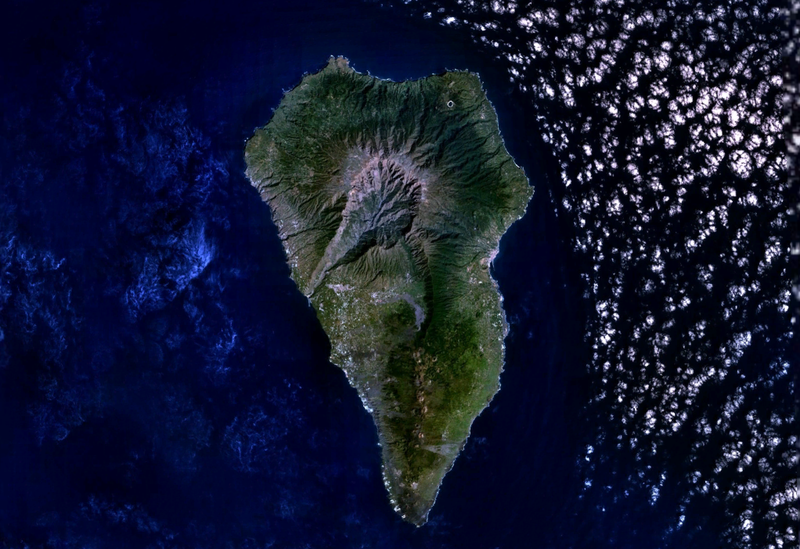
English: La Palma Island (Canary Islands, Spain) from LANDSAT7 satellite of NASA.
Español: Isla de La Palma (Islas Canarias, España) desde el satélite LANDSAT7 de la NASA.
|
| Date | Unknown date |
| Source | NASA's World Wind software (images provided by NASA) |
| Author | NASA |
| This image is in the public domain because it is a screenshot from NASA’s globe software World Wind using a public domain layer, such as Blue Marble, MODIS, Landsat, SRTM, USGS or GLOBE.
|
 |
File history
Click on a date/time to view the file as it appeared at that time.
| Date/Time | Thumbnail | Dimensions | User | Comment | |
|---|---|---|---|---|---|
| current | 22:05, 20 September 2007 | | 1,022 × 701 (1.04 MB) | Pepelopex (talk | contribs) | {{Information |Description= {{en|La Palma Island (Canary Islands, Spain) from LANDSAT7 satellite of NASA. * Coordinates: -17.85514W 28.66873N}} {{es|Isla de La Palma (Islas Canarias, España) desde el satélite LANDSAT7 de la NASA. * Coordenadas: -17.8551 |
You cannot overwrite this file.
File usage on Commons
The following page uses this file:
File usage on other wikis
The following other wikis use this file:
- Usage on af.wikipedia.org
- Usage on an.wikipedia.org
- Usage on ar.wikipedia.org
- Usage on cs.wikipedia.org
- Usage on de.wikipedia.org
- Usage on de.wiktionary.org
- Usage on el.wikipedia.org
- Usage on es.wikipedia.org
- Usage on es.wiktionary.org
- Usage on gl.wikipedia.org
- Usage on haw.wikipedia.org
- Usage on hu.wikipedia.org
- Usage on it.wikipedia.org
- Usage on nn.wikipedia.org
- Usage on no.wikipedia.org
- Usage on sc.wikipedia.org
- Usage on sr.wikipedia.org
- Usage on war.wikipedia.org
- Usage on zh.wikipedia.org