File:La-ms-al pop 090305001.png
Jump to navigation
Jump to search
Size of this preview: 768 × 600 pixels. Other resolutions: 307 × 240 pixels | 615 × 480 pixels | 983 × 768 pixels | 1,280 × 1,000 pixels | 2,560 × 2,000 pixels | 4,096 × 3,200 pixels.
Original file (4,096 × 3,200 pixels, file size: 376 KB, MIME type: image/png)
Captions
Captions
Add a one-line explanation of what this file represents
Summary[edit]
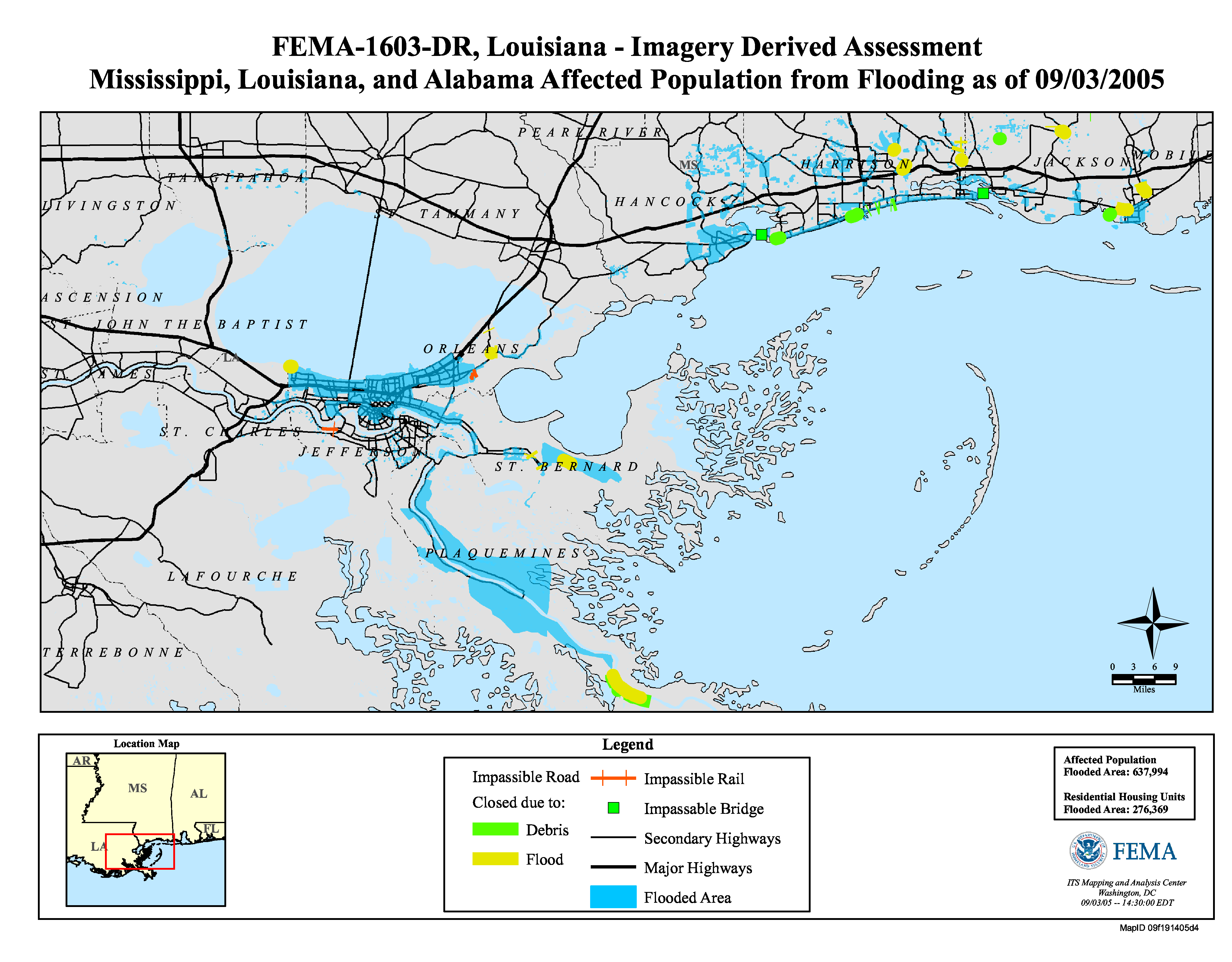
FEMA-1603-DR, Louisiana - Imagery Derived Assessement
Mississippi, Louisiana, and Alabama Affected Population from Flooding as of 09/03/2005
Source[edit]
September 3: http://www.gismaps.fema.gov/2005pages/dr1603.shtm archive copy at the Wayback Machine
Licensing[edit]
This image is a work of a Federal Emergency Management Agency employee, taken or made as part of that person's official duties. As works of the U.S. federal government, all FEMA images are in the public domain in the United States. Additional media usage information may be found at https://www.fema.gov/photo-video-audio-use-guidelines
|
File history
Click on a date/time to view the file as it appeared at that time.
| Date/Time | Thumbnail | Dimensions | User | Comment | |
|---|---|---|---|---|---|
| current | 17:27, 4 September 2005 | | 4,096 × 3,200 (376 KB) | SEWilco (talk | contribs) | FEMA-1603-DR, Louisiana - Imagery Derived Assessement<br> Mississippi, Louisiana, and Alabama Affected Population from Flooding as of 09/03/2005 == Source == Sept |
You cannot overwrite this file.
File usage on Commons
There are no pages that use this file.
File usage on other wikis
The following other wikis use this file:
- Usage on en.wikipedia.org
- Usage on en.wikinews.org
- Usage on no.wikipedia.org