File:Kyoto pref.png
Kyoto_pref.png (216 × 196 pixels, file size: 8 KB, MIME type: image/png)
Captions
Captions
Summary
[edit]
| Description |
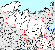
日本語: 京都府、市町村境界図 |
||
| Source | File:Japan map.png | ||
| Author |
|
||
| Permission (Reusing this file) |
|
Licensing
[edit]

|
Permission is granted to copy, distribute and/or modify this document under the terms of the GNU Free Documentation License, Version 1.2 or any later version published by the Free Software Foundation; with no Invariant Sections, no Front-Cover Texts, and no Back-Cover Texts. A copy of the license is included in the section entitled GNU Free Documentation License. |
- You are free:
- to share – to copy, distribute and transmit the work
- to remix – to adapt the work
- Under the following conditions:
- attribution – You must give appropriate credit, provide a link to the license, and indicate if changes were made. You may do so in any reasonable manner, but not in any way that suggests the licensor endorses you or your use.
- share alike – If you remix, transform, or build upon the material, you must distribute your contributions under the same or compatible license as the original.
File history
Click on a date/time to view the file as it appeared at that time.
| Date/Time | Thumbnail | Dimensions | User | Comment | |
|---|---|---|---|---|---|
| current | 08:06, 18 June 2008 | | 216 × 196 (8 KB) | BigBang19 (talk | contribs) | 2007/03/12 相楽郡山城町・木津町・加茂町が合併し木津川市が成立したことを反映 |
| 14:52, 7 January 2006 |  | 216 × 196 (5 KB) | Sea of Japan (talk | contribs) | 京都府内の市町村合併を反映させる | |
| 16:10, 23 April 2005 |  | 216 × 196 (4 KB) | Sea of Japan (talk | contribs) | 以前のバージョンへの差し戻し。 Reverted to earlier revision | |
| 16:09, 23 April 2005 |  | 216 × 196 (5 KB) | Sea of Japan (talk | contribs) | 以前のバージョンへの差し戻し。 Reverted to earlier revision | |
| 22:50, 8 April 2005 |  | 216 × 196 (4 KB) | Sea of Japan (talk | contribs) | 以前のバージョンへの差し戻し。 Reverted to earlier revision | |
| 22:50, 8 April 2005 |  | 216 × 196 (4 KB) | Sea of Japan (talk | contribs) | 以前のバージョンへの差し戻し。 Reverted to earlier revision | |
| 14:42, 17 August 2004 |  | 216 × 196 (5 KB) | Ultratomio (talk | contribs) | 京都府を強調するために他府県を暗くしてみた | |
| 17:20, 13 May 2004 |  | 216 × 196 (4 KB) | Ultratomio (talk | contribs) | 2004/04/01 丹後地方3郡6ヶ町が合併し京丹後市が成立したことを反映 | |
| 05:20, 15 February 2004 |  | 216 × 196 (4 KB) | 赤鉛筆 (talk | contribs) | 京都府、市町村境界図 |
You cannot overwrite this file.
File usage on Commons
There are no pages that use this file.