File:Kulturdenkmale in Gablenz.jpg

Original file (1,483 × 1,212 pixels, file size: 445 KB, MIME type: image/jpeg)
Captions
Captions
Summary[edit]
| Description |
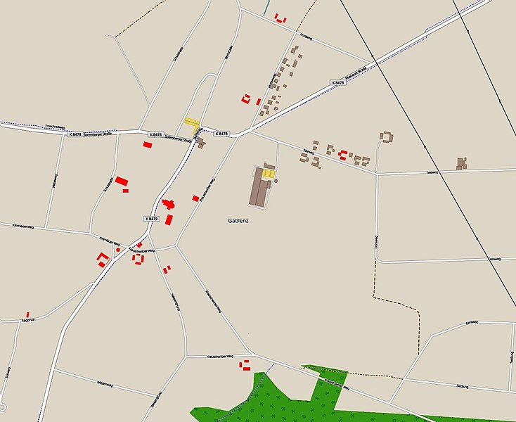
Deutsch: Kulturdenkmale in Gablenz; Karte basiert auf einer OSM-Karte mit eingezeichneten Objekten gem. der Angaben des Geoportals Landkreis Görlitz
English: Cultural heritage monuments in Gablenz |
|||
| Date | ||||
| Source | Own work | |||
| Author | Tommes, OSM | |||
| Permission (Reusing this file) |
English: You are free to use the picture obeying the law, but feel encouraged to mention the author's name.
Deutsch: Freie Verwendung für jeden Zweck im gesetzlichen Rahmen; Die Nennung des Namens des Autors wird mit Freude gesehen. |
| Object location | | View this and other nearby images on: OpenStreetMap |
|---|
| Description |
This map was created from OpenStreetMap project data, collected by the community. This map may be incomplete, and may contain errors. Don't rely solely on it for navigation. |
|||||||||
| Date | (see file history) | |||||||||
| Source | openstreetmap.org | |||||||||
| Creator |
OpenStreetMap contributors OpenStreetMap contributors |
|||||||||
| Permission (Reusing this file) |
OpenStreetMap data is available under the Open Database License (details). Map tiles are licensed under the Creative Commons Attribution-ShareAlike 2.0 license (CC-BY-SA 2.0).
This file is licensed under the Creative Commons Attribution-Share Alike 2.0 Generic license.
|
|||||||||
| Geotemporal data | ||||||||||
| Bounding box |
|
|||||||||
| Georeferencing | If inappropriate please set warp_status = skip to hide. | |||||||||
File history
Click on a date/time to view the file as it appeared at that time.
| Date/Time | Thumbnail | Dimensions | User | Comment | |
|---|---|---|---|---|---|
| current | 11:57, 14 April 2016 | | 1,483 × 1,212 (445 KB) | Tommes (talk | contribs) | =={{int:filedesc}}== {{Information |description= {{de|Kulturdenkmale in Gablenz; Karte basiert auf einer OSM-Karte mit eingezeichneten Objekten gem. der Angaben des Geoportals Landkreis Görlitz}} {{en|Cultural heritage mo... |
You cannot overwrite this file.
File usage on Commons
The following page uses this file: