File:Khab-Kray-Tuguro-Chumikansky.png
Jump to navigation
Jump to search

Size of this preview: 357 × 599 pixels. Other resolutions: 143 × 240 pixels | 286 × 480 pixels | 850 × 1,425 pixels.
Original file (850 × 1,425 pixels, file size: 35 KB, MIME type: image/png)
Captions
Captions
Add a one-line explanation of what this file represents
Summary[edit]
| Description |
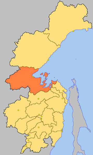
Русский: Тугуро-Чумиканский район ХК – Карта-схема |
| Date | |
| Source | Own work |
| Author | Chakat Rimm |
Licensing[edit]
| This work has been released into the public domain by its author, Chakat Rimm at Russian Wikipedia. This applies worldwide. In some countries this may not be legally possible; if so: Chakat Rimm grants anyone the right to use this work for any purpose, without any conditions, unless such conditions are required by law. |
Original upload log[edit]
The original description page was here. All following user names refer to ru.wikipedia.
- 2006-09-23 13:19 Chakat Rimm 850×1425× (36043 bytes) {{Изображение| Название= Тугуро-Чумиканский район ХК | Описание= Карта-схема | Автор= Chakat Rimm | Время создания= 2006 | Источник= Авторская работа | �
- 2006-09-23 13:17 Chakat Rimm 850×1425× (36199 bytes) {{Изображение| Название= Тугуро-Чумиканский район ХК | Описание= Карта-схема | Автор= Chakat Rimm | Время создания= 2006 | Источник= Авторская работа | �
File history
Click on a date/time to view the file as it appeared at that time.
| Date/Time | Thumbnail | Dimensions | User | Comment | |
|---|---|---|---|---|---|
| current | 10:27, 29 August 2010 | | 850 × 1,425 (35 KB) | Metsavend (talk | contribs) | {{Information |Description={{ru|Тугуро-Чумиканский район ХК – Карта-схема}} |Source={{own}} |Date=2006-09-23 |Author=Chakat Rimm |Permission= }} Category:Maps of Khabarovsk Krai |
You cannot overwrite this file.
File usage on Commons
The following page uses this file:
File usage on other wikis
The following other wikis use this file:
- Usage on et.wikipedia.org
- Usage on hu.wikipedia.org
- Usage on hy.wikipedia.org
- Usage on it.wikipedia.org
- Usage on ru.wikipedia.org
- Usage on uk.wikipedia.org
- Usage on www.wikidata.org
- Usage on zh-min-nan.wikipedia.org