File:Keystone XL - Ogallala Aquifer.png
Jump to navigation
Jump to search
Size of this preview: 412 × 600 pixels. Other resolutions: 165 × 240 pixels | 330 × 480 pixels | 781 × 1,137 pixels.
Original file (781 × 1,137 pixels, file size: 625 KB, MIME type: image/png)
Captions
Captions
Add a one-line explanation of what this file represents

|
This map image could be re-created using vector graphics as an SVG file. This has several advantages; see Commons:Media for cleanup for more information. If an SVG form of this image is available, please upload it and afterwards replace this template with
{{vector version available|new image name}}.
It is recommended to name the SVG file “Keystone XL - Ogallala Aquifer.svg”—then the template Vector version available (or Vva) does not need the new image name parameter. |
Summary[edit]
| Description |
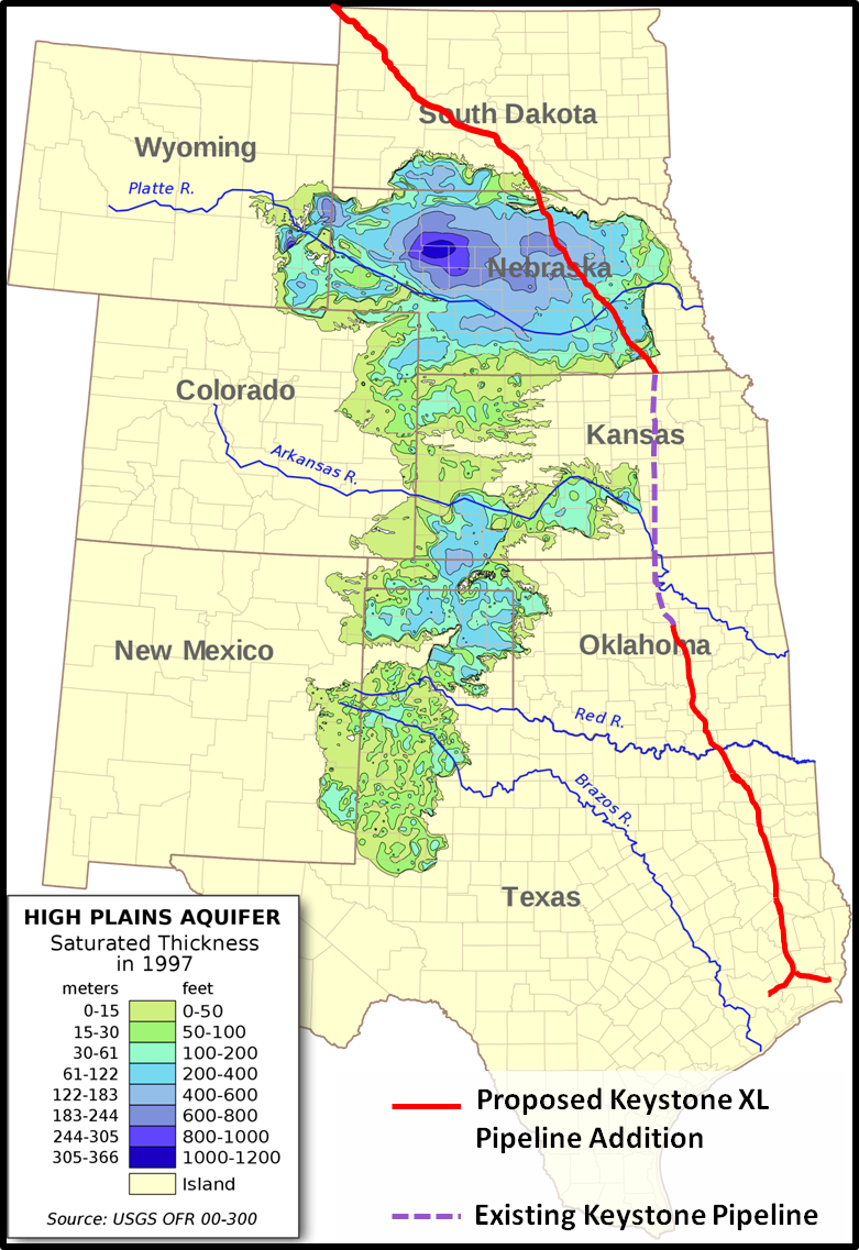
English: A map showing aquifer thickness of the Ogallala Aquifer with the proposed Keystone XL Pipeline route laid over. |
| Date | |
| Source | Wikipedian Kbh3rd - http://en.wikipedia.org/wiki/User:Kbh3rd |
| Author | Myself - Pipeline route, Kbh3rd - Aquifer Map |
Licensing[edit]
| Copyleft: This work of art is free; you can redistribute it and/or modify it according to terms of the Free Art License. You will find a specimen of this license on the Copyleft Attitude site as well as on other sites. |
File history
Click on a date/time to view the file as it appeared at that time.
| Date/Time | Thumbnail | Dimensions | User | Comment | |
|---|---|---|---|---|---|
| current | 17:27, 25 March 2015 | | 781 × 1,137 (625 KB) | H-stt (talk | contribs) | cropped transparent space at right side |
| 00:54, 18 October 2011 |  | 1,175 × 1,139 (597 KB) | 570ajk (talk | contribs) |
You cannot overwrite this file.
File usage on Commons
There are no pages that use this file.
File usage on other wikis
The following other wikis use this file:
- Usage on de.wikipedia.org
- Usage on en.wikipedia.org
- Usage on www.wikidata.org