File:Kentucky Bend map.png
Jump to navigation
Jump to search
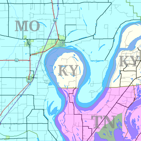
Size of this preview: 600 × 600 pixels. Other resolutions: 240 × 240 pixels | 480 × 480 pixels | 720 × 720 pixels.
Original file (720 × 720 pixels, file size: 31 KB, MIME type: image/png)
Captions
Captions
Add a one-line explanation of what this file represents
Summary[edit]
| Description | |
| Date | |
| Source | self; based on US Census TIGER generated map image |
| Author | Jim Efaw (self) |
| Permission (Reusing this file) |
CC-By-SA for overlay; original map is public domain US government work |
| Other versions | Image:Kentucky Bend.png |
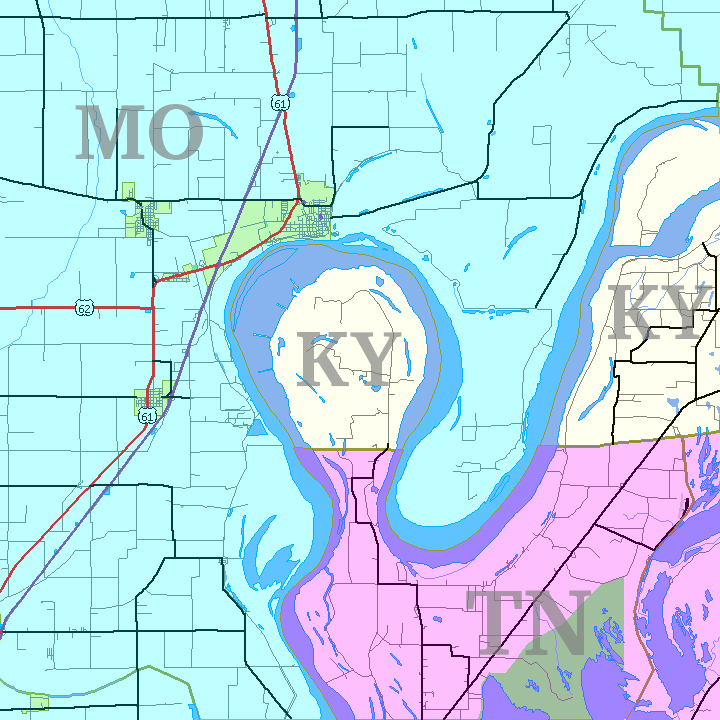
English: This is a map of the Kentucky Bend, the southwest corner of Fulton County, Kentucky that was separated from the rest of the state by the change in the Mississippi River from the New Madrid earthquakes. Based on United States Census TIGER Map output. Color and state abbreviation overlays created using The Gimp; optimized using pngnq and PNGOUT. 720×720, 32 color 8-bit palette.
Licensing[edit]
Jim Efaw, author of this work, the copyright holder of this work, hereby publishes it under the following license:
This file is licensed under the Creative Commons Attribution-Share Alike 2.5 Generic, 2.0 Generic and 1.0 Generic license.
Attribution: Jim Efaw, author of this work
- You are free:
- to share – to copy, distribute and transmit the work
- to remix – to adapt the work
- Under the following conditions:
- attribution – You must give appropriate credit, provide a link to the license, and indicate if changes were made. You may do so in any reasonable manner, but not in any way that suggests the licensor endorses you or your use.
- share alike – If you remix, transform, or build upon the material, you must distribute your contributions under the same or compatible license as the original.
File history
Click on a date/time to view the file as it appeared at that time.
| Date/Time | Thumbnail | Dimensions | User | Comment | |
|---|---|---|---|---|---|
| current | 05:35, 14 January 2007 | | 720 × 720 (31 KB) | Closeapple (talk | contribs) | {{Information |Description=Map of Kentucky Bend w:exclave between Missouri and Tennessee, USA. |Source=self; based on [http://tiger.census.gov/cgi-bin/mapper/map.gif?&lat=39.74099&lon=-89.07248&ht=6.000&wid=5.000&on=CITIES&on=shorelin&on=states&on |
You cannot overwrite this file.
File usage on Commons
The following page uses this file:
File usage on other wikis
The following other wikis use this file:
- Usage on cs.wikipedia.org
- Usage on de.wikipedia.org
- Usage on en.wikipedia.org
- Usage on es.wikipedia.org
- Usage on hu.wikipedia.org
- Usage on ja.wikipedia.org
- Usage on ko.wikipedia.org
- Usage on nl.wikipedia.org
- Usage on pt.wikipedia.org
- Usage on ru.wikipedia.org
- Usage on sv.wikipedia.org