File:Kaufmann Stadium and Arrowhead Stadium, Truman Sports Complex, Kansas City, Missouri (14497073792).jpg
Original file (4,000 × 3,000 pixels, file size: 7.75 MB, MIME type: image/jpeg)
Captions
Captions
Summary[edit]
.jpg&action=edit§ion=1)
| Description |
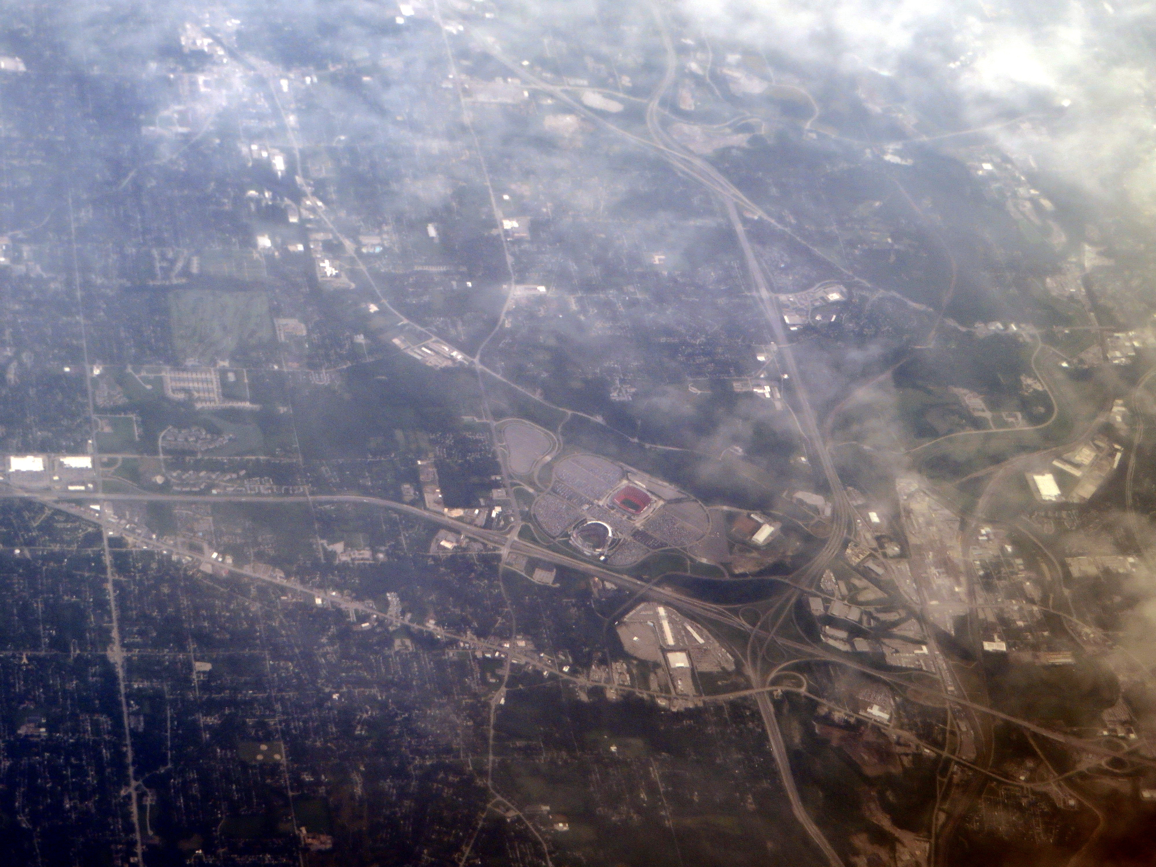
The Ewing M. Kauffman Stadium, nicknamed "The K" and formerly known as Royals Stadium, is a Major League Baseball stadium located in Kansas City, Missouri, and home to the Kansas City Royals of the American League. Together with Arrowhead Stadium, home of the National Football League's Kansas City Chiefs, it is a part of the Truman Sports Complex. Since July 2, 1993, the venue had been known as Kauffman Stadium in honor of the Royals' founding owner, Ewing Kauffman. Kauffman Stadium was built specifically for baseball during an era where building multisport "cookie-cutter" stadiums were commonplace. It is often held up along with Dodger Stadium in Los Angeles as one of the best examples of modernist stadium design. en.wikipedia.org/wiki/Kaufmann_Stadium Arrowhead Stadium (commonly or simply Arrowhead) is a stadium located in Kansas City, Missouri, and home to the NFL's Kansas City Chiefs. It is part of the city's Truman Sports Complex (together with Kauffman Stadium). The stadium is commonly referred to as the "Home of the CHIEFS" at the beginning of every home game during the singing of the national anthem. It is the 27th largest stadium in North America and fifth largest NFL Stadium in seating capacity; behind AT&T Stadium, Lambeau Field, MetLife Stadium, and FedExField. It is the largest sports facility, by capacity, in the state of Missouri. A $375 million renovation of the stadium was completed in 2010. en.wikipedia.org/wiki/Arrowhead_Stadium en.wikipedia.org/wiki/Wikipedia:Text_of_Creative_Commons_... |
| Date | |
| Source | Kaufmann Stadium and Arrowhead Stadium, Truman Sports Complex, Kansas City, Missouri |
| Author | Ken Lund from Reno, Nevada, USA |
| Camera location | | View this and other nearby images on: OpenStreetMap |
|---|
.jpg¶ms=039.050227_N_-094.482303_E_globe:Earth_type:camera_source:Flickr_&language=en)
Licensing[edit]
.jpg&action=edit§ion=2)
- You are free:
- to share – to copy, distribute and transmit the work
- to remix – to adapt the work
- Under the following conditions:
- attribution – You must give appropriate credit, provide a link to the license, and indicate if changes were made. You may do so in any reasonable manner, but not in any way that suggests the licensor endorses you or your use.
- share alike – If you remix, transform, or build upon the material, you must distribute your contributions under the same or compatible license as the original.
| This image was originally posted to Flickr by Ken Lund at https://flickr.com/photos/75683070@N00/14497073792. It was reviewed on 4 December 2015 by FlickreviewR and was confirmed to be licensed under the terms of the cc-by-sa-2.0. |
File history
Click on a date/time to view the file as it appeared at that time.
| Date/Time | Thumbnail | Dimensions | User | Comment | |
|---|---|---|---|---|---|
| current | 03:50, 4 December 2015 | | 4,000 × 3,000 (7.75 MB) | INeverCry (talk | contribs) | Transferred from Flickr via Flickr2Commons |
You cannot overwrite this file.
File usage on Commons
There are no pages that use this file.
.jpg&oldid=473717564)