File:Katia Sept 7 2011 1515Z.jpg
Jump to navigation
Jump to search
Size of this preview: 600 × 600 pixels. Other resolutions: 240 × 240 pixels | 480 × 480 pixels | 768 × 768 pixels | 1,024 × 1,024 pixels | 2,048 × 2,048 pixels | 6,720 × 6,720 pixels.
Original file (6,720 × 6,720 pixels, file size: 5.46 MB, MIME type: image/jpeg)
Captions
Captions
Add a one-line explanation of what this file represents
Summary[edit]
| Description |
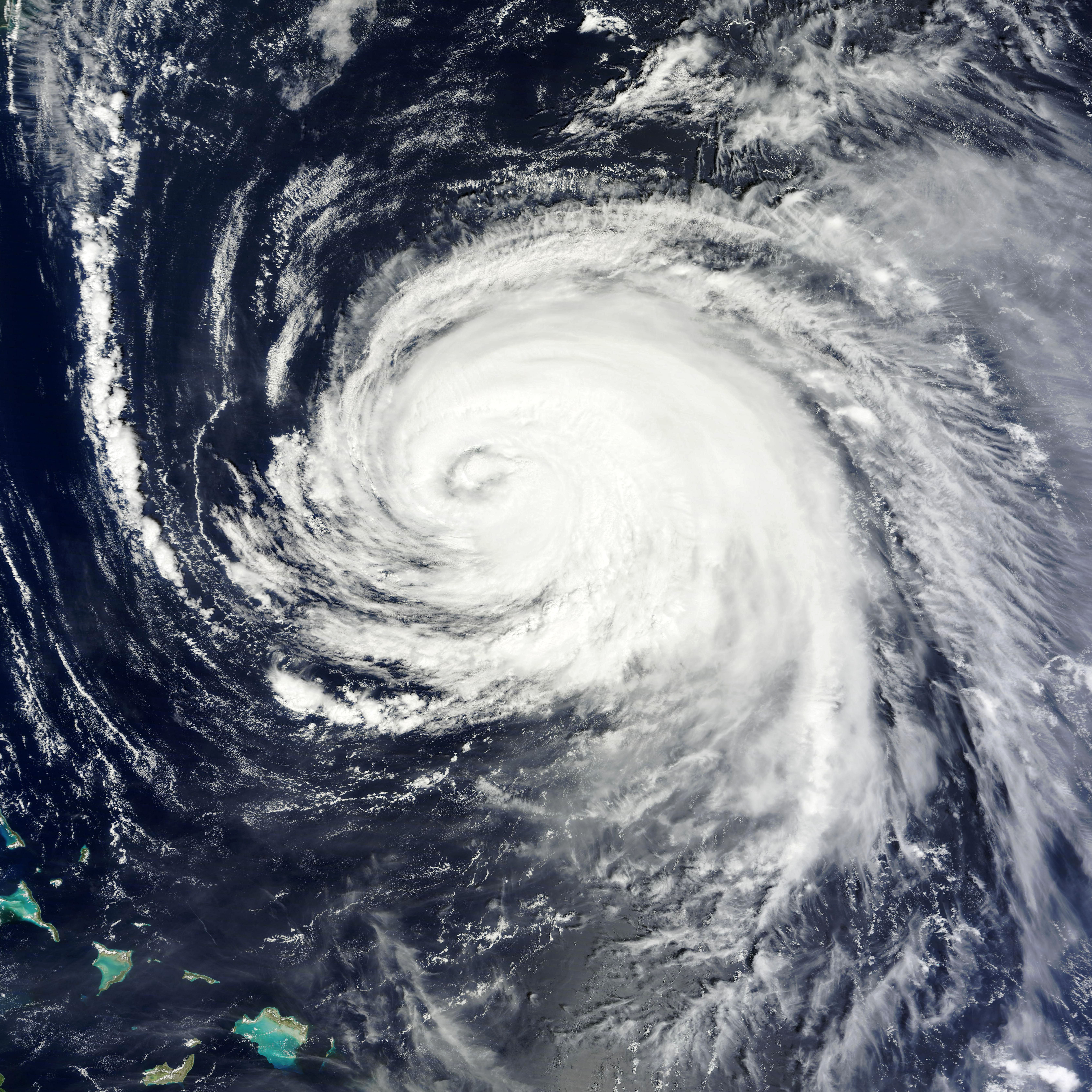
English: Katia continued traveling northwestward over the Atlantic Ocean on September 7, 2011. The same day, the U.S. National Hurricane Center (NHC) reported that Katia was a Category 1 hurricane. Located about 320 miles (515 kilometers) southwest of Bermuda, the storm had maximum sustained winds of 85 miles (140 kilometers) per hour with higher gusts.
The Moderate Resolution Imaging Spectroradiometer (MODIS) on NASA’s Terra satellite captured this natural-color image at 11:15 a.m. Atlantic Standard Time (AST) on September 7. Katia sports the spiral shape and distinct eye typical of strong storms. At 11:00 a.m. AST on September 8, the NHC reported that Katia was still a Category 1 hurricane, but with slightly stronger winds, of 90 miles (150 kilometers) per hour. The storm was now located west-northwest of Bermuda. Five-day projections forecast that Katia would turn toward the northeast and head back out over the open ocean east of the continental United States. As of September 8, however, ocean swells caused by the storm continued to affect the U.S. East Coast and Bermuda. |
| Date | |
| Source | http://earthobservatory.nasa.gov/NaturalHazards/view.php?id=52055 |
| Author | NASA image courtesy MODIS Rapid Response Team, Goddard Space Flight Center. Caption by Michon Scott. |
Licensing[edit]
| This file is in the public domain in the United States because it was solely created by NASA. NASA copyright policy states that "NASA material is not protected by copyright unless noted". (See Template:PD-USGov, NASA copyright policy page or JPL Image Use Policy.) | ||
 |
Warnings:
|
File history
Click on a date/time to view the file as it appeared at that time.
| Date/Time | Thumbnail | Dimensions | User | Comment | |
|---|---|---|---|---|---|
| current | 22:15, 7 September 2011 | | 6,720 × 6,720 (5.46 MB) | Supportstorm (talk | contribs) | {{Information |Description ={{en|1=Hurricane Katia on September 7, 2011}} |Source =http://lance-modis.eosdis.nasa.gov/wms/?zoom=4&lat=29.00098&lon=-71.63159&layers=B0000FFFFFFT&datum1=09/07/2011 |Author =NASA, MODIS Rapid Response Syste |
You cannot overwrite this file.
File usage on Commons
There are no pages that use this file.