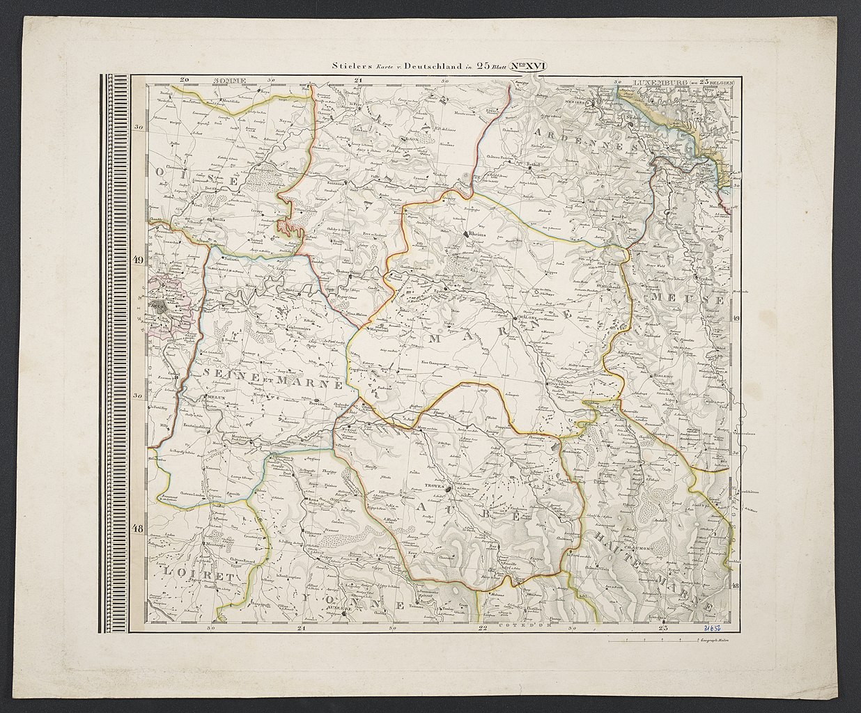
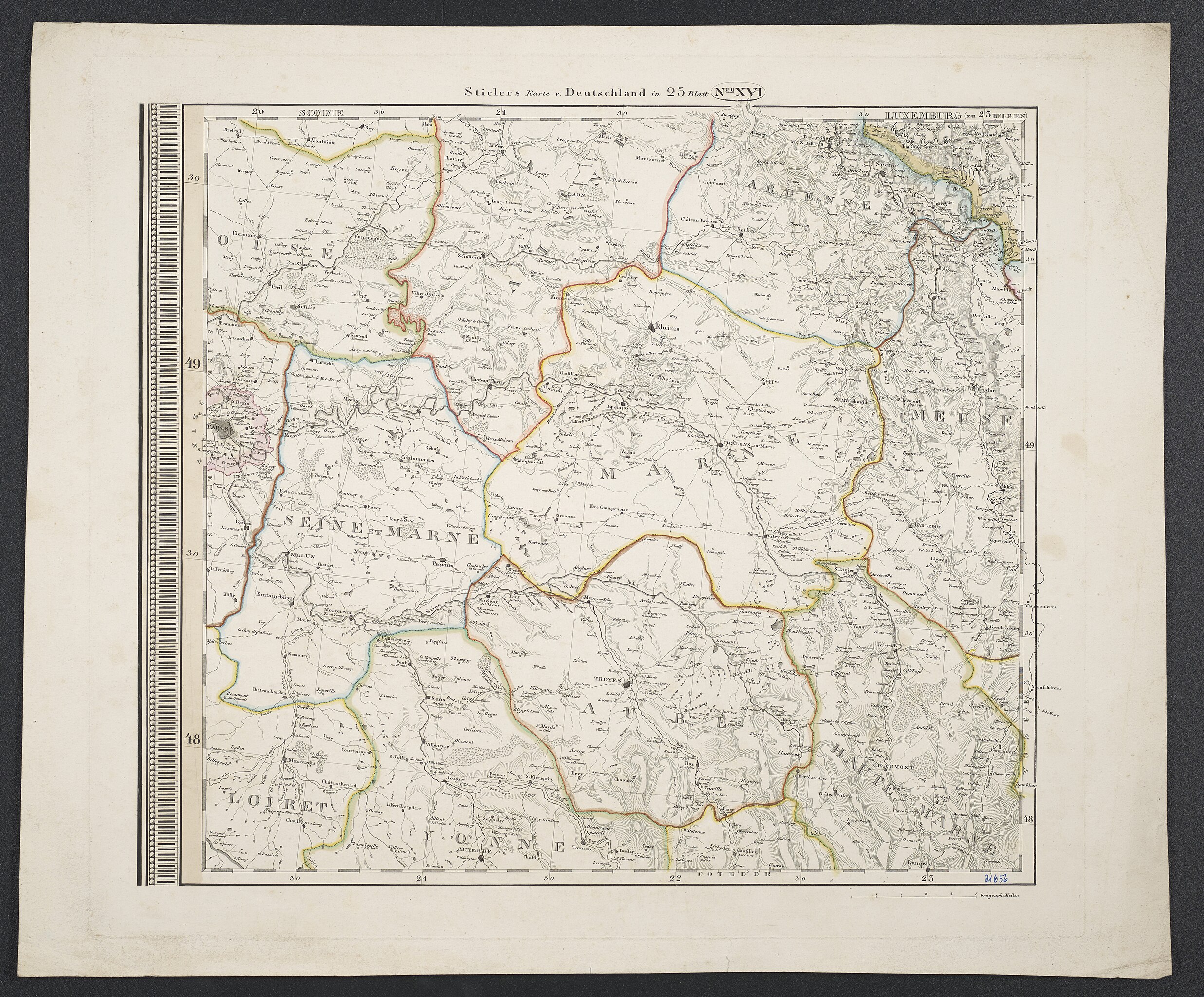
File:Karte von Deutschland, dem Königr. der Niederlande und der Schweiz - Paris, Rheims, Troyes.jpg
Jump to navigation
Jump to search

Size of this preview: 724 × 600 pixels. Other resolutions: 290 × 240 pixels | 580 × 480 pixels | 927 × 768 pixels | 1,236 × 1,024 pixels | 2,473 × 2,048 pixels | 5,670 × 4,696 pixels.
Original file (5,670 × 4,696 pixels, file size: 7.25 MB, MIME type: image/jpeg)
Captions
Captions
Add a one-line explanation of what this file represents
Summary[edit]
| Description |
Deutsch: 1 Kt. auf 25 Bl. : Grenzen kolor. (36 x 31 cm); Koordinaten E 2°12'00"-E 5°43'00"/N 49°49'00"-N 47°41'00"; Maßstab in graph. Form (Geograph. Meilen). - Gesamttitel oberhalb Kt.-Bild. - Relief: Schraffen |
| Date | |
| Source | Leibniz-Institut für Länderkunde, Leipzig |
| Author | Stieler, Adolf (Hrsg.) |
Verwaltungskarte von Mitteleuropa
Licensing[edit]
| This file is made available under the Creative Commons CC0 1.0 Universal Public Domain Dedication. | |
| The person who associated a work with this deed has dedicated the work to the public domain by waiving all of their rights to the work worldwide under copyright law, including all related and neighboring rights, to the extent allowed by law. You can copy, modify, distribute and perform the work, even for commercial purposes, all without asking permission.
|
File history
Click on a date/time to view the file as it appeared at that time.
| Date/Time | Thumbnail | Dimensions | User | Comment | |
|---|---|---|---|---|---|
| current | 09:13, 6 September 2018 | | 5,670 × 4,696 (7.25 MB) | Higgenhorscht (talk | contribs) | User created page with UploadWizard |
You cannot overwrite this file.
File usage on Commons
There are no pages that use this file.
Metadata
Categories:
- 19th-century maps of Oise
- 19th-century maps of Aisne
- Maps of Ardennes (department)
- 19th-century maps of Seine-et-Marne
- 19th-century maps of Marne (department)
- Old maps of Meuse
- Maps of Loiret
- Old maps of Yonne
- 19th-century maps of Aube
- 19th-century maps of Haute-Marne
- Karte von Deutschland, dem Königr. der Niederlande und der Schweiz (1847)